
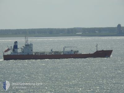
BATELEUR
Lpg Tanker
Current Trip
OPL KHOR FAKKAN
| Time Travelled | 1 day |
|---|---|
| Remaining Time | --- |
| Distance Travelled | 490.30 nm |
| Remaining Distance | --- |
| AVG Speed | 12.3 Knots |
| MAX Speed | 14.1 Knots |
| AVG Wind | 12.3 knots |
| MAX Wind | 16.9 knots |
| MIN Temp | 28.4°C / 83.12°F |
| MAX Temp | 30.9°C / 87.62°F |
| Draught | 6 m |
| Position Received | 9 d ago |
Current Position
| Longitude | 57.37034° |
|---|---|
| Latitude | 25.23125° |
| Status | Under way using engine |
| Speed | 13.7 Knots |
| Course | 112.7° |
| Area | Gulf of Oman |
| Station | T-AIS |
| Position Received | 9 d ago |
Info
Information
The current position of BATELEUR is in Gulf of Oman with coordinates 25.23125° / 57.37034° as reported on 2024-05-25 10:08 by AIS to our vessel tracker app. The vessel's current speed is 13.7 Knots
The vessel BATELEUR (IMO: 9045807, MMSI: 352980786) is a Lpg Tanker that was built in 1995 ( 29 years old ). It's sailing under the flag of [PA] Panama.
In this page you can find informations about the vessels current position, last detected port calls, and current voyage information. If the vessels is not in coverage by AIS you will find the latest position.
The current position of BATELEUR is detected by our AIS receivers and we are not responsible for the reliability of the data. The last position was recorded while the vessel was in Coverage by the Ais receivers of our vessel tracking app.
The current draught of BATELEUR as reported by AIS is 6 meters
Weather
| Temperature | 30.9°C / 87.62°F |
|---|---|
| Wind Speed | 15 knots |
| Direction | 132° SE |
| Pressure | 1002.4 hPa |
| Humidity | 81.9 % |
| Cloud Coverage | --- |
Featured Company
Last Port Calls
| Port | Arrival | Departure | Time In Port |
|---|---|---|---|
| 2024-05-30 03:18 | 2024-06-02 02:09 | 2 d | |
| 2024-04-24 03:43 | 2024-04-27 01:19 | 2 d |
Most Visited Ports (Last year)
| Port | Arrivals | |
|---|---|---|
| 5 | ||
| 3 | ||
| 2 | ||
| 2 | ||
| 1 | ||
| 1 |
Last Trips
| Origin | Departure | Destination | Arrival | Distance | |
|---|---|---|---|---|---|
| 2024-04-27 06:19 | 2024-05-30 08:18 | 2700.92 nm | |||
| 2024-02-18 06:04 | 2024-04-24 08:43 | 3864.79 nm |
Events
| Time | Event | Details | Position / Dest | Info |
|---|---|---|---|---|
| 2024-06-02 02:09 | START Moving | 1.4 nm, West of PORT QASIM |
24.77755 / 67.29617
OPL KHOR FAKKAN
|
Speed: 9.6 kn Course: 299° |
| 2024-06-02 02:09 | PORT DEPARTURE |
|
24.77755 / 67.29617
OPL KHOR FAKKAN
|
Speed: 3.3 kn Course: 316° |
| 2024-05-30 03:19 | STOP Moving |
24.76833 / 67.31333
[PK] PORT QASIM
|
Speed: Course: -1° |
|
| 2024-05-30 03:18 | PORT ARRIVAL |
|
24.76833 / 67.31333
[PK] PORT QASIM
|
Speed: 0.9 kn Course: 129° |
| 2024-05-29 20:24 | START Moving |
24.65635 / 66.31050
OPL KHOR FAKKAN
|
Speed: 7 kn Course: 116° |
|
| 2024-05-29 14:54 | STOP Moving |
24.58500 / 66.17500
OPL KHOR FAKKAN
|
Speed: Course: -1° |
|
| 2024-05-29 14:31 | START Moving |
24.58876 / 66.16627
OPL KHOR FAKKAN
|
Speed: 4.9 kn Course: 107° |
|
| 2024-05-29 12:04 | STOP Moving |
24.56459 / 66.12121
OPL KHOR FAKKAN
|
Speed: 0.2 kn Course: 263° |
|
| 2024-05-29 07:41 | START Moving | 14.89 nm, South of SALEHAABAD ISLAND |
24.55732 / 66.94248
OPL KHOR FAKKAN
|
Speed: 3.1 kn Course: 293° |
| 2024-05-29 01:13 | STOP Moving | 19.56 nm, South West of SALEHAABAD ISLAND |
24.55167 / 66.74333
OPL KHOR FAKKAN
|
Speed: Course: -1° |