
BAYREUTH
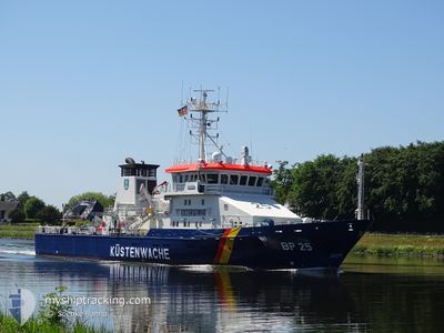
Pollution Control Vessel
Current Position
| Longitude | 10.80266° |
|---|---|
| Latitude | 54.09665° |
| Status | Moored |
| Speed | |
| Course | --- |
| Area | Baltic Sea |
| Station | T-AIS |
| Position Received | 9 h, 5 m ago |
Info
Information
The current position of BAYREUTH is in Baltic Sea with coordinates 54.09665° / 10.80266° as reported on 2024-06-27 03:32 by AIS to our vessel tracker app. The vessel's current speed is 0 Knots and is currently inside the port of NEUSTADT.
The vessel BAYREUTH (IMO: 9252632, MMSI: 211386450) is a Pollution Control Vessel that was built in 2003 ( 21 years old ). It's sailing under the flag of [DE] Germany.
In this page you can find informations about the vessels current position, last detected port calls, and current voyage information. If the vessels is not in coverage by AIS you will find the latest position.
The current position of BAYREUTH is detected by our AIS receivers and we are not responsible for the reliability of the data. The last position was recorded while the vessel was in Coverage by the Ais receivers of our vessel tracking app.
The current draught of BAYREUTH as reported by AIS is 3.7 meters
Weather
| Temperature | 19°C / 66.2°F |
|---|---|
| Wind Speed | 6 knots |
| Direction | 72° ENE |
| Pressure | 1009.4 hPa |
| Humidity | 74.4 % |
| Cloud Coverage | 51 % |
Featured Company
Last Port Calls
| Port | Arrival | Departure | Time In Port |
|---|---|---|---|
| 2024-06-14 10:53 | 2024-06-19 12:24 | 5 d | |
| 2024-06-10 07:33 | 2024-06-10 11:29 | 3 h | |
| 2024-05-27 10:00 | 2024-05-31 12:58 | 4 d | |
| 2024-05-17 10:19 | 2024-05-22 12:53 | 5 d | |
| 2024-05-13 10:22 | 2024-05-13 14:53 | 4 h | |
| 2024-05-08 10:28 | 2024-05-08 15:00 | 4 h | |
| 2024-05-04 08:18 | 2024-05-04 13:33 | 5 h | |
| 2024-04-29 09:54 | 2024-04-29 14:56 | 5 h | |
| 2024-04-05 11:19 | 2024-04-15 07:50 | 9 d | |
| 2024-04-02 10:09 | 2024-04-02 15:13 | 5 h |
Most Visited Ports (Last year)
| Port | Arrivals | |
|---|---|---|
| 19 | ||
| 6 | ||
| 4 |
Last Trips
| Origin | Departure | Destination | Arrival | Distance | |
|---|---|---|---|---|---|
| 2024-06-10 13:29 | 2024-06-14 12:53 | 525.87 nm | |||
| 2024-05-31 14:58 | 2024-06-10 09:33 | 1042.50 nm | |||
| 2024-05-22 14:53 | 2024-05-27 12:00 | 721.56 nm | |||
| 2024-05-13 16:53 | 2024-05-17 12:19 | 535.19 nm | |||
| 2024-05-08 17:00 | 2024-05-13 12:22 | 562.30 nm | |||
| 2024-05-04 15:33 | 2024-05-08 12:28 | 544.54 nm | |||
| 2024-04-29 16:56 | 2024-05-04 10:18 | 764.47 nm | |||
| 2024-04-15 09:50 | 2024-04-29 11:54 | 556.75 nm | |||
| 2024-04-02 17:13 | 2024-04-05 13:19 | 287.01 nm | |||
| 2024-03-28 17:22 | 2024-04-02 12:09 | 398.54 nm |
Events
| Time | Event | Details | Position / Dest | Info |
|---|---|---|---|---|
| 2024-06-27 03:32 | OUT of Coverage |
54.09665 / 10.80266
Baltic Sea
[DE] NEUSTADT
|
Speed: Course: 0° |
|
| 2024-06-27 01:01 | IN Coverage |
54.09665 / 10.80266
Baltic Sea
[DE] NEUSTADT
|
Speed: Course: 0° |
|
| 2024-06-26 04:52 | OUT of Coverage |
54.09665 / 10.80266
Baltic Sea
[DE] NEUSTADT
|
Speed: Course: 0° |
|
| 2024-06-26 02:21 | IN Coverage |
54.09665 / 10.80266
Baltic Sea
[DE] NEUSTADT
|
Speed: Course: 0° |
|
| 2024-06-24 08:39 | OUT of Coverage |
54.14060 / 11.17610
Baltic Sea
|
Speed: 7.2 kn Course: 243.4° |
|
| 2024-06-24 04:08 | Draught Changed | 3.7 3 |
54.33975 / 12.03452
PATROL
|
Speed: 7 kn Course: 247.7° |
| 2024-06-24 04:08 | ETA Changed | 2024/12/31 23:59 |
54.33975 / 12.03452
PATROL
|
Speed: 7 kn Course: 247.7° |
| 2024-06-24 03:50 | Draught Changed | 3 3.7 |
54.35215 / 12.09010
PATROL
|
Speed: 6.6 kn Course: 248° |
| 2024-06-23 19:02 | IN Coverage |
54.69477 / 13.35223
Baltic Sea
|
Speed: 6.5 kn Course: 258.2° |
|
| 2024-06-23 17:01 | OUT of Coverage |
54.59348 / 13.64433
Baltic Sea
|
Speed: 6.3 kn Course: 311° |