
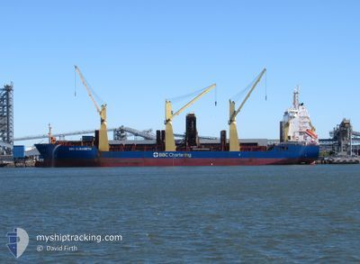
BBC ELISABETH
General Cargo
Current Trip
| Time Travelled | 10 days |
|---|---|
| Remaining Time | --- |
| Distance Travelled | 3329.18 nm |
| Remaining Distance | --- |
| AVG Speed | 13.7 Knots |
| MAX Speed | 15.2 Knots |
| AVG Wind | 14.5 knots |
| MAX Wind | 24 knots |
| MIN Temp | 15°C / 59°F |
| MAX Temp | 28.6°C / 83.48°F |
| Draught | 6.8 m |
| Position Received | 9 d ago |
Current Position
| Longitude | 17.62528° |
|---|---|
| Latitude | -33.67881° |
| Status | Under way using engine |
| Speed | 12.8 Knots |
| Course | 334.5° |
| Area | South Atlantic Ocean |
| Station | T-AIS |
| Position Received | 9 d ago |
Info
Information
The current position of BBC ELISABETH is in South Atlantic Ocean with coordinates -33.67881° / 17.62528° as reported on 2024-05-07 06:25 by AIS to our vessel tracker app. The vessel's current speed is 12.8 Knots and is heading at the port of PORT CARTIER. The estimated time of arrival as calculated by vessel tracking app is 2024-05-28 10:00 LT
The vessel BBC ELISABETH (IMO: 9593660, MMSI: 305630000) is a General Cargo that was built in 2013 ( 11 years old ). It's sailing under the flag of [AG] Antigua Barbuda.
In this page you can find informations about the vessels current position, last detected port calls, and current voyage information. If the vessels is not in coverage by AIS you will find the latest position.
The current position of BBC ELISABETH is detected by our AIS receivers and we are not responsible for the reliability of the data. The last position was recorded while the vessel was in Coverage by the Ais receivers of our vessel tracking app.
The current draught of BBC ELISABETH as reported by AIS is 6.8 meters
Weather
| Temperature | 26.8°C / 80.24°F |
|---|---|
| Wind Speed | 6 knots |
| Direction | 7° N |
| Pressure | 1011.8 hPa |
| Humidity | 82.9 % |
| Cloud Coverage | 63 % |
Featured Company
Last Port Calls
| Port | Arrival | Departure | Time In Port |
|---|---|---|---|
| 2024-05-06 08:47 | 2024-05-07 02:32 | 17 h | |
| 2024-04-04 23:52 | 2024-04-06 06:21 | 1 d | |
| 2024-04-01 01:05 | 2024-04-02 08:17 | 1 d | |
| 2024-03-22 22:00 | 2024-03-23 10:32 | 12 h |
Most Visited Ports (Last year)
| Port | Arrivals | |
|---|---|---|
| 2 | ||
| 2 | ||
| 1 | ||
| 1 | ||
| 1 | ||
| 1 |
Last Trips
| Origin | Departure | Destination | Arrival | Distance | |
|---|---|---|---|---|---|
| 2024-04-06 15:21 | 2024-05-06 10:47 | 8539.27 nm | |||
| 2024-04-02 16:17 | 2024-04-05 08:52 | 816.22 nm | |||
| 2024-03-23 19:32 | 2024-04-01 09:05 | 1593.36 nm | |||
| 2024-02-01 01:41 | 2024-03-23 07:00 | 14692.21 nm |
Events
| Time | Event | Details | Position / Dest | Info |
|---|---|---|---|---|
| 2024-05-07 06:30 | Status Changed | Default Under way using engine |
-33.67075 / 17.61045
PORT CARTIER
|
Speed: 12.8 kn Course: 334.5° |
| 2024-05-07 06:25 | OUT of Coverage |
-33.67881 / 17.62528
South Atlantic Ocean
PORT CARTIER
|
Speed: 12.8 kn Course: 334.5° |
|
| 2024-05-07 06:25 | Status Changed | Under way using engine Default |
-33.67985 / 17.62667
PORT CARTIER
|
Speed: 12.7 kn Course: 306° |
| 2024-05-07 06:23 | Status Changed | Default Under way using engine |
-33.68280 / 17.63085
PORT CARTIER
|
Speed: 12 kn Course: 315.7° |
| 2024-05-07 06:17 | Status Changed | Under way using engine Default |
-33.69788 / 17.65170
PORT CARTIER
|
Speed: 11.3 kn Course: 308° |
| 2024-05-07 06:15 | Status Changed | Default Under way using engine |
-33.70117 / 17.65616
PORT CARTIER
|
Speed: 11.9 kn Course: 312.6° |
| 2024-05-07 06:05 | Status Changed | Under way using engine Default |
-33.72328 / 17.68614
PORT CARTIER
|
Speed: 12.4 kn Course: 312° |
| 2024-05-07 05:59 | Status Changed | Default Under way using engine |
-33.73695 / 17.70440
PORT CARTIER
|
Speed: 11.3 kn Course: 313° |
| 2024-05-07 05:41 | Status Changed | Under way using engine Default |
-33.77559 / 17.76356
PORT CARTIER
|
Speed: 12 kn Course: 306° |
| 2024-05-07 05:38 | Status Changed | Default Under way using engine |
-33.78041 / 17.77302
PORT CARTIER
|
Speed: 12.5 kn Course: 308.8° |