
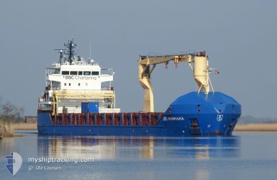
BBC MARMARA
General Cargo
Current Trip
| Time Travelled | 21 days |
|---|---|
| Remaining Time | 1 day |
| Distance Travelled | 3851.55 nm |
| Remaining Distance | 296.66 nm |
| AVG Speed | 10.2 Knots |
| MAX Speed | 14.9 Knots |
| AVG Wind | 17.7 knots |
| MAX Wind | 26.6 knots |
| MIN Temp | 21.2°C / 70.16°F |
| MAX Temp | 30°C / 86°F |
| Draught | 4.5 m |
| Position Received | 3 h, 51 m ago |
Current Position
| Longitude | 153.73179° |
|---|---|
| Latitude | -28.05992° |
| Status | Under way using engine |
| Speed | 8.7 Knots |
| Course | 179.1° |
| Area | Coral Sea |
| Station | T-AIS |
| Position Received | 3 h, 51 m ago |
Info
Information
The current position of BBC MARMARA is in Coral Sea with coordinates -28.05992° / 153.73179° as reported on 2024-05-29 02:02 by AIS to our vessel tracker app. The vessel's current speed is 8.7 Knots and is heading at the port of NEWCASTLE. The estimated time of arrival as calculated by vessel tracking app is 2024-05-30 14:53 LT
The vessel BBC MARMARA (IMO: 9454228, MMSI: 255806141) is a General Cargo that was built in 2010 ( 14 years old ). It's sailing under the flag of [PT] Portugal.
In this page you can find informations about the vessels current position, last detected port calls, and current voyage information. If the vessels is not in coverage by AIS you will find the latest position.
The current position of BBC MARMARA is detected by our AIS receivers and we are not responsible for the reliability of the data. The last position was recorded while the vessel was in Coverage by the Ais receivers of our vessel tracking app.
The current draught of BBC MARMARA as reported by AIS is 4.5 meters
Weather
| Temperature | 21.5°C / 70.7°F |
|---|---|
| Wind Speed | 9 knots |
| Direction | 134° SE |
| Pressure | 1026.1 hPa |
| Humidity | 56.6 % |
| Cloud Coverage | 66 % |
Featured Company
Last Port Calls
| Port | Arrival | Departure | Time In Port |
|---|---|---|---|
| 2024-05-06 04:17 | 2024-05-07 07:12 | 1 d | |
| 2024-05-02 16:47 | 2024-05-04 04:19 | 1 d | |
| 2024-04-11 07:20 | 2024-04-12 11:17 | 1 d | |
| 2024-04-06 23:50 | 2024-04-07 20:44 | 20 h | |
| 2024-03-17 16:51 | 2024-03-18 23:24 | 1 d | |
| 2024-03-14 00:35 | 2024-03-14 21:21 | 20 h |
Last Trips
| Origin | Departure | Destination | Arrival | Distance | |
|---|---|---|---|---|---|
| 2024-05-04 14:19 | 2024-05-06 14:17 | 465.90 nm | |||
| 2024-04-12 21:17 | 2024-05-03 02:47 | 4128.44 nm | |||
| 2024-04-08 06:44 | 2024-04-11 17:20 | 473.35 nm | |||
| 2024-03-19 09:24 | 2024-04-07 09:50 | 4109.58 nm | |||
| 2024-03-15 08:21 | 2024-03-18 02:51 | 461.79 nm | |||
| 2024-02-22 01:09 | 2024-03-14 11:35 | 4056.01 nm |
Events
| Time | Event | Details | Position / Dest | Info |
|---|---|---|---|---|
| 2024-05-29 02:09 | Status Changed | Default Under way using engine |
-28.07499 / 153.73218
AU NTL
|
Speed: 8.7 kn Course: 179.1° |
| 2024-05-29 02:02 | Status Changed | Under way using engine Default |
-28.05992 / 153.73179
AU NTL
|
Speed: 8.7 kn Course: 184° |
| 2024-05-29 02:02 | OUT of Coverage |
-28.05992 / 153.73179
Coral Sea
AU NTL
|
Speed: 8.7 kn Course: 179.1° |
|
| 2024-05-29 01:21 | Status Changed | Default Under way using engine |
-27.95990 / 153.73050
AU NTL
|
Speed: 8.6 kn Course: 178.9° |
| 2024-05-29 00:33 | Status Changed | Under way using engine Default |
-27.84350 / 153.72378
AU NTL
|
Speed: 9.8 kn Course: 177° |
| 2024-05-29 00:33 | Status Changed | Default Under way using engine |
-27.84168 / 153.72368
AU NTL
|
Speed: 9.8 kn Course: 177.5° |
| 2024-05-29 00:32 | Status Changed | Under way using engine Default |
-27.84037 / 153.72359
AU NTL
|
Speed: 10.5 kn Course: 177° |
| 2024-05-29 00:25 | Status Changed | Default Under way using engine |
-27.81827 / 153.72218
AU NTL
|
Speed: 11 kn Course: 178.2° |
| 2024-05-28 21:39 | ETA Changed | 2024/05/30 06:00 2024/05/30 04:00 |
-27.28192 / 153.70323
AU NTL
|
Speed: 11.7 kn Course: 169.9° |
| 2024-05-28 20:11 | Status Changed | Under way using engine Default |
-27.00053 / 153.68281
AU NTL
|
Speed: 11.1 kn Course: 178° |