
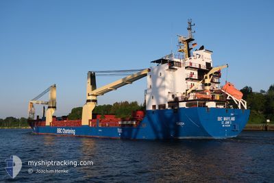
BBC MARYLAND
General Cargo
Current Trip
| Time Travelled | 4 days |
|---|---|
| Remaining Time | --- |
| Distance Travelled | 1284.83 nm |
| Remaining Distance | --- |
| AVG Speed | 11.1 Knots |
| MAX Speed | 17.7 Knots |
| AVG Wind | 15.5 knots |
| MAX Wind | 32 knots |
| MIN Temp | 10.6°C / 51.08°F |
| MAX Temp | 17.6°C / 63.68°F |
| Draught | 6.5 m |
| Position Received | Now |
Current Position
| Longitude | -10.27673° |
|---|---|
| Latitude | 39.49142° |
| Status | Under way using engine |
| Speed | 12.7 Knots |
| Course | 183.4° |
| Area | North Atlantic Ocean |
| Station | T-AIS |
| Position Received | Now |
Info
Information
The current position of BBC MARYLAND is in North Atlantic Ocean with coordinates 39.49142° / -10.27673° as reported on 2024-06-18 13:10 by AIS to our vessel tracker app. The vessel's current speed is 12.7 Knots and is heading at the port of YANTAI. The estimated time of arrival as calculated by vessel tracking app is 2024-08-01 08:00 LT
The vessel BBC MARYLAND (IMO: 9433298, MMSI: 305459000) is a General Cargo that was built in 2010 ( 14 years old ). It's sailing under the flag of [AG] Antigua Barbuda.
In this page you can find informations about the vessels current position, last detected port calls, and current voyage information. If the vessels is not in coverage by AIS you will find the latest position.
The current position of BBC MARYLAND is detected by our AIS receivers and we are not responsible for the reliability of the data. The last position was recorded while the vessel was in Coverage by the Ais receivers of our vessel tracking app.
The current draught of BBC MARYLAND as reported by AIS is 6.5 meters
Weather
| Temperature | 17.6°C / 63.68°F |
|---|---|
| Wind Speed | 15 knots |
| Direction | 213° SSW |
| Pressure | 1012.9 hPa |
| Humidity | 71.2 % |
| Cloud Coverage | 3 % |
Featured Company
Last Port Calls
| Port | Arrival | Departure | Time In Port |
|---|---|---|---|
| 2024-06-13 17:22 | 2024-06-13 20:14 | 2 h | |
| 2024-06-13 07:43 | 2024-06-13 09:06 | 1 h | |
| 2024-06-07 17:50 | 2024-06-10 14:39 | 2 d | |
| 2024-06-05 06:56 | 2024-06-05 06:58 | 2 m | |
| 2024-05-31 12:39 | 2024-06-01 18:25 | 1 d | |
| 2024-05-27 10:55 | 2024-05-29 00:04 | 1 d | |
| 2024-05-25 13:31 | 2024-05-25 15:00 | 1 h | |
| 2024-05-20 06:26 | 2024-05-24 10:35 | 4 d | |
| 2024-05-18 22:27 | 2024-05-18 22:30 | 2 m | |
| 2024-05-15 07:39 | 2024-05-16 15:15 | 1 d |
Last Trips
| Origin | Departure | Destination | Arrival | Distance | |
|---|---|---|---|---|---|
| 2024-06-13 11:06 | 2024-06-13 19:22 | 49.95 nm | |||
| 2024-06-10 17:39 | 2024-06-13 09:43 | 779.29 nm | |||
| 2024-06-05 08:58 | 2024-06-07 20:50 | 806.18 nm | |||
| 2024-06-01 20:25 | 2024-06-05 08:56 | 1068.25 nm | |||
| 2024-05-29 02:04 | 2024-05-31 14:39 | 802.20 nm | |||
| 2024-05-25 17:00 | 2024-05-27 12:55 | 399.19 nm | |||
| 2024-05-24 12:35 | 2024-05-25 15:31 | 356.72 nm | |||
| 2024-05-19 00:30 | 2024-05-20 08:26 | 357.04 nm | |||
| 2024-05-16 16:15 | 2024-05-19 00:27 | 454.52 nm | |||
| 2024-05-12 15:05 | 2024-05-15 08:39 | 272.57 nm |
Events
| Time | Event | Details | Position / Dest | Info |
|---|---|---|---|---|
| 2024-06-18 11:43 | Detected in Sea | Portuguese part of the North Atlantic Ocean |
39.80360 / -10.26966
North Atlantic Ocean
|
Speed: 12.9 kn Course: 183.1° |
| 2024-06-18 11:43 | IN Coverage |
39.80360 / -10.26966
North Atlantic Ocean
|
Speed: 12.9 kn Course: 183.1° |
|
| 2024-06-18 11:42 | Status Changed | Under way using engine Default |
39.80915 / -10.26940
YANTAI
|
Speed: 13.1 kn Course: 182° |
| 2024-06-16 18:29 | Status Changed | Default Under way using engine |
48.13334 / -6.23500
YANTAI
|
Speed: 13.2 kn Course: 199.3° |
| 2024-06-16 18:24 | OUT of Coverage |
48.15151 / -6.22643
Celtic Sea
|
Speed: 13.2 kn Course: 199.3° |
|
| 2024-06-16 18:05 | Status Changed | Under way using engine Default |
48.22004 / -6.19083
YANTAI
|
Speed: 13.5 kn Course: 201° |
| 2024-06-16 17:54 | Status Changed | Default Under way using engine |
48.25638 / -6.17189
YANTAI
|
Speed: 13.4 kn Course: 197.8° |
| 2024-06-16 17:53 | Status Changed | Under way using engine Default |
48.25987 / -6.17009
YANTAI
|
Speed: 13 kn Course: 197° |
| 2024-06-16 17:44 | Status Changed | Default Under way using engine |
48.29167 / -6.15167
YANTAI
|
Speed: 13.4 kn Course: 200.1° |
| 2024-06-16 17:12 | Status Changed | Under way using engine Default |
48.40508 / -6.09670
YANTAI
|
Speed: 13 kn Course: 195° |