
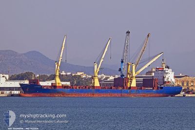
BBC RAINBOW
General Cargo
Current Trip
| Trip Time | 6 days |
|---|---|
| Trip Distance | 1743.71 nm |
| AVG Speed | 7 Knots |
| MAX Speed | 7 Knots |
| Draught | 6.2 m |
| AVG Wind | 23 knots |
| MAX Wind | 32.8 knots |
| MIN Temp | 12.2°C / 53.96°F |
| MAX Temp | 26°C / 78.8°F |
| Position Received | 8 d ago |
Current Position
| Longitude | 152.63649° |
|---|---|
| Latitude | -32.54257° |
| Status | Under way using engine |
| Speed | 15.1 Knots |
| Course | 42.2° |
| Area | Tasman Sea |
| Station | T-AIS |
| Position Received | 8 d ago |
Info
Information
The current position of BBC RAINBOW is in Tasman Sea with coordinates -32.54257° / 152.63649° as reported on 2024-06-17 13:24 by AIS to our vessel tracker app. The vessel's current speed is 15.1 Knots and is currently inside the port of PORT MORESBY.
The vessel BBC RAINBOW (IMO: 9423516, MMSI: 352001219) is a General Cargo that was built in 2010 ( 14 years old ). It's sailing under the flag of [PA] Panama.
In this page you can find informations about the vessels current position, last detected port calls, and current voyage information. If the vessels is not in coverage by AIS you will find the latest position.
The current position of BBC RAINBOW is detected by our AIS receivers and we are not responsible for the reliability of the data. The last position was recorded while the vessel was in Coverage by the Ais receivers of our vessel tracking app.
The current draught of BBC RAINBOW as reported by AIS is 6.2 meters
Weather
| Temperature | 24.7°C / 76.46°F |
|---|---|
| Wind Speed | 4 knots |
| Direction | 17° NNE |
| Pressure | 1009.6 hPa |
| Humidity | 92.2 % |
| Cloud Coverage | 81 % |
Featured Company
Last Port Calls
| Port | Arrival | Departure | Time In Port |
|---|---|---|---|
| 2024-06-22 09:55 | |||
| 2024-06-13 10:55 | 2024-06-15 23:34 | 2 d | |
| 2024-05-25 23:32 | 2024-06-09 21:24 | 14 d | |
| 2024-04-03 10:25 | 2024-04-03 12:09 | 1 h | |
| 2024-04-01 16:27 |
Most Visited Ports (Last year)
| Port | Arrivals | |
|---|---|---|
| 3 | ||
| 2 | ||
| 1 | ||
| 1 | ||
| 1 | ||
| 1 |
Last Trips
| Origin | Departure | Destination | Arrival | Distance | |
|---|---|---|---|---|---|
| 2024-06-16 09:34 | 2024-06-22 19:55 | 1743.71 nm | |||
| 2024-06-10 07:24 | 2024-06-13 20:55 | 841.40 nm | |||
| 2024-04-03 14:09 | 2024-05-26 09:32 | 14456.70 nm | |||
| 2024-04-01 19:27 | 2024-04-03 12:25 | 463.66 nm |
Events
| Time | Event | Details | Position / Dest | Info |
|---|---|---|---|---|
| 2024-06-22 09:55 | PORT ARRIVAL |
|
-9.45701 / 147.12920
[PG] PORT MORESBY
|
Speed: 8.9 kn Course: 322° |
| 2024-06-17 13:28 | Status Changed | Default Under way using engine |
-32.53025 / 152.65057
AUNTL>PGPOM
|
Speed: 15.1 kn Course: 42.2° |
| 2024-06-17 13:24 | OUT of Coverage |
-32.54257 / 152.63649
Tasman Sea
AUNTL>PGPOM
|
Speed: 15.1 kn Course: 42.2° |
|
| 2024-06-17 12:45 | Destination Changed | AUNTL>PGPOM AUNTLM |
-32.65999 / 152.50399
AUNTL>PGPOM
|
Speed: 14.6 kn Course: 43.8° |
| 2024-06-17 12:31 | Destination Changed | AUNTLM PG POM |
-32.69953 / 152.46019
AUNTLM
|
Speed: 14.1 kn Course: 44.2° |
| 2024-06-17 12:13 | ETA Changed | 2024/06/22 07:00 2024/06/22 16:00 |
-32.75253 / 152.40076
PG POM
|
Speed: 14.8 kn Course: 44.1° |
| 2024-06-17 11:36 | ETA Changed | 2024/06/22 16:00 2024/06/22 04:00 |
-32.85927 / 152.27877
PG POM
|
Speed: 13.3 kn Course: 49.5° |
| 2024-06-17 11:30 | ETA Changed | 2024/06/22 04:00 2024/06/16 04:00 |
-32.87721 / 152.25979
PG POM
|
Speed: 13.8 kn Course: 42.7° |
| 2024-06-17 11:29 | Destination Changed | PG POM AUNTL |
-32.88021 / 152.25688
PG POM
|
Speed: 13.7 kn Course: 40.2° |
| 2024-06-17 01:44 | START Moving | 11.31 nm, South of PORT STEPHENS |
-32.90576 / 152.11644
AUNTL
|
Speed: 3.1 kn Course: 217° |