
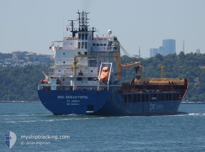
BBC SEBASTOPOL
Cargo
Current Trip
KANDLA
| Time Travelled | 1 h, 25 mins |
|---|---|
| Remaining Time | --- |
| Distance Travelled | 13.87 nm |
| Remaining Distance | --- |
| AVG Speed | 10.5 Knots |
| MAX Speed | 12.5 Knots |
| AVG Wind | 16.1 knots |
| MAX Wind | 17 knots |
| MIN Temp | 28.2°C / 82.76°F |
| MAX Temp | 31.6°C / 88.88°F |
| Draught | 7.7 m |
| Position Received | 4 d ago |
Current Position
| Longitude | 57.13036° |
|---|---|
| Latitude | 24.68933° |
| Status | Under way using engine |
| Speed | 14.4 Knots |
| Course | 135.1° |
| Area | Gulf of Oman |
| Station | T-AIS |
| Position Received | 4 d ago |
Info
Information
The current position of BBC SEBASTOPOL is in Gulf of Oman with coordinates 24.68933° / 57.13036° as reported on 2024-05-04 23:16 by AIS to our vessel tracker app. The vessel's current speed is 14.4 Knots
The vessel BBC SEBASTOPOL (IMO: 9812004, MMSI: 304824000) is a Cargo It's sailing under the flag of [AG] Antigua Barbuda.
In this page you can find informations about the vessels current position, last detected port calls, and current voyage information. If the vessels is not in coverage by AIS you will find the latest position.
The current position of BBC SEBASTOPOL is detected by our AIS receivers and we are not responsible for the reliability of the data. The last position was recorded while the vessel was in Coverage by the Ais receivers of our vessel tracking app.
The current draught of BBC SEBASTOPOL as reported by AIS is 7.7 meters
Weather
| Temperature | 28.2°C / 82.76°F |
|---|---|
| Wind Speed | 16 knots |
| Direction | 255° WSW |
| Pressure | 1006.8 hPa |
| Humidity | 84.2 % |
| Cloud Coverage | --- |
Featured Company
Last Port Calls
| Port | Arrival | Departure | Time In Port |
|---|---|---|---|
| 2024-05-07 21:27 | 2024-05-09 15:41 | 1 d | |
| 2024-04-27 22:28 | 2024-05-03 12:27 | 5 d | |
| 2024-04-25 10:41 | 2024-04-27 00:27 | 1 d | |
| 2024-04-18 08:40 | 2024-04-19 16:14 | 1 d | |
| 2024-04-15 08:42 | 2024-04-16 07:25 | 22 h | |
| 2024-04-11 11:55 | 2024-04-12 22:16 | 1 d | |
| 2024-03-27 20:08 | 2024-03-28 17:39 | 21 h | |
| 2024-03-10 01:22 | 2024-03-10 01:57 | 34 m | |
| 2024-03-04 22:04 | 2024-03-08 11:14 | 3 d | |
| 2024-03-01 20:31 |
Most Visited Ports (Last year)
| Port | Arrivals | |
|---|---|---|
| 3 | ||
| 2 | ||
| 2 | ||
| 2 | ||
| 1 | ||
| 1 |
Last Trips
| Origin | Departure | Destination | Arrival | Distance | |
|---|---|---|---|---|---|
| 2024-05-03 16:27 | 2024-05-08 02:57 | 1079.60 nm | |||
| 2024-04-27 03:27 | 2024-04-28 02:28 | 325.35 nm | |||
| 2024-04-19 19:14 | 2024-04-25 13:41 | 294.90 nm | |||
| 2024-04-16 10:25 | 2024-04-18 11:40 | 155.47 nm | |||
| 2024-04-13 02:16 | 2024-04-15 11:42 | 609.24 nm | |||
| 2024-03-28 19:39 | 2024-04-11 15:55 | 4291.78 nm | |||
| 2024-03-09 22:57 | 2024-03-27 22:08 | 4254.29 nm | |||
| 2024-03-08 08:14 | 2024-03-09 22:22 | 236.70 nm | |||
| 2024-03-01 17:31 | 2024-03-04 19:04 | 13.28 nm |
Events
| Time | Event | Details | Position / Dest | Info |
|---|---|---|---|---|
| 2024-05-09 15:41 | PORT DEPARTURE |
|
22.95507 / 70.24064
KANDLA
|
Speed: 6.5 kn Course: 162° |
| 2024-05-09 15:34 | START Moving |
22.97253 / 70.23495
[IN] KANDLA
|
Speed: 6.2 kn Course: 162° |
|
| 2024-05-07 21:42 | STOP Moving |
22.97500 / 70.22833
[IN] KANDLA
|
Speed: Course: -1° |
|
| 2024-05-07 21:27 | PORT ARRIVAL |
|
22.97333 / 70.23333
[IN] KANDLA
|
Speed: 11.1 kn Course: 338° |
| 2024-05-07 19:33 | START Moving | 16.05 nm, South of KANDLA |
22.77667 / 70.09167
KANDLA
|
Speed: 7 kn Course: 10° |
| 2024-05-07 04:48 | STOP Moving | 16.17 nm, South of KANDLA |
22.77370 / 70.09412
KANDLA
|
Speed: 0.3 kn Course: 250° |
| 2024-05-04 23:22 | Status Changed | Default Under way using engine |
24.67305 / 57.14799
KANDLA
|
Speed: 14.4 kn Course: 135.1° |
| 2024-05-04 23:16 | OUT of Coverage |
24.68933 / 57.13036
Gulf of Oman
KANDLA
|
Speed: 14.4 kn Course: 135.1° |
|
| 2024-05-04 21:13 | Change Sea Area | Omani part of the Gulf of Oman United Arab Emirates part of the Gulf of Oman |
25.04625 / 56.77548
Gulf of Oman
KANDLA
|
Speed: 13.3 kn Course: 142.7° |
| 2024-05-04 19:45 | START Moving | 10.59 nm, East of FUJAIRAH |
25.19350 / 56.55255
KANDLA
|
Speed: 3.7 kn Course: 95° |