
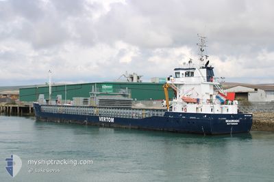
BEAUMAGIC
General Cargo
Current Trip
| Time Travelled | 1 day |
|---|---|
| Remaining Time | 1 day |
| Distance Travelled | 371.25 nm |
| Remaining Distance | 352.73 nm |
| AVG Speed | 9.8 Knots |
| MAX Speed | 11.5 Knots |
| AVG Wind | 11.5 knots |
| MAX Wind | 16 knots |
| MIN Temp | 13.6°C / 56.48°F |
| MAX Temp | 17.2°C / 62.96°F |
| Draught | 4.7 m |
| Position Received | 1 h, 11 m ago |
Current Position
| Longitude | -1.95471° |
|---|---|
| Latitude | 49.95486° |
| Status | Under way using engine |
| Speed | 9.9 Knots |
| Course | 76.2° |
| Area | English Channel |
| Station | T-AIS |
| Position Received | 1 h, 11 m ago |
Info
Information
The current position of BEAUMAGIC is in English Channel with coordinates 49.95486° / -1.95471° as reported on 2024-06-02 00:34 by AIS to our vessel tracker app. The vessel's current speed is 9.9 Knots and is heading at the port of HARLINGEN. The estimated time of arrival as calculated by vessel tracking app is 2024-06-03 15:39 LT
The vessel BEAUMAGIC (IMO: 9373266, MMSI: 244615000) is a General Cargo that was built in 2007 ( 17 years old ). It's sailing under the flag of [NL] Netherlands.
In this page you can find informations about the vessels current position, last detected port calls, and current voyage information. If the vessels is not in coverage by AIS you will find the latest position.
The current position of BEAUMAGIC is detected by our AIS receivers and we are not responsible for the reliability of the data. The last position was recorded while the vessel was in Coverage by the Ais receivers of our vessel tracking app.
The current draught of BEAUMAGIC as reported by AIS is 4.7 meters
Weather
| Temperature | 13.6°C / 56.48°F |
|---|---|
| Wind Speed | 11 knots |
| Direction | 40° NE |
| Pressure | 1027.6 hPa |
| Humidity | 82 % |
| Cloud Coverage | 93 % |
Featured Company
Last Port Calls
| Port | Arrival | Departure | Time In Port |
|---|---|---|---|
| 2024-05-29 06:30 | 2024-05-31 11:21 | 2 d | |
| 2024-05-26 05:54 | 2024-05-27 15:43 | 1 d | |
| 2024-05-18 21:16 | 2024-05-22 10:12 | 3 d | |
| 2024-05-17 06:12 | 2024-05-18 03:42 | 21 h | |
| 2024-05-11 07:59 | 2024-05-13 10:53 | 2 d | |
| 2024-05-04 03:50 | 2024-05-09 19:38 | 5 d | |
| 2024-04-24 19:45 | 2024-04-25 14:39 | 18 h | |
| 2024-04-17 15:34 | 2024-04-19 15:57 | 2 d | |
| 2024-04-16 09:46 | 2024-04-17 10:03 | 1 d | |
| 2024-04-09 08:29 | 2024-04-10 02:27 | 17 h |
Most Visited Ports (Last year)
| Port | Arrivals | |
|---|---|---|
| 5 | ||
| 4 | ||
| 3 | ||
| 3 | ||
| 3 | ||
| 2 |
Last Trips
| Origin | Departure | Destination | Arrival | Distance | |
|---|---|---|---|---|---|
| 2024-05-27 17:43 | 2024-05-29 08:30 | 344.20 nm | |||
| 2024-05-22 12:12 | 2024-05-26 07:54 | 773.23 nm | |||
| 2024-05-18 04:42 | 2024-05-18 23:16 | 147.79 nm | |||
| 2024-05-13 11:53 | 2024-05-17 07:12 | 697.23 nm | |||
| 2024-05-09 20:38 | 2024-05-11 08:59 | 342.19 nm | |||
| 2024-04-25 16:39 | 2024-05-04 04:50 | 1622.21 nm | |||
| 2024-04-19 16:57 | 2024-04-24 21:45 | 1132.92 nm | |||
| 2024-04-17 11:03 | 2024-04-17 16:34 | 55.19 nm | |||
| 2024-04-10 04:27 | 2024-04-16 10:46 | 1103.76 nm | |||
| 2024-04-04 16:25 | 2024-04-09 10:29 | 811.58 nm |
Events
| Time | Event | Details | Position / Dest | Info |
|---|---|---|---|---|
| 2024-06-02 00:40 | Status Changed | Default Under way using engine |
49.95909 / -1.93059
NLHAR
|
Speed: 9.9 kn Course: 76.2° |
| 2024-06-02 00:34 | OUT of Coverage |
49.95486 / -1.95471
English Channel
NLHAR
|
Speed: 9.9 kn Course: 76.2° |
|
| 2024-06-02 00:34 | Status Changed | Under way using engine Default |
49.95448 / -1.95684
NLHAR
|
Speed: 9.8 kn Course: 74° |
| 2024-06-02 00:32 | Status Changed | Default Under way using engine |
49.95314 / -1.96429
NLHAR
|
Speed: 9.7 kn Course: 74.5° |
| 2024-06-02 00:15 | Detected in Sea | French part of the English Channel |
49.94059 / -2.03341
English Channel
NLHAR
|
Speed: 9.4 kn Course: 74.6° |
| 2024-06-01 20:27 | Status Changed | Under way using engine Default |
49.79680 / -2.82096
NLHAR
|
Speed: 8.7 kn Course: 78° |
| 2024-06-01 20:24 | Status Changed | Default Under way using engine |
49.79507 / -2.83311
NLHAR
|
Speed: 8.7 kn Course: 57.2° |
| 2024-06-01 20:17 | Status Changed | Under way using engine Default |
49.78914 / -2.85705
NLHAR
|
Speed: 8.7 kn Course: 58° |
| 2024-06-01 20:12 | Status Changed | Default Under way using engine |
49.78258 / -2.87282
NLHAR
|
Speed: 8.7 kn Course: 55.9° |
| 2024-06-01 20:04 | Detected in Sea | Guernsey part of the English Channel |
49.77252 / -2.89722
English Channel
NLHAR
|
Speed: 8.8 kn Course: 58.1° |