
BEAUMONT
General Cargo
Current Trip
| Time Travelled | 3 days |
|---|---|
| Remaining Time | 1 h, 15 mins |
| Distance Travelled | 757.62 nm |
| Remaining Distance | 15.75 nm |
| AVG Speed | 9.2 Knots |
| MAX Speed | 12.4 Knots |
| AVG Wind | 12.4 knots |
| MAX Wind | 18.5 knots |
| MIN Temp | 10.4°C / 50.72°F |
| MAX Temp | 15.4°C / 59.72°F |
| Draught | 5.3 m |
| Position Received | 1 m ago |
Current Position
| Longitude | -5.52099° |
|---|---|
| Latitude | 54.71111° |
| Status | Under way using engine |
| Speed | 8 Knots |
| Course | 273.7° |
| Area | Inner Seas off the West Coast of Scotland |
| Station | T-AIS |
| Position Received | 1 m ago |
Info
Information
The current position of BEAUMONT is in Inner Seas off the West Coast of Scotland with coordinates 54.71111° / -5.52099° as reported on 2024-06-02 00:14 by AIS to our vessel tracker app. The vessel's current speed is 8 Knots and is heading at the port of BELFAST. The estimated time of arrival as calculated by vessel tracking app is 2024-06-02 01:30 LT
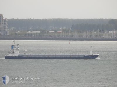
The vessel BEAUMONT (IMO: 9319416, MMSI: 235050609) is a General Cargo that was built in 2005 ( 19 years old ). It's sailing under the flag of [GB] United Kingdom.
In this page you can find informations about the vessels current position, last detected port calls, and current voyage information. If the vessels is not in coverage by AIS you will find the latest position.
The current position of BEAUMONT is detected by our AIS receivers and we are not responsible for the reliability of the data. The last position was recorded while the vessel was in Coverage by the Ais receivers of our vessel tracking app.
The current draught of BEAUMONT as reported by AIS is 5.3 meters
Weather
| Temperature | 10.4°C / 50.72°F |
|---|---|
| Wind Speed | 12 knots |
| Direction | 317° NW |
| Pressure | 1031 hPa |
| Humidity | 82 % |
| Cloud Coverage | 2 % |
Featured Company
Last Port Calls
| Port | Arrival | Departure | Time In Port |
|---|---|---|---|
| 2024-05-26 09:24 | 2024-05-29 16:29 | 3 d | |
| 2024-05-26 07:58 | 2024-05-26 08:26 | 27 m | |
| 2024-05-22 16:32 | 2024-05-25 18:06 | 3 d | |
| 2024-05-18 13:58 | 2024-05-19 13:59 | 1 d | |
| 2024-05-15 23:30 | 2024-05-17 12:22 | 1 d | |
| 2024-05-09 13:41 | 2024-05-13 17:41 | 4 d | |
| 2024-05-07 23:36 | 2024-05-08 23:51 | 1 d | |
| 2024-05-04 03:49 | 2024-05-05 12:26 | 1 d | |
| 2024-05-03 05:46 | 2024-05-03 19:18 | 13 h | |
| 2024-04-27 17:10 | 2024-04-30 09:16 | 2 d |
Last Trips
| Origin | Departure | Destination | Arrival | Distance | |
|---|---|---|---|---|---|
| 2024-05-26 10:26 | 2024-05-26 11:24 | 9.15 nm | |||
| 2024-05-25 19:06 | 2024-05-26 09:58 | 138.52 nm | |||
| 2024-05-19 14:59 | 2024-05-22 17:32 | 702.66 nm | |||
| 2024-05-17 13:22 | 2024-05-18 14:58 | 274.80 nm | |||
| 2024-05-13 19:41 | 2024-05-16 00:30 | 458.93 nm | |||
| 2024-05-09 00:51 | 2024-05-09 15:41 | 159.58 nm | |||
| 2024-05-05 13:26 | 2024-05-08 00:36 | 544.42 nm | |||
| 2024-05-03 20:18 | 2024-05-04 04:49 | 90.52 nm | |||
| 2024-04-30 11:16 | 2024-05-03 06:46 | 537.42 nm | |||
| 2024-04-25 22:29 | 2024-04-27 19:10 | 421.34 nm |
Events
| Time | Event | Details | Position / Dest | Info |
|---|---|---|---|---|
| 2024-06-01 22:22 | Change Sea Area | United Kingdom part of the Inner Seas off the West Coast of Scotland United Kingdom part of the Irish Sea and St. George's Channel |
54.44578 / -5.31350
Inner Seas off the West Coast of Scotland
GBBEL
|
Speed: 9.6 kn Course: 345.9° |
| 2024-06-01 21:38 | Status Changed | Under way using engine Default |
54.32873 / -5.32072
GBBEL
|
Speed: 10 kn Course: 7° |
| 2024-06-01 21:36 | Status Changed | Default Under way using engine |
54.32379 / -5.32178
GBBEL
|
Speed: 9.5 kn Course: 6.6° |
| 2024-06-01 19:19 | Detected in Sea | United Kingdom part of the Irish Sea and St. George's Channel |
53.96236 / -5.38979
Irish Sea and St. George's Channel
GBBEL
|
Speed: 9.7 kn Course: 5.7° |
| 2024-06-01 19:19 | Status Changed | Under way using engine Default |
53.96236 / -5.38979
GBBEL
|
Speed: 9.6 kn Course: 6° |
| 2024-06-01 19:08 | IN Coverage |
53.96236 / -5.38979
Irish Sea and St. George's Channel
GBBEL
|
Speed: 9.7 kn Course: 5.7° |
|
| 2024-06-01 17:08 | Status Changed | Default Under way using engine |
53.59819 / -5.45652
GBBEL
|
Speed: 11 kn Course: 5.7° |
| 2024-06-01 17:03 | OUT of Coverage |
53.58316 / -5.45913
Irish Sea and St. George's Channel
GBBEL
|
Speed: 11 kn Course: 5.7° |
|
| 2024-06-01 12:44 | Status Changed | Under way using engine Default |
52.80089 / -5.60747
GBBEL
|
Speed: 10.3 kn Course: 6° |
| 2024-06-01 12:24 | Status Changed | Default Under way using engine |
52.74730 / -5.61728
GBBEL
|
Speed: 9.7 kn Course: 7.2° |