
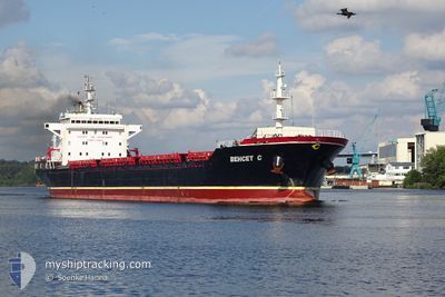
BEHCET C
Bulk Carrier
Current Trip
| Time Travelled | 1 day |
|---|---|
| Remaining Time | 19 mins |
| Distance Travelled | 272.25 nm |
| Remaining Distance | 6.35 nm |
| AVG Speed | 10.3 Knots |
| MAX Speed | 14.7 Knots |
| AVG Wind | 4 knots |
| MAX Wind | 11 knots |
| MIN Temp | 14.8°C / 58.64°F |
| MAX Temp | 20.4°C / 68.72°F |
| Draught | 5.8 m |
| Position Received | 1 m ago |
Current Position
| Longitude | 28.95787° |
|---|---|
| Latitude | 40.93218° |
| Status | Under way using engine |
| Speed | 5.8 Knots |
| Course | 339.4° |
| Area | Sea of Marmara |
| Station | T-AIS |
| Position Received | 1 m ago |
Info
Information
The current position of BEHCET C is in Sea of Marmara with coordinates 40.93218° / 28.95787° as reported on 2024-05-23 07:35 by AIS to our vessel tracker app. The vessel's current speed is 5.8 Knots and is heading at the port of ISTANBUL. The estimated time of arrival as calculated by vessel tracking app is 2024-05-23 07:55 LT
The vessel BEHCET C (IMO: 9503744, MMSI: 357250000) is a Bulk Carrier that was built in 2009 ( 15 years old ). It's sailing under the flag of [PA] Panama.
In this page you can find informations about the vessels current position, last detected port calls, and current voyage information. If the vessels is not in coverage by AIS you will find the latest position.
The current position of BEHCET C is detected by our AIS receivers and we are not responsible for the reliability of the data. The last position was recorded while the vessel was in Coverage by the Ais receivers of our vessel tracking app.
The current draught of BEHCET C as reported by AIS is 5.8 meters
Weather
| Temperature | 19°C / 66.2°F |
|---|---|
| Wind Speed | 4 knots |
| Direction | 14° NNE |
| Pressure | 1009.9 hPa |
| Humidity | 64.8 % |
| Cloud Coverage | 2 % |
Featured Company
Last Port Calls
| Port | Arrival | Departure | Time In Port |
|---|---|---|---|
| 2024-05-18 11:16 | 2024-05-21 22:39 | 3 d | |
| 2024-04-17 22:10 | 2024-04-21 18:04 | 3 d | |
| 2024-04-07 13:22 | 2024-04-07 18:08 | 4 h | |
| 2024-03-30 16:53 | 2024-04-04 19:25 | 5 d |
Most Visited Ports (Last year)
| Port | Arrivals | |
|---|---|---|
| 4 | ||
| 2 | ||
| 1 | ||
| 1 | ||
| 1 | ||
| 1 |
Last Trips
| Origin | Departure | Destination | Arrival | Distance | |
|---|---|---|---|---|---|
| 2024-04-21 19:04 | 2024-05-18 14:16 | 4860.15 nm | |||
| 2024-04-07 20:08 | 2024-04-17 23:10 | 1703.22 nm | |||
| 2024-04-04 22:25 | 2024-04-07 15:22 | 461.55 nm |
Events
| Time | Event | Details | Position / Dest | Info |
|---|---|---|---|---|
| 2024-05-23 05:13 | Status Changed | Under way using engine Default |
40.81261 / 28.45031
TR IST
|
Speed: 11.2 kn Course: 82° |
| 2024-05-23 04:42 | Status Changed | Default Under way using engine |
40.80024 / 28.32534
TR IST
|
Speed: 11.1 kn Course: 84.4° |
| 2024-05-23 03:58 | Status Changed | Under way using engine Default |
40.77354 / 28.14326
TR IST
|
Speed: 11.3 kn Course: 80° |
| 2024-05-23 03:34 | Status Changed | Default Under way using engine |
40.76076 / 28.04420
TR IST
|
Speed: 11.3 kn Course: 82° |
| 2024-05-23 00:25 | Status Changed | Under way using engine Default |
40.61031 / 27.31007
TR IST
|
Speed: 10.8 kn Course: 68° |
| 2024-05-23 00:17 | IN Coverage |
40.61031 / 27.31007
Sea of Marmara
TR IST
|
Speed: 10.9 kn Course: 67.5° |
|
| 2024-05-22 20:31 | Status Changed | Default Under way using engine |
40.27417 / 26.54562
TR IST
|
Speed: 9.7 kn Course: 44.8° |
| 2024-05-22 20:28 | OUT of Coverage |
40.26753 / 26.53769
Sea of Marmara
TR IST
|
Speed: 9.7 kn Course: 44.8° |
|
| 2024-05-22 18:12 | Change Sea Area | Turkish part of the Sea of Marmara Turkish part of the Aegean Sea |
40.02203 / 26.23083
Sea of Marmara
TR IST
|
Speed: 9.6 kn Course: 74.2° |
| 2024-05-22 18:12 | Status Changed | Under way using engine Default |
40.02203 / 26.23083
TR IST
|
Speed: 7.8 kn Course: 82° |