
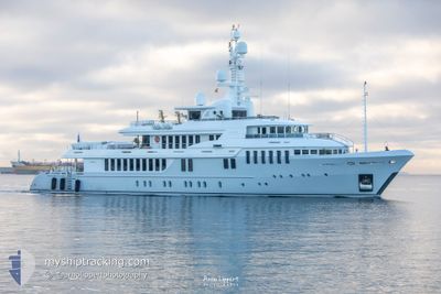
BELLA II
Yacht
Current Trip
| Time Travelled | 15 h, 17 mins |
|---|---|
| Remaining Time | --- |
| Distance Travelled | 19.36 nm |
| Remaining Distance | --- |
| AVG Speed | 9.7 Knots |
| MAX Speed | 13.3 Knots |
| AVG Wind | 2.7 knots |
| MAX Wind | 5 knots |
| MIN Temp | 20.5°C / 68.9°F |
| MAX Temp | 22.7°C / 72.86°F |
| Draught | 3.2 m |
| Position Received | 3 m ago |
Current Position
| Longitude | 14.23892° |
|---|---|
| Latitude | 40.54024° |
| Status | At anchor |
| Speed | |
| Course | 314° |
| Area | Tyrrhenian Sea |
| Station | T-AIS |
| Position Received | 3 m ago |
Info
Information
The current position of BELLA II is in Tyrrhenian Sea with coordinates 40.54024° / 14.23892° as reported on 2024-06-15 22:01 by AIS to our vessel tracker app. The vessel's current speed is 0 Knots
The vessel BELLA II (IMO: 9559286, MMSI: 538071319) is a Yacht that was built in 2008 ( 16 years old ). It's sailing under the flag of [MH] Marshall Is.
In this page you can find informations about the vessels current position, last detected port calls, and current voyage information. If the vessels is not in coverage by AIS you will find the latest position.
The current position of BELLA II is detected by our AIS receivers and we are not responsible for the reliability of the data. The last position was recorded while the vessel was in Coverage by the Ais receivers of our vessel tracking app.
The current draught of BELLA II as reported by AIS is 3.2 meters
Weather
| Temperature | 22.3°C / 72.14°F |
|---|---|
| Wind Speed | 1 knots |
| Direction | 177° S |
| Pressure | 1013.3 hPa |
| Humidity | 56.8 % |
| Cloud Coverage | 93 % |
Featured Company
Last Port Calls
| Port | Arrival | Departure | Time In Port |
|---|---|---|---|
| 2024-06-12 18:27 | 2024-06-15 06:47 | 2 d | |
| 2024-06-05 10:19 | 2024-06-06 12:10 | 1 d | |
| 2024-05-22 10:02 | 2024-05-24 08:08 | 1 d | |
| 2024-05-06 16:46 | 2024-05-10 07:14 | 3 d | |
| 2024-05-05 09:35 |
Last Trips
| Origin | Departure | Destination | Arrival | Distance | |
|---|---|---|---|---|---|
| 2024-06-06 14:10 | 2024-06-12 20:27 | 446.50 nm | |||
| 2024-05-24 10:08 | 2024-06-05 12:19 | 131.93 nm | |||
| 2024-05-10 09:14 | 2024-05-22 12:02 | 98.52 nm | |||
| 2024-05-05 11:35 | 2024-05-06 18:46 | 310.26 nm |
Events
| Time | Event | Details | Position / Dest | Info |
|---|---|---|---|---|
| 2024-06-15 08:40 | Status Changed | At anchor Under way using engine |
40.54138 / 14.23883
CAPRI
|
Speed: 0.2 kn Course: 187° |
| 2024-06-15 08:34 | STOP Moving | 0.97 nm, South of CAPRI |
40.54084 / 14.23878
CAPRI
|
Speed: 0.2 kn Course: 203° |
| 2024-06-15 08:22 | START Moving | 1.27 nm, South of CAPRI |
40.53643 / 14.24947
CAPRI
|
Speed: 6.3 kn Course: 298.2° |
| 2024-06-15 08:21 | STOP Moving | 1.31 nm, South of CAPRI |
40.53626 / 14.25188
CAPRI
|
Speed: 0.3 kn Course: 232° |
| 2024-06-15 06:53 | Destination Changed | CAPRI NAPOLI |
40.82461 / 14.23119
CAPRI
|
Speed: 3.9 kn Course: 149° |
| 2024-06-15 06:53 | ETA Changed | 2024/06/15 10:30 2024/06/12 19:30 |
40.82461 / 14.23119
CAPRI
|
Speed: 3.9 kn Course: 149° |
| 2024-06-15 06:47 | PORT DEPARTURE |
|
40.82714 / 14.22873
NAPOLI
|
Speed: 4.1 kn Course: 113° |
| 2024-06-15 06:46 | START Moving |
40.82753 / 14.22760
[IT] MERGELLINA
|
Speed: 4.9 kn Course: 112° |
|
| 2024-06-15 06:23 | Status Changed | Under way using engine Moored |
40.82707 / 14.22516
[IT] MERGELLINA
|
Speed: Course: 332° |
| 2024-06-12 18:55 | Status Changed | Moored Under way using engine |
40.82707 / 14.22513
[IT] MERGELLINA
|
Speed: Course: 332° |