
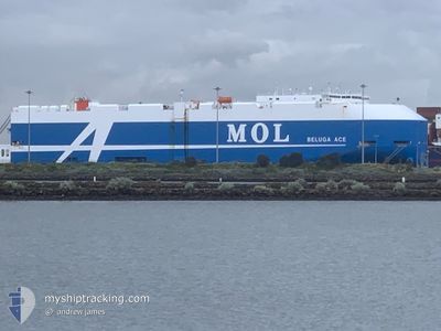
BELUGA ACE
Cargo
Current Trip
| Trip Time | 15 days |
|---|---|
| Trip Distance | 5379.26 nm |
| AVG Speed | 14.9 Knots |
| MAX Speed | 18.7 Knots |
| Draught | 8.7 m |
| AVG Wind | 11.6 knots |
| MAX Wind | 25 knots |
| MIN Temp | 14.6°C / 58.28°F |
| MAX Temp | 30.5°C / 86.9°F |
| Position Received | 5 d ago |
Current Position
| Longitude | 119.71138° |
|---|---|
| Latitude | 14.71593° |
| Status | Under way using engine |
| Speed | 13.6 Knots |
| Course | 350.6° |
| Area | South China Sea |
| Station | T-AIS |
| Position Received | 5 d ago |
Info
Information
The current position of BELUGA ACE is in South China Sea with coordinates 14.71593° / 119.71138° as reported on 2024-06-22 02:02 by AIS to our vessel tracker app. The vessel's current speed is 13.6 Knots and is currently inside the port of SHANGHAI.
The vessel BELUGA ACE (IMO: 9777802, MMSI: 353580000) is a Cargo It's sailing under the flag of [PA] Panama.
In this page you can find informations about the vessels current position, last detected port calls, and current voyage information. If the vessels is not in coverage by AIS you will find the latest position.
The current position of BELUGA ACE is detected by our AIS receivers and we are not responsible for the reliability of the data. The last position was recorded while the vessel was in Coverage by the Ais receivers of our vessel tracking app.
The current draught of BELUGA ACE as reported by AIS is 8.7 meters
Weather
| Temperature | 22.4°C / 72.32°F |
|---|---|
| Wind Speed | 7 knots |
| Direction | 235° SW |
| Pressure | 1009.7 hPa |
| Humidity | 95.9 % |
| Cloud Coverage | 100 % |
Featured Company
Last Port Calls
| Port | Arrival | Departure | Time In Port |
|---|---|---|---|
| 2024-06-26 07:17 | |||
| 2024-06-09 08:38 | 2024-06-10 10:52 | 1 d | |
| 2024-06-04 12:16 | 2024-06-05 15:28 | 1 d | |
| 2024-05-27 12:13 | 2024-05-28 01:42 | 13 h | |
| 2024-05-24 05:27 | 2024-05-25 05:27 | 23 h | |
| 2024-05-21 11:19 | 2024-05-21 23:11 | 11 h | |
| 2024-05-17 05:49 | 2024-05-17 13:45 | 7 h | |
| 2024-05-14 21:04 | 2024-05-15 09:27 | 12 h | |
| 2024-04-28 02:47 | 2024-04-30 09:29 | 2 d | |
| 2024-04-24 11:39 | 2024-04-26 15:03 | 2 d |
Last Trips
| Origin | Departure | Destination | Arrival | Distance | |
|---|---|---|---|---|---|
| 2024-06-10 20:22 | 2024-06-26 15:17 | 5379.26 nm | |||
| 2024-06-05 23:28 | 2024-06-09 18:08 | 1363.50 nm | |||
| 2024-05-28 09:42 | 2024-06-04 20:16 | 2305.25 nm | |||
| 2024-05-25 12:27 | 2024-05-27 20:13 | 812.35 nm | |||
| 2024-05-22 07:11 | 2024-05-24 12:27 | 821.63 nm | |||
| 2024-05-17 21:45 | 2024-05-21 19:19 | 1656.47 nm | |||
| 2024-05-15 17:27 | 2024-05-17 13:49 | 635.60 nm | |||
| 2024-04-30 19:29 | 2024-05-15 05:04 | 5163.66 nm | |||
| 2024-04-27 01:03 | 2024-04-28 12:47 | 556.36 nm | |||
| 2024-04-23 08:29 | 2024-04-24 21:39 | 556.95 nm |
Events
| Time | Event | Details | Position / Dest | Info |
|---|---|---|---|---|
| 2024-06-26 07:25 | STOP Moving |
31.32366 / 121.67992
[CN] SHANGHAI
|
Speed: 0.3 kn Course: 130° |
|
| 2024-06-26 07:17 | PORT ARRIVAL |
|
31.32503 / 121.68050
[CN] SHANGHAI
|
Speed: 1.2 kn Course: -1° |
| 2024-06-26 01:13 | START Moving |
31.18464 / 122.57159
CNSHA
|
Speed: 5 kn Course: 237° |
|
| 2024-06-25 07:28 | STOP Moving |
31.18862 / 122.57929
CNSHA
|
Speed: 0.2 kn Course: 263° |
|
| 2024-06-22 02:13 | Status Changed | Default Under way using engine |
14.75751 / 119.70505
CNSHA
|
Speed: 13.6 kn Course: 350.6° |
| 2024-06-22 02:02 | Status Changed | Under way using engine Default |
14.71594 / 119.71138
CNSHA
|
Speed: 13.6 kn Course: 350° |
| 2024-06-22 02:02 | OUT of Coverage |
14.71594 / 119.71138
South China Sea
CNSHA
|
Speed: 13.6 kn Course: 350.6° |
|
| 2024-06-22 01:54 | Status Changed | Default Under way using engine |
14.68786 / 119.71645
CNSHA
|
Speed: 13.5 kn Course: 350.3° |
| 2024-06-22 01:46 | Change Sea Area | Philippines part of the South China Sea Australian part of the Indian Ocean |
14.65599 / 119.72217
South China Sea
CNSHA
|
Speed: 13.5 kn Course: 350.3° |
| 2024-06-22 01:46 | Status Changed | Under way using engine Default |
14.65599 / 119.72217
CNSHA
|
Speed: 13 kn Course: 350° |