
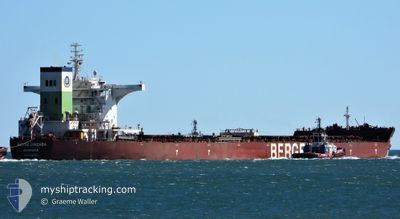
BERGE ORIZABA
Cargo
Current Trip
| Time Travelled | 14 days |
|---|---|
| Remaining Time | --- |
| Distance Travelled | 3631.37 nm |
| Remaining Distance | 14.02 nm |
| AVG Speed | 10.6 Knots |
| MAX Speed | 15.2 Knots |
| AVG Wind | 10.7 knots |
| MAX Wind | 24 knots |
| MIN Temp | 13.7°C / 56.66°F |
| MAX Temp | 30.2°C / 86.36°F |
| Draught | 8.6 m |
| Position Received | 1 m ago |
Current Position
| Longitude | 118.61891° |
|---|---|
| Latitude | -20.10283° |
| Status | At anchor |
| Speed | |
| Course | 92° |
| Area | Indian Ocean |
| Station | T-AIS |
| Position Received | 1 m ago |
Info
Information
The current position of BERGE ORIZABA is in Indian Ocean with coordinates -20.10283° / 118.61891° as reported on 2024-05-18 05:14 by AIS to our vessel tracker app. The vessel's current speed is 0 Knots and is heading at the port of PORT HEDLAND. The estimated time of arrival as calculated by vessel tracking app is 2024-05-17 08:00 LT
The vessel BERGE ORIZABA (IMO: 9567087, MMSI: 636019097) is a Cargo It's sailing under the flag of [LR] Liberia.
In this page you can find informations about the vessels current position, last detected port calls, and current voyage information. If the vessels is not in coverage by AIS you will find the latest position.
The current position of BERGE ORIZABA is detected by our AIS receivers and we are not responsible for the reliability of the data. The last position was recorded while the vessel was in Coverage by the Ais receivers of our vessel tracking app.
The current draught of BERGE ORIZABA as reported by AIS is 8.6 meters
Weather
| Temperature | 26.6°C / 79.88°F |
|---|---|
| Wind Speed | 14 knots |
| Direction | 65° ENE |
| Pressure | 1016.1 hPa |
| Humidity | 60.8 % |
| Cloud Coverage | 90 % |
Featured Company
Last Port Calls
| Port | Arrival | Departure | Time In Port |
|---|---|---|---|
| 2024-04-30 14:08 | 2024-05-03 16:00 | 3 d | |
| 2024-04-13 05:22 | 2024-04-14 05:39 | 1 d | |
| 2024-03-21 08:39 | 2024-03-25 00:21 | 3 d | |
| 2024-03-03 06:31 | 2024-03-05 19:29 | 2 d |
Last Trips
| Origin | Departure | Destination | Arrival | Distance | |
|---|---|---|---|---|---|
| 2024-04-14 13:39 | 2024-04-30 22:08 | 3673.15 nm | |||
| 2024-03-25 08:21 | 2024-04-13 13:22 | 3750.42 nm | |||
| 2024-03-06 03:29 | 2024-03-21 16:39 | 3694.46 nm | |||
| 2024-02-07 13:22 | 2024-03-03 14:31 | 3374.25 nm |
Events
| Time | Event | Details | Position / Dest | Info |
|---|---|---|---|---|
| 2024-05-17 18:26 | Status Changed | At anchor Default |
-20.10229 / 118.61970
AU PHE
|
Speed: Course: -1° |
| 2024-05-17 18:21 | Status Changed | Default At anchor |
-20.10167 / 118.61833
AU PHE
|
Speed: Course: 112° |
| 2024-05-17 12:44 | Status Changed | At anchor Default |
-20.10427 / 118.61997
AU PHE
|
Speed: Course: 86° |
| 2024-05-17 12:41 | Status Changed | Default At anchor |
-20.10429 / 118.61999
AU PHE
|
Speed: Course: 87° |
| 2024-05-17 07:20 | Status Changed | At anchor Under way using engine |
-20.10414 / 118.62065
AU PHE
|
Speed: 0.3 kn Course: 62° |
| 2024-05-17 07:19 | STOP Moving | 13.33 nm, North of PORT HEDLAND |
-20.10402 / 118.62056
AU PHE
|
Speed: 0.3 kn Course: 60° |
| 2024-05-17 03:39 | Status Changed | Under way using engine Default |
-19.67732 / 118.38969
AU PHE
|
Speed: 10.1 kn Course: 160° |
| 2024-05-17 03:31 | IN Coverage |
-19.68129 / 118.39125
Indian Ocean
AU PHE
|
Speed: 10.2 kn Course: 159.1° |
|
| 2024-05-16 21:46 | Status Changed | Default Under way using engine |
-18.71737 / 118.14741
AU PHE
|
Speed: 10.3 kn Course: 163.4° |
| 2024-05-16 21:40 | OUT of Coverage |
-18.70126 / 118.14264
Indian Ocean
AU PHE
|
Speed: 10.3 kn Course: 163.4° |