
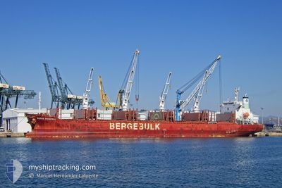
BERGE SNAEFELL
Cargo
Current Trip
| Time Travelled | 25 days |
|---|---|
| Remaining Time | --- |
| Distance Travelled | 6060.40 nm |
| Remaining Distance | --- |
| AVG Speed | 11.6 Knots |
| MAX Speed | 15.4 Knots |
| AVG Wind | 11.8 knots |
| MAX Wind | 48 knots |
| MIN Temp | 7.8°C / 46.04°F |
| MAX Temp | 28.4°C / 83.12°F |
| Draught | 10.4 m |
| Position Received | 22 h, 42 m ago |
Current Position
| Longitude | 5.19034° |
|---|---|
| Latitude | 36.72232° |
| Status | At anchor |
| Speed | 0.1 Knots |
| Course | 352° |
| Area | Mediterranean Sea - Western Basin |
| Station | T-AIS |
| Position Received | 22 h, 42 m ago |
Info
Information
The current position of BERGE SNAEFELL is in Mediterranean Sea - Western Basin with coordinates 36.72232° / 5.19034° as reported on 2024-06-15 06:36 by AIS to our vessel tracker app. The vessel's current speed is 0.1 Knots
The vessel BERGE SNAEFELL (IMO: 9816593, MMSI: 232012490) is a Cargo It's sailing under the flag of [GB] United Kingdom.
In this page you can find informations about the vessels current position, last detected port calls, and current voyage information. If the vessels is not in coverage by AIS you will find the latest position.
The current position of BERGE SNAEFELL is detected by our AIS receivers and we are not responsible for the reliability of the data. The last position was recorded while the vessel was in Coverage by the Ais receivers of our vessel tracking app.
The current draught of BERGE SNAEFELL as reported by AIS is 10.4 meters
Weather
| Temperature | 22.3°C / 72.14°F |
|---|---|
| Wind Speed | 3 knots |
| Direction | 291° WNW |
| Pressure | 1014 hPa |
| Humidity | 75.9 % |
| Cloud Coverage | 100 % |
Featured Company
Last Port Calls
| Port | Arrival | Departure | Time In Port |
|---|---|---|---|
| 2024-05-18 04:22 | 2024-05-21 06:41 | 3 d | |
| 2024-04-20 07:36 | 2024-04-20 19:07 | 11 h | |
| 2024-04-14 04:26 | 2024-04-18 09:07 | 4 d |
Most Visited Ports (Last year)
| Port | Arrivals | |
|---|---|---|
| 1 | ||
| 1 | ||
| 1 | ||
| 1 | ||
| 1 | ||
| 1 |
Last Trips
| Origin | Departure | Destination | Arrival | Distance | |
|---|---|---|---|---|---|
| 2024-04-20 20:07 | 2024-05-18 01:22 | 4945.96 nm | |||
| 2024-04-18 10:07 | 2024-04-20 08:36 | 565.65 nm | |||
| 2024-03-13 09:52 | 2024-04-14 05:26 | 2226.19 nm |
Events
| Time | Event | Details | Position / Dest | Info |
|---|---|---|---|---|
| 2024-06-15 06:39 | Status Changed | Default At anchor |
36.72234 / 5.19030
BEJAIA
|
Speed: 0.1 kn Course: 352° |
| 2024-06-15 06:36 | OUT of Coverage |
36.72232 / 5.19034
Mediterranean Sea - Western Basin
|
Speed: 0.1 kn Course: 250.2° |
|
| 2024-06-15 06:33 | Status Changed | At anchor Default |
36.72228 / 5.19031
BEJAIA
|
Speed: 0.2 kn Course: 11° |
| 2024-06-15 06:15 | IN Coverage |
36.72228 / 5.19031
Mediterranean Sea - Western Basin
|
Speed: 0.1 kn Course: 110.4° |
|
| 2024-06-15 05:27 | Status Changed | Default At anchor |
36.72271 / 5.19147
BEJAIA
|
Speed: Course: 314° |
| 2024-06-15 05:21 | OUT of Coverage |
36.72268 / 5.19151
Mediterranean Sea - Western Basin
|
Speed: Course: 201.7° |
|
| 2024-06-15 04:18 | Status Changed | At anchor Default |
36.72295 / 5.19193
BEJAIA
|
Speed: 0.2 kn Course: 297° |
| 2024-06-15 04:15 | Status Changed | Default At anchor |
36.72311 / 5.19204
BEJAIA
|
Speed: 0.4 kn Course: 287° |
| 2024-06-15 04:09 | Status Changed | At anchor Default |
36.72342 / 5.19233
BEJAIA
|
Speed: 0.3 kn Course: 270° |
| 2024-06-15 04:09 | IN Coverage |
36.72342 / 5.19233
Mediterranean Sea - Western Basin
|
Speed: 0.4 kn Course: 217.8° |