
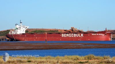
BERGE TAI SHAN
Cargo
Current Trip
CH FAN
| Time Travelled | 14 days |
|---|---|
| Remaining Time | --- |
| Distance Travelled | 2881.69 nm |
| Remaining Distance | --- |
| AVG Speed | 9.9 Knots |
| MAX Speed | 12.6 Knots |
| AVG Wind | 15.2 knots |
| MAX Wind | 23 knots |
| MIN Temp | 25°C / 77°F |
| MAX Temp | 32.3°C / 90.14°F |
| Draught | 17.6 m |
| Position Received | 4 d ago |
Current Position
| Longitude | 110.09454° |
|---|---|
| Latitude | 14.64937° |
| Status | Under way using engine |
| Speed | 10.2 Knots |
| Course | 1.1° |
| Area | South China Sea |
| Station | T-AIS |
| Position Received | 4 d ago |
Info
Information
The current position of BERGE TAI SHAN is in South China Sea with coordinates 14.64937° / 110.09454° as reported on 2024-05-27 16:53 by AIS to our vessel tracker app. The vessel's current speed is 10.2 Knots
The vessel BERGE TAI SHAN (IMO: 9675937, MMSI: 235107512) is a Cargo It's sailing under the flag of [GB] United Kingdom.
In this page you can find informations about the vessels current position, last detected port calls, and current voyage information. If the vessels is not in coverage by AIS you will find the latest position.
The current position of BERGE TAI SHAN is detected by our AIS receivers and we are not responsible for the reliability of the data. The last position was recorded while the vessel was in Coverage by the Ais receivers of our vessel tracking app.
The current draught of BERGE TAI SHAN as reported by AIS is 17.6 meters
Weather
| Temperature | 25.8°C / 78.44°F |
|---|---|
| Wind Speed | 4 knots |
| Direction | 260° W |
| Pressure | 1008.9 hPa |
| Humidity | 83.3 % |
| Cloud Coverage | 93 % |
Featured Company
Last Port Calls
| Port | Arrival | Departure | Time In Port |
|---|---|---|---|
| 2024-05-16 18:55 | 2024-05-17 23:42 | 1 d | |
| 2024-04-25 21:16 | 2024-04-28 12:04 | 2 d | |
| 2024-04-06 04:22 | 2024-04-07 14:28 | 1 d |
Most Visited Ports (Last year)
| Port | Arrivals | |
|---|---|---|
| 9 | ||
| 3 | ||
| 1 | ||
| 1 | ||
| 1 | ||
| 1 |
Last Trips
| Origin | Departure | Destination | Arrival | Distance | |
|---|---|---|---|---|---|
| 2024-04-28 20:04 | 2024-05-17 02:55 | 3934.53 nm | |||
| 2024-04-07 22:28 | 2024-04-26 05:16 | 3941.80 nm | |||
| 2024-03-15 20:22 | 2024-04-06 12:22 | 3755.84 nm |
Events
| Time | Event | Details | Position / Dest | Info |
|---|---|---|---|---|
| 2024-05-31 16:57 | STOP Moving | 3.25 nm, South of FANGCHENG |
21.53404 / 108.36162
CH FAN
|
Speed: 0.2 kn Course: 359° |
| 2024-05-31 12:33 | START Moving |
21.18665 / 108.39983
CH FAN
|
Speed: 3.5 kn Course: 354° |
|
| 2024-05-29 10:17 | STOP Moving |
21.18262 / 108.39471
CH FAN
|
Speed: Course: 131° |
|
| 2024-05-27 16:59 | Status Changed | Default Under way using engine |
14.66543 / 110.09467
CH FAN
|
Speed: 10.2 kn Course: 1.1° |
| 2024-05-27 16:53 | OUT of Coverage |
14.64937 / 110.09454
South China Sea
CH FAN
|
Speed: 10.2 kn Course: 1.1° |
|
| 2024-05-27 16:52 | ETA Changed | 2024/05/29 14:30 2024/05/29 23:00 |
14.64462 / 110.09446
CH FAN
|
Speed: 10.1 kn Course: 0.9° |
| 2024-05-27 16:49 | Change Sea Area | Vietnamese part of the South China Sea Australian part of the Indian Ocean |
14.63800 / 110.09486
South China Sea
CH FAN
|
Speed: 10.1 kn Course: 352.4° |
| 2024-05-27 16:49 | Status Changed | Under way using engine Default |
14.63705 / 110.09497
CH FAN
|
Speed: 10.3 kn Course: 351° |
| 2024-05-27 16:49 | IN Coverage |
14.63800 / 110.09486
South China Sea
CH FAN
|
Speed: 10.1 kn Course: 352.4° |