
BERING GAS
Tanker
Current Trip
US CRP
| Time Travelled | 5 days |
|---|---|
| Remaining Time | --- |
| Distance Travelled | 1521.26 nm |
| Remaining Distance | --- |
| AVG Speed | 13.9 Knots |
| MAX Speed | 16 Knots |
| AVG Wind | 12.6 knots |
| MAX Wind | 20 knots |
| MIN Temp | 27.2°C / 80.96°F |
| MAX Temp | 35.7°C / 96.26°F |
| Draught | 7 m |
| Position Received | 3 d ago |
Current Position
| Longitude | -91.72996° |
|---|---|
| Latitude | 24.68287° |
| Status | Under way using engine |
| Speed | 13.2 Knots |
| Course | 121.7° |
| Area | Gulf of Mexico |
| Station | T-AIS |
| Position Received | 3 d ago |
Info
Information
The current position of BERING GAS is in Gulf of Mexico with coordinates 24.68287° / -91.72996° as reported on 2024-06-03 23:41 by AIS to our vessel tracker app. The vessel's current speed is 13.2 Knots
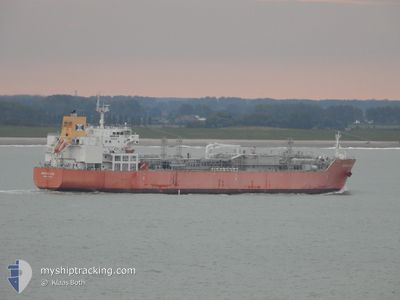
The vessel BERING GAS (IMO: 9745536, MMSI: 219672000) is a Tanker It's sailing under the flag of [DK] Denmark.
In this page you can find informations about the vessels current position, last detected port calls, and current voyage information. If the vessels is not in coverage by AIS you will find the latest position.
The current position of BERING GAS is detected by our AIS receivers and we are not responsible for the reliability of the data. The last position was recorded while the vessel was in Coverage by the Ais receivers of our vessel tracking app.
The current draught of BERING GAS as reported by AIS is 7 meters
Weather
| Temperature | 28.7°C / 83.66°F |
|---|---|
| Wind Speed | 4 knots |
| Direction | 104° ESE |
| Pressure | 1010.4 hPa |
| Humidity | 76.9 % |
| Cloud Coverage | 21 % |
Featured Company
Last Port Calls
| Port | Arrival | Departure | Time In Port |
|---|---|---|---|
| 2024-06-01 17:48 | 2024-06-01 18:24 | 35 m | |
| 2024-05-15 01:34 | 2024-05-17 09:37 | 2 d | |
| 2024-05-13 07:59 | 2024-05-14 23:10 | 1 d |
Most Visited Ports (Last year)
| Port | Arrivals | |
|---|---|---|
| 4 | ||
| 3 | ||
| 2 | ||
| 2 | ||
| 1 | ||
| 1 |
Last Trips
| Origin | Departure | Destination | Arrival | Distance | |
|---|---|---|---|---|---|
| 2024-05-17 11:37 | 2024-06-01 12:48 | 5203.96 nm | |||
| 2024-05-15 01:10 | 2024-05-15 03:34 | 31.29 nm | |||
| 2024-04-01 07:01 | 2024-05-13 09:59 | 14950.20 nm |
Events
| Time | Event | Details | Position / Dest | Info |
|---|---|---|---|---|
| 2024-06-03 23:47 | Status Changed | Default Under way using engine |
24.67153 / -91.70975
US CRP
|
Speed: 13.2 kn Course: 121.7° |
| 2024-06-03 23:41 | OUT of Coverage |
24.68287 / -91.72996
Gulf of Mexico
|
Speed: 13.2 kn Course: 121.7° |
|
| 2024-06-03 23:36 | Detected in Sea | Mexican part of the Gulf of Mexico |
24.69152 / -91.74558
Gulf of Mexico
|
Speed: 13.3 kn Course: 121° |
| 2024-06-03 23:36 | Status Changed | Under way using engine Default |
24.69152 / -91.74558
US CRP
|
Speed: 13 kn Course: 117° |
| 2024-06-03 23:28 | IN Coverage |
24.69152 / -91.74558
Gulf of Mexico
|
Speed: 13.3 kn Course: 121° |
|
| 2024-06-02 21:16 | START Moving | 5.77 nm, West of CORPUS CHRISTI |
27.82704 / -97.49101
US CRP
|
Speed: 3.9 kn Course: 127° |
| 2024-06-01 19:12 | STOP Moving | 6.14 nm, West of CORPUS CHRISTI |
27.83065 / -97.49744
US CRP
|
Speed: 0.2 kn Course: 126° |
| 2024-06-01 18:24 | PORT DEPARTURE |
|
27.82274 / -97.44353
US CRP
|
Speed: 4 kn Course: 269° |
| 2024-06-01 17:48 | PORT ARRIVAL |
|
27.81274 / -97.39731
[US] CORPUS CHRISTI
|
Speed: 8.5 kn Course: 270° |
| 2024-06-01 14:08 | START Moving | 10.28 nm, East of PORT ARANSAS |
27.79614 / -96.88068
US CRP
|
Speed: 3.8 kn Course: 148° |