
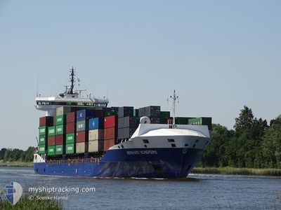
BERNHARD SCHEPERS
Container Ship
Current Trip
| Time Travelled | 22 h, 37 mins |
|---|---|
| Remaining Time | 16 h, 51 mins |
| Distance Travelled | 249.64 nm |
| Remaining Distance | 216.92 nm |
| AVG Speed | 11.9 Knots |
| MAX Speed | 17.6 Knots |
| AVG Wind | 5.4 knots |
| MAX Wind | 8 knots |
| MIN Temp | 7.3°C / 45.14°F |
| MAX Temp | 11.1°C / 51.98°F |
| Draught | 7.3 m |
| Position Received | 9 h, 27 m ago |
Current Position
| Longitude | 21.45833° |
|---|---|
| Latitude | 58.96126° |
| Status | Under way using engine |
| Speed | 10.9 Knots |
| Course | 202.4° |
| Area | Baltic Sea |
| Station | T-AIS |
| Position Received | 9 h, 27 m ago |
Info
Information
The current position of BERNHARD SCHEPERS is in Baltic Sea with coordinates 58.96126° / 21.45833° as reported on 2024-05-15 13:17 by AIS to our vessel tracker app. The vessel's current speed is 10.9 Knots and is heading at the port of GDYNIA. The estimated time of arrival as calculated by vessel tracking app is 2024-05-16 15:35 LT
The vessel BERNHARD SCHEPERS (IMO: 9492505, MMSI: 305741000) is a Container Ship that was built in 2011 ( 13 years old ). It's sailing under the flag of [AG] Antigua Barbuda.
In this page you can find informations about the vessels current position, last detected port calls, and current voyage information. If the vessels is not in coverage by AIS you will find the latest position.
The current position of BERNHARD SCHEPERS is detected by our AIS receivers and we are not responsible for the reliability of the data. The last position was recorded while the vessel was in Coverage by the Ais receivers of our vessel tracking app.
The current draught of BERNHARD SCHEPERS as reported by AIS is 7.3 meters
Weather
| Temperature | 10.7°C / 51.26°F |
|---|---|
| Wind Speed | 1 knots |
| Direction | 170° S |
| Pressure | 1024.3 hPa |
| Humidity | 77 % |
| Cloud Coverage | 33 % |
Featured Company
Last Port Calls
| Port | Arrival | Departure | Time In Port |
|---|---|---|---|
| 2024-05-14 09:45 | 2024-05-15 00:07 | 14 h | |
| 2024-05-10 03:42 | 2024-05-11 11:35 | 1 d | |
| 2024-04-30 14:29 | 2024-05-01 04:13 | 13 h | |
| 2024-04-29 00:59 | 2024-04-29 21:04 | 20 h | |
| 2024-04-27 22:44 | 2024-04-29 00:55 | 1 d | |
| 2024-04-27 14:06 | 2024-04-27 21:07 | 7 h | |
| 2024-04-25 12:28 | 2024-04-25 13:11 | 42 m | |
| 2024-04-23 11:51 | 2024-04-24 11:03 | 23 h | |
| 2024-04-22 11:58 | 2024-04-22 23:39 | 11 h | |
| 2024-04-21 18:26 | 2024-04-22 01:56 | 7 h |
Most Visited Ports (Last year)
| Port | Arrivals | |
|---|---|---|
| 60 | ||
| 25 | ||
| 13 | ||
| 9 | ||
| 9 | ||
| 8 |
Last Trips
| Origin | Departure | Destination | Arrival | Distance | |
|---|---|---|---|---|---|
| 2024-05-11 13:35 | 2024-05-14 12:45 | 740.84 nm | |||
| 2024-05-01 06:13 | 2024-05-10 05:42 | 1874.16 nm | |||
| 2024-04-29 23:04 | 2024-04-30 16:29 | 109.95 nm | |||
| 2024-04-29 02:55 | 2024-04-29 02:59 | 0.89 nm | |||
| 2024-04-27 23:07 | 2024-04-28 00:44 | 16.02 nm | |||
| 2024-04-25 15:11 | 2024-04-27 16:06 | 354.87 nm | |||
| 2024-04-24 13:03 | 2024-04-25 14:28 | 359.41 nm | |||
| 2024-04-23 02:39 | 2024-04-23 13:51 | 161.21 nm | |||
| 2024-04-22 03:56 | 2024-04-22 14:58 | 166.34 nm | |||
| 2024-04-20 11:08 | 2024-04-21 20:26 | 359.24 nm |
Events
| Time | Event | Details | Position / Dest | Info |
|---|---|---|---|---|
| 2024-05-15 13:22 | Status Changed | Default Under way using engine |
58.94737 / 21.44702
PLGDY
|
Speed: 10.9 kn Course: 202.4° |
| 2024-05-15 13:17 | OUT of Coverage |
58.96126 / 21.45833
Baltic Sea
PLGDY
|
Speed: 10.9 kn Course: 202.4° |
|
| 2024-05-15 12:51 | Status Changed | Under way using engine Default |
59.03193 / 21.51753
PLGDY
|
Speed: 10.8 kn Course: 204° |
| 2024-05-15 12:35 | Status Changed | Default Under way using engine |
59.07533 / 21.55518
PLGDY
|
Speed: 10.9 kn Course: 206° |
| 2024-05-15 11:50 | Status Changed | Under way using engine Default |
59.18668 / 21.69460
PLGDY
|
Speed: 10.8 kn Course: 231° |
| 2024-05-15 11:40 | Status Changed | Default Under way using engine |
59.20634 / 21.74256
PLGDY
|
Speed: 10.9 kn Course: 230.9° |
| 2024-05-15 10:08 | Change Sea Area | Estonian part of the Baltic Sea Finnish part of the Baltic Sea |
59.37818 / 22.16552
Baltic Sea
PLGDY
|
Speed: 10.9 kn Course: 232.5° |
| 2024-05-15 07:08 | Detected in Sea | Finnish part of the Baltic Sea |
59.60035 / 23.09321
Baltic Sea
PLGDY
|
Speed: 10.5 kn Course: 254.4° |
| 2024-05-15 06:06 | Status Changed | Under way using engine Default |
59.65743 / 23.52014
PLGDY
|
Speed: 10.9 kn Course: 252° |
| 2024-05-15 05:56 | Status Changed | Default Under way using engine |
59.66623 / 23.57663
PLGDY
|
Speed: 11 kn Course: 253.4° |