
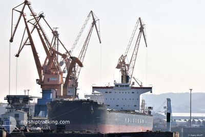
BESKIDY
Bulk Carrier
Current Trip
| Time Travelled | 23 days |
|---|---|
| Remaining Time | --- |
| Distance Travelled | 4176.96 nm |
| Remaining Distance | --- |
| AVG Speed | 12.4 Knots |
| MAX Speed | 14 Knots |
| AVG Wind | 12.9 knots |
| MAX Wind | 24 knots |
| MIN Temp | 15°C / 59°F |
| MAX Temp | 28.6°C / 83.48°F |
| Draught | 7 m |
| Position Received | 1 d ago |
Current Position
| Longitude | -38.60999° |
|---|---|
| Latitude | -13.07015° |
| Status | At anchor |
| Speed | 0.6 Knots |
| Course | 154° |
| Area | South Atlantic Ocean |
| Station | T-AIS |
| Position Received | 1 d ago |
Info
Information
The current position of BESKIDY is in South Atlantic Ocean with coordinates -13.07015° / -38.60999° as reported on 2024-06-06 02:51 by AIS to our vessel tracker app. The vessel's current speed is 0.6 Knots
The vessel BESKIDY (IMO: 9582958, MMSI: 636015817) is a Bulk Carrier that was built in 2013 ( 11 years old ). It's sailing under the flag of [LR] Liberia.
In this page you can find informations about the vessels current position, last detected port calls, and current voyage information. If the vessels is not in coverage by AIS you will find the latest position.
The current position of BESKIDY is detected by our AIS receivers and we are not responsible for the reliability of the data. The last position was recorded while the vessel was in Coverage by the Ais receivers of our vessel tracking app.
The current draught of BESKIDY as reported by AIS is 7 meters
Weather
| Temperature | 26.2°C / 79.16°F |
|---|---|
| Wind Speed | 15 knots |
| Direction | 139° SE |
| Pressure | 1018.9 hPa |
| Humidity | 75.4 % |
| Cloud Coverage | 6 % |
Featured Company
Last Port Calls
| Port | Arrival | Departure | Time In Port |
|---|---|---|---|
| 2024-05-06 06:45 | 2024-05-15 07:20 | 9 d | |
| 2024-05-03 04:22 | 2024-05-04 23:11 | 1 d | |
| 2024-04-17 13:01 | 2024-04-21 03:36 | 3 d |
Last Trips
| Origin | Departure | Destination | Arrival | Distance | |
|---|---|---|---|---|---|
| 2024-05-05 01:11 | 2024-05-06 08:45 | 300.73 nm | |||
| 2024-04-21 00:36 | 2024-05-03 06:22 | 3455.59 nm | |||
| 2024-03-22 20:42 | 2024-04-17 10:01 | 5092.89 nm |
Events
| Time | Event | Details | Position / Dest | Info |
|---|---|---|---|---|
| 2024-06-06 07:12 | STOP Moving | 8.33 nm, South West of SALVADOR |
-13.07050 / -38.61022
BRSSA
|
Speed: 0.2 kn Course: 145° |
| 2024-06-06 03:21 | Status Changed | Default At anchor |
-13.06998 / -38.60981
BRSSA
|
Speed: 0.6 kn Course: 154° |
| 2024-06-06 02:51 | Status Changed | At anchor Default |
-13.07015 / -38.60999
BRSSA
|
Speed: 0.5 kn Course: 149° |
| 2024-06-06 02:51 | IN Coverage |
-13.07015 / -38.60999
South Atlantic Ocean
|
Speed: 0.6 kn Course: 328.1° |
|
| 2024-06-06 02:51 | OUT of Coverage |
-13.07015 / -38.60999
South Atlantic Ocean
|
Speed: 0.6 kn Course: 328.1° |
|
| 2024-06-03 12:17 | Status Changed | Default At anchor |
-13.07113 / -38.61089
BRSSA
|
Speed: 0.4 kn Course: 135° |
| 2024-06-03 12:14 | OUT of Coverage |
-13.07101 / -38.61069
South Atlantic Ocean
|
Speed: 0.4 kn Course: 219.8° |
|
| 2024-06-03 12:05 | Status Changed | At anchor Default |
-13.07009 / -38.61007
BRSSA
|
Speed: 0.5 kn Course: 125° |
| 2024-06-03 11:41 | Status Changed | Default At anchor |
-13.07020 / -38.60982
BRSSA
|
Speed: 1.3 kn Course: 104° |
| 2024-06-03 11:38 | Status Changed | At anchor Default |
-13.07102 / -38.61061
BRSSA
|
Speed: 0.1 kn Course: 104° |