
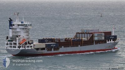
BF FORTALEZA
Container Ship
Current Trip
| Trip Time | 20 mins |
|---|---|
| Trip Distance | 0.32 nm |
| AVG Speed | --- |
| MAX Speed | --- |
| Draught | 4.8 m |
| AVG Wind | 5.8 knots |
| MAX Wind | 6.3 knots |
| MIN Temp | 26.4°C / 79.52°F |
| MAX Temp | 26.8°C / 80.24°F |
| Position Received | 5 d ago |
Current Position
| Longitude | -70.02262° |
|---|---|
| Latitude | 18.17550° |
| Status | Under way using engine |
| Speed | 13.5 Knots |
| Course | 242.8° |
| Area | Caribbean Sea |
| Station | T-AIS |
| Position Received | 5 d ago |
Info
Information
The current position of BF FORTALEZA is in Caribbean Sea with coordinates 18.17550° / -70.02262° as reported on 2024-06-15 22:48 by AIS to our vessel tracker app. The vessel's current speed is 13.5 Knots and is currently inside the port of PORT AU PRINCE.
The vessel BF FORTALEZA (IMO: 9130432, MMSI: 212723000) is a Container Ship that was built in 1996 ( 28 years old ). It's sailing under the flag of [CY] Cyprus.
In this page you can find informations about the vessels current position, last detected port calls, and current voyage information. If the vessels is not in coverage by AIS you will find the latest position.
The current position of BF FORTALEZA is detected by our AIS receivers and we are not responsible for the reliability of the data. The last position was recorded while the vessel was in Coverage by the Ais receivers of our vessel tracking app.
The current draught of BF FORTALEZA as reported by AIS is 4.8 meters
Weather
| Temperature | 27.3°C / 81.14°F |
|---|---|
| Wind Speed | 6 knots |
| Direction | 67° ENE |
| Pressure | 1015.7 hPa |
| Humidity | 57.3 % |
| Cloud Coverage | 71 % |
Featured Company
Last Port Calls
| Port | Arrival | Departure | Time In Port |
|---|---|---|---|
| 2024-06-20 13:42 | |||
| 2024-06-20 10:55 | 2024-06-20 13:22 | 2 h | |
| 2024-06-17 15:39 | 2024-06-19 01:07 | 1 d | |
| 2024-06-15 04:15 | 2024-06-15 20:25 | 16 h | |
| 2024-06-13 16:57 | 2024-06-13 23:00 | 6 h | |
| 2024-06-07 15:59 | 2024-06-08 10:19 | 18 h | |
| 2024-06-07 01:58 | 2024-06-07 10:47 | 8 h | |
| 2024-06-02 14:25 | 2024-06-03 04:06 | 13 h | |
| 2024-06-01 21:44 | 2024-06-02 06:05 | 8 h | |
| 2024-05-28 13:55 | 2024-05-29 03:00 | 13 h |
Most Visited Ports (Last year)
| Port | Arrivals | |
|---|---|---|
| 21 | ||
| 20 | ||
| 12 | ||
| 9 | ||
| 6 | ||
| 6 |
Last Trips
| Origin | Departure | Destination | Arrival | Distance | |
|---|---|---|---|---|---|
| 2024-06-20 09:22 | 2024-06-20 09:42 | 0.32 nm | |||
| 2024-06-18 20:07 | 2024-06-20 06:55 | 296.44 nm | |||
| 2024-06-15 16:25 | 2024-06-17 10:39 | 448.43 nm | |||
| 2024-06-13 19:00 | 2024-06-15 00:15 | 78.86 nm | |||
| 2024-06-08 04:19 | 2024-06-13 12:57 | 1163.42 nm | |||
| 2024-06-07 04:47 | 2024-06-07 09:59 | 63.37 nm | |||
| 2024-06-03 00:06 | 2024-06-06 19:58 | 1085.84 nm | |||
| 2024-06-02 02:05 | 2024-06-02 10:25 | 36.96 nm | |||
| 2024-05-28 21:00 | 2024-06-01 17:44 | 1129.45 nm | |||
| 2024-05-28 02:31 | 2024-05-28 07:55 | 63.54 nm |
Events
| Time | Event | Details | Position / Dest | Info |
|---|---|---|---|---|
| 2024-06-20 13:42 | PORT ARRIVAL |
|
18.55487 / -72.38957
[HT] PORT AU PRINCE
|
Speed: 0.5 kn Course: 94° |
| 2024-06-20 13:22 | PORT DEPARTURE |
|
18.55772 / -72.39435
JMKIN
|
Speed: 0.7 kn Course: 103° |
| 2024-06-20 10:55 | PORT ARRIVAL |
|
18.55617 / -72.38474
[HT] PORT AU PRINCE
|
Speed: 12.3 kn Course: 103° |
| 2024-06-20 08:52 | START Moving |
18.62435 / -72.78397
JMKIN
|
Speed: 12.4 kn Course: 90° |
|
| 2024-06-20 01:26 | STOP Moving | 20.38 nm, West of PORT AU PRINCE |
18.60453 / -72.71843
JMKIN
|
Speed: 0.3 kn Course: 83° |
| 2024-06-19 01:07 | PORT DEPARTURE |
|
17.95668 / -76.85070
JMKIN
|
Speed: 11.9 kn Course: 242° |
| 2024-06-19 00:55 | START Moving |
17.97950 / -76.82778
[JM] KINGSTON (JM)
|
Speed: 7.4 kn Course: 145° |
|
| 2024-06-17 16:07 | STOP Moving |
17.98427 / -76.83028
[JM] KINGSTON (JM)
|
Speed: Course: 312° |
|
| 2024-06-17 15:39 | PORT ARRIVAL |
|
17.96655 / -76.83500
[JM] KINGSTON (JM)
|
Speed: 7.8 kn Course: 64° |
| 2024-06-17 13:35 | START Moving | 11.82 nm, South East of KINGSTON (JM) |
17.80348 / -76.68767
JMKIN
|
Speed: 7 kn Course: 356° |