
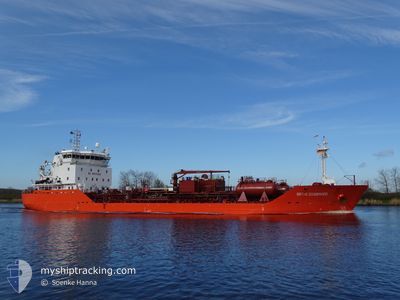
BIRTHE ESSBERGER
Oil/Chemical Tanker
Current Trip
| Time Travelled | 1 day |
|---|---|
| Remaining Time | 10 h, 35 mins |
| Distance Travelled | 532.76 nm |
| Remaining Distance | 137.08 nm |
| AVG Speed | 13.2 Knots |
| MAX Speed | 13.8 Knots |
| AVG Wind | 8 knots |
| MAX Wind | 14 knots |
| MIN Temp | 11.7°C / 53.06°F |
| MAX Temp | 15.4°C / 59.72°F |
| Draught | 7.2 m |
| Position Received | Now |
Current Position
| Longitude | 13.48930° |
|---|---|
| Latitude | 54.94040° |
| Status | Under way using engine |
| Speed | 13.3 Knots |
| Course | 251.8° |
| Area | Baltic Sea |
| Station | T-AIS |
| Position Received | Now |
Info
Information
The current position of BIRTHE ESSBERGER is in Baltic Sea with coordinates 54.94040° / 13.48930° as reported on 2024-06-01 04:01 by AIS to our vessel tracker app. The vessel's current speed is 13.3 Knots and is heading at the port of KIEL. The estimated time of arrival as calculated by vessel tracking app is 2024-06-01 14:37 LT
The vessel BIRTHE ESSBERGER (IMO: 9294692, MMSI: 255806320) is a Oil/Chemical Tanker that was built in 2005 ( 19 years old ). It's sailing under the flag of [PT] Portugal.
In this page you can find informations about the vessels current position, last detected port calls, and current voyage information. If the vessels is not in coverage by AIS you will find the latest position.
The current position of BIRTHE ESSBERGER is detected by our AIS receivers and we are not responsible for the reliability of the data. The last position was recorded while the vessel was in Coverage by the Ais receivers of our vessel tracking app.
The current draught of BIRTHE ESSBERGER as reported by AIS is 7.2 meters
Weather
| Temperature | 13.5°C / 56.3°F |
|---|---|
| Wind Speed | 14 knots |
| Direction | 49° NE |
| Pressure | 1011.7 hPa |
| Humidity | 93.1 % |
| Cloud Coverage | 13 % |
Featured Company
Last Port Calls
| Port | Arrival | Departure | Time In Port |
|---|---|---|---|
| 2024-05-29 12:01 | 2024-05-30 12:02 | 1 d | |
| 2024-05-24 13:32 | 2024-05-25 19:36 | 1 d | |
| 2024-05-22 21:11 | 2024-05-23 10:34 | 13 h | |
| 2024-05-17 07:46 | 2024-05-19 03:07 | 1 d | |
| 2024-05-14 21:31 | 2024-05-15 14:32 | 17 h | |
| 2024-05-12 20:34 | 2024-05-14 20:30 | 1 d | |
| 2024-05-07 22:49 | 2024-05-08 08:13 | 9 h | |
| 2024-05-06 23:05 | 2024-05-07 13:30 | 14 h | |
| 2024-05-03 07:13 | 2024-05-04 14:33 | 1 d | |
| 2024-04-30 15:18 | 2024-05-01 15:05 | 23 h |
Most Visited Ports (Last year)
| Port | Arrivals | |
|---|---|---|
| 15 | ||
| 11 | ||
| 7 | ||
| 6 | ||
| 5 | ||
| 4 |
Last Trips
| Origin | Departure | Destination | Arrival | Distance | |
|---|---|---|---|---|---|
| 2024-05-25 22:36 | 2024-05-29 15:01 | 328.13 nm | |||
| 2024-05-23 13:34 | 2024-05-24 16:32 | 226.28 nm | |||
| 2024-05-19 05:07 | 2024-05-23 00:11 | 1040.03 nm | |||
| 2024-05-15 16:32 | 2024-05-17 09:46 | 117.36 nm | |||
| 2024-05-14 22:30 | 2024-05-14 23:31 | 9.93 nm | |||
| 2024-05-08 09:13 | 2024-05-12 22:34 | 770.02 nm | |||
| 2024-05-07 14:30 | 2024-05-07 23:49 | 108.82 nm | |||
| 2024-05-04 16:33 | 2024-05-07 00:05 | 739.59 nm | |||
| 2024-05-01 17:05 | 2024-05-03 09:13 | 241.52 nm | |||
| 2024-04-30 14:26 | 2024-04-30 17:18 | 32.35 nm |
Events
| Time | Event | Details | Position / Dest | Info |
|---|---|---|---|---|
| 2024-06-01 03:04 | Change Sea Area | German part of the Baltic Sea Swedish part of the Baltic Sea |
55.00674 / 13.82193
Baltic Sea
DE - KEL
|
Speed: 12.9 kn Course: 250.1° |
| 2024-05-31 23:49 | Change Sea Area | Swedish part of the Baltic Sea Danish part of the Kattegat |
55.48248 / 14.72052
Baltic Sea
DE - KEL
|
Speed: 13.4 kn Course: 240.1° |
| 2024-05-31 22:22 | Change Sea Area | Danish part of the Kattegat Swedish part of the Baltic Sea |
55.64445 / 15.21217
Kattegat
DE - KEL
|
Speed: 13.2 kn Course: 240° |
| 2024-05-31 16:43 | Status Changed | Under way using engine Default |
56.39168 / 16.92459
DE - KEL
|
Speed: 13.3 kn Course: 201° |
| 2024-05-31 16:38 | IN Coverage |
56.39168 / 16.92459
Baltic Sea
DE - KEL
|
Speed: 13.3 kn Course: 201.4° |
|
| 2024-05-31 13:54 | Status Changed | Default Under way using engine |
56.98115 / 17.33866
DE - KEL
|
Speed: 13.2 kn Course: 200.7° |
| 2024-05-31 13:50 | OUT of Coverage |
56.99444 / 17.34785
Baltic Sea
DE - KEL
|
Speed: 13.2 kn Course: 200.7° |
|
| 2024-05-31 13:39 | Status Changed | Under way using engine Default |
57.03434 / 17.37492
DE - KEL
|
Speed: 13.2 kn Course: 200° |
| 2024-05-31 13:26 | Status Changed | Default Under way using engine |
57.07794 / 17.40409
DE - KEL
|
Speed: 13.2 kn Course: 198.5° |
| 2024-05-31 13:20 | Status Changed | Under way using engine Default |
57.09812 / 17.41707
DE - KEL
|
Speed: 13.3 kn Course: 200° |