
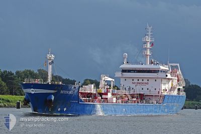
BITFJORD
Tanker
Current Trip
| Time Travelled | 1 day |
|---|---|
| Remaining Time | 21 h, 54 mins |
| Distance Travelled | 434.39 nm |
| Remaining Distance | 203.66 nm |
| AVG Speed | 11 Knots |
| MAX Speed | 13.8 Knots |
| AVG Wind | 6.1 knots |
| MAX Wind | 10 knots |
| MIN Temp | 12.8°C / 55.04°F |
| MAX Temp | 15.1°C / 59.18°F |
| Draught | 5.2 m |
| Position Received | 14 m ago |
Current Position
| Longitude | -5.37517° |
|---|---|
| Latitude | 49.02835° |
| Status | Under way using engine |
| Speed | 8.2 Knots |
| Course | 240.3° |
| Area | Celtic Sea |
| Station | T-AIS |
| Position Received | 14 m ago |
Info
Information
The current position of BITFJORD is in Celtic Sea with coordinates 49.02835° / -5.37517° as reported on 2024-05-18 23:14 by AIS to our vessel tracker app. The vessel's current speed is 8.2 Knots and is heading at the port of DONGES. The estimated time of arrival as calculated by vessel tracking app is 2024-05-19 21:22 LT
The vessel BITFJORD (IMO: 9753844, MMSI: 244090224) is a Tanker It's sailing under the flag of [NL] Netherlands.
In this page you can find informations about the vessels current position, last detected port calls, and current voyage information. If the vessels is not in coverage by AIS you will find the latest position.
The current position of BITFJORD is detected by our AIS receivers and we are not responsible for the reliability of the data. The last position was recorded while the vessel was in Coverage by the Ais receivers of our vessel tracking app.
The current draught of BITFJORD as reported by AIS is 5.2 meters
Weather
| Temperature | 14.3°C / 57.74°F |
|---|---|
| Wind Speed | 3 knots |
| Direction | 48° NE |
| Pressure | 1014.4 hPa |
| Humidity | 88.4 % |
| Cloud Coverage | 99 % |
Featured Company
Last Port Calls
| Port | Arrival | Departure | Time In Port |
|---|---|---|---|
| 2024-05-16 11:26 | 2024-05-17 06:20 | 18 h | |
| 2024-05-13 07:32 | 2024-05-15 08:29 | 2 d | |
| 2024-05-07 15:11 | 2024-05-09 04:05 | 1 d | |
| 2024-05-03 18:40 | 2024-05-04 06:55 | 12 h | |
| 2024-05-02 18:34 | 2024-05-03 18:09 | 23 h | |
| 2024-05-02 14:50 | 2024-05-02 17:54 | 3 h | |
| 2024-04-23 06:07 | 2024-04-25 07:53 | 2 d | |
| 2024-04-20 07:21 | 2024-04-20 22:30 | 15 h | |
| 2024-04-17 19:17 | 2024-04-19 19:50 | 2 d | |
| 2024-04-17 06:50 | 2024-04-17 16:13 | 9 h |
Most Visited Ports (Last year)
| Port | Arrivals | |
|---|---|---|
| 22 | ||
| 8 | ||
| 7 | ||
| 7 | ||
| 4 | ||
| 4 |
Last Trips
| Origin | Departure | Destination | Arrival | Distance | |
|---|---|---|---|---|---|
| 2024-05-15 09:29 | 2024-05-16 13:26 | 279.22 nm | |||
| 2024-05-09 06:05 | 2024-05-13 08:32 | 823.88 nm | |||
| 2024-05-04 08:55 | 2024-05-07 17:11 | 717.55 nm | |||
| 2024-05-03 20:09 | 2024-05-03 20:40 | 2.24 nm | |||
| 2024-05-02 19:54 | 2024-05-02 20:34 | 4.11 nm | |||
| 2024-04-25 09:53 | 2024-05-02 16:50 | 1027.48 nm | |||
| 2024-04-20 23:30 | 2024-04-23 08:07 | 629.74 nm | |||
| 2024-04-19 20:50 | 2024-04-20 08:21 | 125.45 nm | |||
| 2024-04-16 20:53 | 2024-04-17 20:17 | 149.70 nm | |||
| 2024-04-16 20:53 | 2024-04-17 07:50 | 122.33 nm |
Events
| Time | Event | Details | Position / Dest | Info |
|---|---|---|---|---|
| 2024-05-18 23:28 | Status Changed | Under way using engine Default |
49.01190 / -5.41711
NLRTM>FRDON
|
Speed: 8.1 kn Course: 239° |
| 2024-05-18 23:18 | Status Changed | Default Under way using engine |
49.02311 / -5.38875
NLRTM>FRDON
|
Speed: 8.2 kn Course: 240.3° |
| 2024-05-18 22:57 | Status Changed | Under way using engine Default |
49.04813 / -5.32300
NLRTM>FRDON
|
Speed: 8.1 kn Course: 240° |
| 2024-05-18 22:34 | Status Changed | Default Under way using engine |
49.07284 / -5.25551
NLRTM>FRDON
|
Speed: 8.6 kn Course: 238.5° |
| 2024-05-18 22:03 | Status Changed | Under way using engine Default |
49.11127 / -5.15528
NLRTM>FRDON
|
Speed: 8.8 kn Course: 239° |
| 2024-05-18 21:46 | Status Changed | Default Under way using engine |
49.13197 / -5.10309
NLRTM>FRDON
|
Speed: 8.9 kn Course: 240.2° |
| 2024-05-18 21:17 | Detected in Sea | French part of the Celtic Sea |
49.16931 / -5.00495
Celtic Sea
NLRTM>FRDON
|
Speed: 9.2 kn Course: 239.3° |
| 2024-05-18 21:08 | Status Changed | Under way using engine Default |
49.18031 / -4.97681
NLRTM>FRDON
|
Speed: 9.3 kn Course: 239° |
| 2024-05-18 21:07 | Status Changed | Default Under way using engine |
49.18251 / -4.97131
NLRTM>FRDON
|
Speed: 9.2 kn Course: 238.5° |
| 2024-05-18 20:53 | Status Changed | Under way using engine Default |
49.20004 / -4.92683
NLRTM>FRDON
|
Speed: 9.2 kn Course: 240° |