
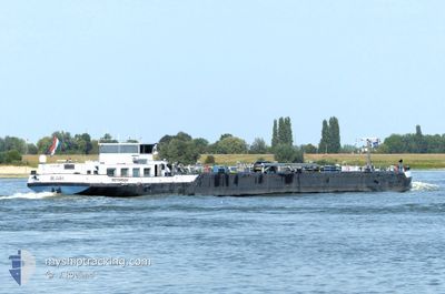
BLAAK
Tanker
Current Trip
HAFEN ESPELKAMP BEIS
| Time Travelled | 1 day |
|---|---|
| Remaining Time | --- |
| Distance Travelled | 36.92 nm |
| Remaining Distance | --- |
| AVG Speed | 4.7 Knots |
| MAX Speed | 5.3 Knots |
| AVG Wind | 9.2 knots |
| MAX Wind | 10 knots |
| MIN Temp | 20.2°C / 68.36°F |
| MAX Temp | 26.2°C / 79.16°F |
| Draught | 2.5 m |
| Position Received | 3 h, 7 m ago |
Current Position
| Longitude | 8.17504° |
|---|---|
| Latitude | 52.39518° |
| Status | Under way using engine |
| Speed | 4.6 Knots |
| Course | 114° |
| Area | North Sea |
| Station | T-AIS |
| Position Received | 3 h, 7 m ago |
Info
Information
The current position of BLAAK is in North Sea with coordinates 52.39518° / 8.17504° as reported on 2024-06-26 09:59 by AIS to our vessel tracker app. The vessel's current speed is 4.6 Knots
The vessel BLAAK (MMSI: 244721416) is a Tanker It's sailing under the flag of [NL] Netherlands.
In this page you can find informations about the vessels current position, last detected port calls, and current voyage information. If the vessels is not in coverage by AIS you will find the latest position.
The current position of BLAAK is detected by our AIS receivers and we are not responsible for the reliability of the data. The last position was recorded while the vessel was in Coverage by the Ais receivers of our vessel tracking app.
The current draught of BLAAK as reported by AIS is 2.5 meters
Weather
| Temperature | 24.8°C / 76.64°F |
|---|---|
| Wind Speed | 10 knots |
| Direction | 83° E |
| Pressure | 1012 hPa |
| Humidity | 61.4 % |
| Cloud Coverage | 8 % |
Featured Company
Last Port Calls
| Port | Arrival | Departure | Time In Port |
|---|---|---|---|
| 2024-06-25 11:53 | 2024-06-25 12:48 | 55 m | |
| 2024-06-23 15:48 | 2024-06-23 16:49 | 1 h | |
| 2024-06-22 15:33 | 2024-06-22 15:48 | 15 m | |
| 2024-06-22 12:11 | 2024-06-22 14:15 | 2 h | |
| 2024-06-21 19:08 | 2024-06-22 11:44 | 16 h | |
| 2024-06-21 03:23 | 2024-06-21 18:17 | 14 h | |
| 2024-06-21 01:54 | 2024-06-21 02:25 | 31 m | |
| 2024-06-20 19:44 | 2024-06-20 21:47 | 2 h | |
| 2024-06-17 13:57 | 2024-06-17 15:32 | 1 h | |
| 2024-06-16 10:30 | 2024-06-17 13:39 | 1 d |
Most Visited Ports (Last year)
| Port | Arrivals | |
|---|---|---|
| 20 | ||
| 19 | ||
| 19 | ||
| 17 | ||
| 15 | ||
| 13 |
Last Trips
| Origin | Departure | Destination | Arrival | Distance | |
|---|---|---|---|---|---|
| 2024-06-23 18:49 | 2024-06-25 13:53 | 66.00 nm | |||
| 2024-06-22 17:48 | 2024-06-23 17:48 | 101.15 nm | |||
| 2024-06-22 16:15 | 2024-06-22 17:33 | 11.11 nm | |||
| 2024-06-22 13:44 | 2024-06-22 14:11 | 2.75 nm | |||
| 2024-06-21 20:17 | 2024-06-21 21:08 | 4.67 nm | |||
| 2024-06-21 04:25 | 2024-06-21 05:23 | 7.09 nm | |||
| 2024-06-20 23:47 | 2024-06-21 03:54 | 24.49 nm | |||
| 2024-06-17 17:32 | 2024-06-20 21:44 | 203.50 nm | |||
| 2024-06-17 15:39 | 2024-06-17 15:57 | 1.52 nm | |||
| 2024-06-15 13:27 | 2024-06-16 12:30 | 115.20 nm |
Events
| Time | Event | Details | Position / Dest | Info |
|---|---|---|---|---|
| 2024-06-26 09:59 | OUT of Coverage |
52.39518 / 8.17504
North Sea
|
Speed: 4.6 kn Course: 115.5° |
|
| 2024-06-26 09:26 | START Moving | 4.26 nm, East of BRAMSCHE |
52.41280 / 8.11010
HAFEN ESPELKAMP BEIS
|
Speed: 3.9 kn Course: 90° |
| 2024-06-26 09:24 | Status Changed | Under way using engine Moored |
52.41301 / 8.10729
HAFEN ESPELKAMP BEIS
|
Speed: 0.1 kn Course: 90° |
| 2024-06-26 08:34 | Status Changed | Moored Under way using engine |
52.41305 / 8.10702
HAFEN ESPELKAMP BEIS
|
Speed: 0.1 kn Course: 92° |
| 2024-06-26 08:29 | STOP Moving | 4.15 nm, East of BRAMSCHE |
52.41309 / 8.10703
HAFEN ESPELKAMP BEIS
|
Speed: 0.1 kn Course: 89° |
| 2024-06-26 06:32 | IN Coverage |
52.37586 / 7.87142
North Sea
|
Speed: 4.7 kn Course: 61.1° |
|
| 2024-06-25 13:02 | OUT of Coverage |
52.00256 / 7.65911
North Sea
|
Speed: 5 kn Course: 359.2° |
|
| 2024-06-25 12:48 | START Moving | 1.34 nm, South of COERHEIDE |
51.98148 / 7.66115
HAFEN ESPELKAMP BEIS
|
Speed: 4.9 kn Course: 352° |
| 2024-06-25 12:48 | PORT DEPARTURE |
|
51.98148 / 7.66115
HAFEN ESPELKAMP BEIS
|
Speed: 1.5 kn Course: 351° |
| 2024-06-25 12:32 | STOP Moving |
51.97860 / 7.66185
[DE] MUNSTER
|
Speed: Course: 352° |