
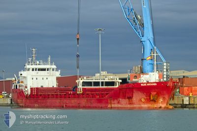
BLUE ANTARES
General Cargo
Current Trip
| Time Travelled | 2 days |
|---|---|
| Remaining Time | --- |
| Distance Travelled | 457.09 nm |
| Remaining Distance | 3.16 nm |
| AVG Speed | 10.1 Knots |
| MAX Speed | 12.5 Knots |
| AVG Wind | 12.7 knots |
| MAX Wind | 19.5 knots |
| MIN Temp | 12.9°C / 55.22°F |
| MAX Temp | 20.4°C / 68.72°F |
| Draught | 6.2 m |
| Position Received | 1 m ago |
Current Position
| Longitude | -8.77674° |
|---|---|
| Latitude | 41.16045° |
| Status | At anchor |
| Speed | 0.6 Knots |
| Course | 328° |
| Area | North Atlantic Ocean |
| Station | T-AIS |
| Position Received | 1 m ago |
Info
Information
The current position of BLUE ANTARES is in North Atlantic Ocean with coordinates 41.16045° / -8.77674° as reported on 2024-05-27 03:02 by AIS to our vessel tracker app. The vessel's current speed is 0.6 Knots and is heading at the port of LEIXOES. The estimated time of arrival as calculated by vessel tracking app is 2024-05-26 14:00 LT
The vessel BLUE ANTARES (IMO: 9346689, MMSI: 305329000) is a General Cargo that was built in 2008 ( 16 years old ). It's sailing under the flag of [AG] Antigua Barbuda.
In this page you can find informations about the vessels current position, last detected port calls, and current voyage information. If the vessels is not in coverage by AIS you will find the latest position.
The current position of BLUE ANTARES is detected by our AIS receivers and we are not responsible for the reliability of the data. The last position was recorded while the vessel was in Coverage by the Ais receivers of our vessel tracking app.
The current draught of BLUE ANTARES as reported by AIS is 6.2 meters
Weather
| Temperature | 12.7°C / 54.86°F |
|---|---|
| Wind Speed | 9 knots |
| Direction | 1° N |
| Pressure | 1020.3 hPa |
| Humidity | 82.1 % |
| Cloud Coverage | 36 % |
Featured Company
Last Port Calls
| Port | Arrival | Departure | Time In Port |
|---|---|---|---|
| 2024-05-21 13:37 | 2024-05-24 19:34 | 3 d | |
| 2024-05-19 12:09 | 2024-05-20 15:54 | 1 d | |
| 2024-05-16 09:53 | 2024-05-17 17:05 | 1 d | |
| 2024-05-12 13:38 | 2024-05-12 23:06 | 9 h | |
| 2024-05-10 01:00 | 2024-05-10 18:16 | 17 h | |
| 2024-05-06 05:00 | 2024-05-07 20:04 | 1 d | |
| 2024-04-30 17:56 | 2024-05-04 10:45 | 3 d | |
| 2024-04-29 05:44 | 2024-04-29 21:16 | 15 h | |
| 2024-04-24 15:30 | 2024-04-25 17:31 | 1 d | |
| 2024-04-23 07:36 | 2024-04-23 19:36 | 11 h |
Most Visited Ports (Last year)
| Port | Arrivals | |
|---|---|---|
| 15 | ||
| 11 | ||
| 10 | ||
| 9 | ||
| 3 | ||
| 3 |
Last Trips
| Origin | Departure | Destination | Arrival | Distance | |
|---|---|---|---|---|---|
| 2024-05-20 16:54 | 2024-05-21 15:37 | 163.33 nm | |||
| 2024-05-17 19:05 | 2024-05-19 13:09 | 419.26 nm | |||
| 2024-05-13 00:06 | 2024-05-16 11:53 | 493.08 nm | |||
| 2024-05-10 20:16 | 2024-05-12 14:38 | 429.53 nm | |||
| 2024-05-07 21:04 | 2024-05-10 03:00 | 601.69 nm | |||
| 2024-05-04 11:45 | 2024-05-06 06:00 | 442.57 nm | |||
| 2024-04-29 22:16 | 2024-04-30 18:56 | 163.60 nm | |||
| 2024-04-25 19:31 | 2024-04-29 06:44 | 824.00 nm | |||
| 2024-04-23 21:36 | 2024-04-24 17:30 | 133.82 nm | |||
| 2024-04-19 11:15 | 2024-04-23 09:36 | 870.62 nm |
Events
| Time | Event | Details | Position / Dest | Info |
|---|---|---|---|---|
| 2024-05-26 22:50 | Status Changed | At anchor Default |
41.16034 / -8.77716
PT LEI
|
Speed: 0.4 kn Course: 346° |
| 2024-05-26 22:47 | Status Changed | Default At anchor |
41.16032 / -8.77726
PT LEI
|
Speed: 0.3 kn Course: 342° |
| 2024-05-26 15:17 | STOP Moving | 3.52 nm, West of LEIXOES |
41.16051 / -8.77667
PT LEI
|
Speed: 0.3 kn Course: 333° |
| 2024-05-26 15:14 | Status Changed | At anchor Under way using engine |
41.16096 / -8.77703
PT LEI
|
Speed: 1.1 kn Course: 353° |
| 2024-05-26 14:58 | START Moving | 3.48 nm, South West of LEIXOES |
41.15114 / -8.76971
PT LEI
|
Speed: 3.3 kn Course: 340° |
| 2024-05-26 14:57 | Status Changed | Under way using engine At anchor |
41.15057 / -8.76929
PT LEI
|
Speed: 2 kn Course: 333° |
| 2024-05-26 14:48 | STOP Moving | 3.5 nm, South West of LEIXOES |
41.14933 / -8.76851
PT LEI
|
Speed: 0.2 kn Course: 351° |
| 2024-05-26 14:39 | Status Changed | At anchor Under way using engine |
41.14954 / -8.76910
PT LEI
|
Speed: 1.1 kn Course: 3° |
| 2024-05-26 12:38 | Status Changed | Under way using engine Default |
40.85492 / -8.91730
PT LEI
|
Speed: 10 kn Course: 22° |
| 2024-05-26 12:34 | IN Coverage |
40.86055 / -8.91433
North Atlantic Ocean
PT LEI
|
Speed: 10.7 kn Course: 22.3° |