
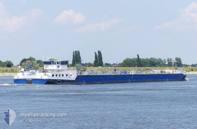
BLUE ANTOINETTE
Tanker
Current Trip
| Time Travelled | 7 h, 52 mins |
|---|---|
| Remaining Time | --- |
| Distance Travelled | 4.74 nm |
| Remaining Distance | --- |
| AVG Speed | 4.2 Knots |
| MAX Speed | 8.4 Knots |
| AVG Wind | 12 knots |
| MAX Wind | 12 knots |
| MIN Temp | 13.3°C / 55.94°F |
| MAX Temp | 13.4°C / 56.12°F |
| Draught | 2.8 m |
| Position Received | Now |
Current Position
| Longitude | 4.22696° |
|---|---|
| Latitude | 51.45803° |
| Status | Under way using engine |
| Speed | 2.9 Knots |
| Course | --- |
| Area | North Sea |
| Station | T-AIS |
| Position Received | Now |
Info
Information
The current position of BLUE ANTOINETTE is in North Sea with coordinates 51.45803° / 4.22696° as reported on 2024-06-02 08:51 by AIS to our vessel tracker app. The vessel's current speed is 2.9 Knots
The vessel BLUE ANTOINETTE (MMSI: 244721362) is a Tanker It's sailing under the flag of [NL] Netherlands.
In this page you can find informations about the vessels current position, last detected port calls, and current voyage information. If the vessels is not in coverage by AIS you will find the latest position.
The current position of BLUE ANTOINETTE is detected by our AIS receivers and we are not responsible for the reliability of the data. The last position was recorded while the vessel was in Coverage by the Ais receivers of our vessel tracking app.
The current draught of BLUE ANTOINETTE as reported by AIS is 2.8 meters
Weather
| Temperature | 15.2°C / 59.36°F |
|---|---|
| Wind Speed | 11 knots |
| Direction | 356° N |
| Pressure | 1023.8 hPa |
| Humidity | 72.1 % |
| Cloud Coverage | 54 % |
Featured Company
Last Port Calls
| Port | Arrival | Departure | Time In Port |
|---|---|---|---|
| 2024-06-01 23:30 | 2024-06-02 01:00 | 1 h | |
| 2024-05-29 09:16 | 2024-05-29 09:24 | 8 m | |
| 2024-05-28 22:35 | 2024-05-28 23:24 | 49 m | |
| 2024-05-27 21:01 | 2024-05-28 18:51 | 21 h | |
| 2024-05-27 15:31 | 2024-05-27 18:52 | 3 h | |
| 2024-05-27 09:15 | 2024-05-27 10:07 | 52 m | |
| 2024-05-27 07:00 | |||
| 2024-05-25 17:09 | |||
| 2024-05-25 17:09 | |||
| 2024-05-24 14:25 |
Most Visited Ports (Last year)
| Port | Arrivals | |
|---|---|---|
| 32 | ||
| 28 | ||
| 22 | ||
| 20 | ||
| 18 | ||
| 17 |
Last Trips
| Origin | Departure | Destination | Arrival | Distance | |
|---|---|---|---|---|---|
| 2024-05-29 11:24 | 2024-06-02 01:30 | 128.46 nm | |||
| 2024-05-29 01:24 | 2024-05-29 11:16 | 75.21 nm | |||
| 2024-05-28 20:51 | 2024-05-29 00:35 | 11.84 nm | |||
| 2024-05-27 20:52 | 2024-05-27 23:01 | 9.40 nm | |||
| 2024-05-27 12:07 | 2024-05-27 17:31 | 27.19 nm | |||
| 2024-05-27 09:00 | 2024-05-27 11:15 | 5.92 nm | |||
| 2024-05-25 19:09 | 2024-05-25 19:09 | --- | |||
| 2024-05-24 14:13 | 2024-05-24 16:25 | 5.74 nm | |||
| 2024-05-24 04:40 | 2024-05-24 10:36 | 58.25 nm | |||
| 2024-05-23 11:48 | 2024-05-23 13:41 | 10.67 nm |
Events
| Time | Event | Details | Position / Dest | Info |
|---|---|---|---|---|
| 2024-06-02 08:51 | START Moving | 2.82 nm, South West of BERGEN OP ZOOM |
51.45816 / 4.22699
ROTTERDAM 2E PETROHA
|
Speed: 3.4 kn Course: 7.6° |
| 2024-06-02 06:55 | Status Changed | Under way using engine Default |
51.45764 / 4.22658
ROTTERDAM 2E PETROHA
|
Speed: Course: -1° |
| 2024-06-02 06:40 | Status Changed | Default Moored |
51.45764 / 4.22660
ROTTERDAM 2E PETROHA
|
Speed: Course: 511° |
| 2024-06-02 06:37 | Status Changed | Moored Default |
51.45764 / 4.22659
ROTTERDAM 2E PETROHA
|
Speed: Course: -1° |
| 2024-06-02 06:37 | IN Coverage |
51.45764 / 4.22659
North Sea
ROTTERDAM 2E PETROHA
|
Speed: Course: 511° |
|
| 2024-06-02 05:25 | Status Changed | Default Moored |
51.45768 / 4.22661
ROTTERDAM 2E PETROHA
|
Speed: Course: 511° |
| 2024-06-02 05:16 | Status Changed | Moored Default |
51.45763 / 4.22657
ROTTERDAM 2E PETROHA
|
Speed: Course: -1° |
| 2024-06-02 05:16 | OUT of Coverage |
51.45763 / 4.22657
North Sea
ROTTERDAM 2E PETROHA
|
Speed: Course: 511° |
|
| 2024-06-02 04:28 | Status Changed | Default Moored |
51.45765 / 4.22660
ROTTERDAM 2E PETROHA
|
Speed: Course: 511° |
| 2024-06-02 04:22 | Status Changed | Moored Default |
51.45765 / 4.22659
ROTTERDAM 2E PETROHA
|
Speed: Course: -1° |