
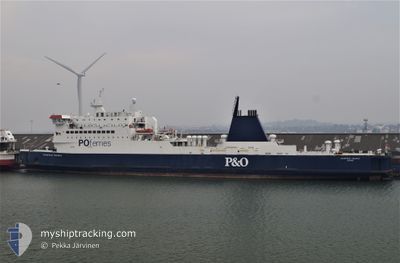
BLUE WAVE HARMONY
Ro-Ro/Passenger Ship
Current Trip
PR SJU
| Time Travelled | 4 h, 31 mins |
|---|---|
| Remaining Time | --- |
| Distance Travelled | 57.49 nm |
| Remaining Distance | --- |
| AVG Speed | 13.5 Knots |
| MAX Speed | 15 Knots |
| AVG Wind | 16.2 knots |
| MAX Wind | 22.6 knots |
| MIN Temp | 28.4°C / 83.12°F |
| MAX Temp | 32.4°C / 90.32°F |
| Draught | 5.8 m |
| Position Received | 3 h, 33 m ago |
Current Position
| Longitude | -66.19677° |
|---|---|
| Latitude | 18.59372° |
| Status | Under way using engine |
| Speed | 14.5 Knots |
| Course | 303.7° |
| Area | North Atlantic Ocean |
| Station | T-AIS |
| Position Received | 3 h, 33 m ago |
Info
Information
The current position of BLUE WAVE HARMONY is in North Atlantic Ocean with coordinates 18.59372° / -66.19677° as reported on 2024-06-01 19:48 by AIS to our vessel tracker app. The vessel's current speed is 14.5 Knots
The vessel BLUE WAVE HARMONY (IMO: 9007283, MMSI: 352001076) is a Ro-Ro/Passenger Ship that was built in 1991 ( 33 years old ). It's sailing under the flag of [PA] Panama.
In this page you can find informations about the vessels current position, last detected port calls, and current voyage information. If the vessels is not in coverage by AIS you will find the latest position.
The current position of BLUE WAVE HARMONY is detected by our AIS receivers and we are not responsible for the reliability of the data. The last position was recorded while the vessel was in Coverage by the Ais receivers of our vessel tracking app.
The current draught of BLUE WAVE HARMONY as reported by AIS is 5.8 meters
Weather
| Temperature | 28.1°C / 82.58°F |
|---|---|
| Wind Speed | 11 knots |
| Direction | 90° E |
| Pressure | 1013.2 hPa |
| Humidity | 78.8 % |
| Cloud Coverage | 83 % |
Featured Company
Last Port Calls
| Port | Arrival | Departure | Time In Port |
|---|---|---|---|
| 2024-06-01 06:15 | 2024-06-01 18:51 | 12 h | |
| 2024-05-31 00:47 | 2024-05-31 10:16 | 9 h | |
| 2024-05-29 21:40 | 2024-05-30 07:37 | 9 h | |
| 2024-05-28 18:19 | 2024-05-29 02:52 | 8 h | |
| 2024-05-27 15:08 | 2024-05-28 00:46 | 9 h | |
| 2024-05-26 11:54 | 2024-05-26 21:03 | 9 h | |
| 2024-05-25 05:46 | 2024-05-25 18:40 | 12 h | |
| 2024-05-24 02:54 | 2024-05-24 12:12 | 9 h | |
| 2024-05-22 21:16 | 2024-05-23 09:50 | 12 h | |
| 2024-05-21 19:07 | 2024-05-22 04:04 | 8 h |
Most Visited Ports (Last year)
| Port | Arrivals | |
|---|---|---|
| 19 | ||
| 15 | ||
| 14 | ||
| 13 | ||
| 2 | ||
| 2 |
Last Trips
| Origin | Departure | Destination | Arrival | Distance | |
|---|---|---|---|---|---|
| 2024-05-31 06:16 | 2024-06-01 02:15 | 244.24 nm | |||
| 2024-05-30 03:37 | 2024-05-30 20:47 | 236.81 nm | |||
| 2024-05-28 22:52 | 2024-05-29 17:40 | 240.51 nm | |||
| 2024-05-27 20:46 | 2024-05-28 14:19 | 235.79 nm | |||
| 2024-05-26 17:03 | 2024-05-27 11:08 | 240.12 nm | |||
| 2024-05-25 14:40 | 2024-05-26 07:54 | 237.22 nm | |||
| 2024-05-24 08:12 | 2024-05-25 01:46 | 239.12 nm | |||
| 2024-05-23 05:50 | 2024-05-23 22:54 | 235.65 nm | |||
| 2024-05-22 00:04 | 2024-05-22 17:16 | 237.96 nm | |||
| 2024-05-20 21:35 | 2024-05-21 15:07 | 236.60 nm |
Events
| Time | Event | Details | Position / Dest | Info |
|---|---|---|---|---|
| 2024-06-01 19:58 | Status Changed | Default Under way using engine |
18.60833 / -66.23333
PR SJU
|
Speed: 14.5 kn Course: 303.7° |
| 2024-06-01 19:48 | OUT of Coverage |
18.59372 / -66.19677
North Atlantic Ocean
|
Speed: 14.5 kn Course: 303.7° |
|
| 2024-06-01 19:47 | Status Changed | Under way using engine Default |
18.59145 / -66.19328
PR SJU
|
Speed: 14.3 kn Course: 316° |
| 2024-06-01 19:11 | Status Changed | Default Under way using engine |
18.51011 / -66.11275
PR SJU
|
Speed: 7.3 kn Course: 111° |
| 2024-06-01 19:05 | Status Changed | Under way using engine Default |
18.51035 / -66.12382
PR SJU
|
Speed: 12 kn Course: 1° |
| 2024-06-01 18:51 | IN Coverage |
18.51035 / -66.12382
North Atlantic Ocean
|
Speed: 7.3 kn Course: 111° |
|
| 2024-06-01 18:51 | PORT DEPARTURE |
|
18.47333 / -66.12833
PR SJU
|
Speed: 10.5 kn Course: 312° |
| 2024-06-01 18:39 | START Moving |
18.44833 / -66.10333
[PR] SAN JUAN
|
Speed: 11 kn Course: -1° |
|
| 2024-06-01 06:46 | STOP Moving |
18.44782 / -66.08918
[PR] SAN JUAN
|
Speed: 0.1 kn Course: 213° |
|
| 2024-06-01 06:15 | PORT ARRIVAL |
|
18.44500 / -66.09500
[PR] SAN JUAN
|
Speed: 12 kn Course: 185° |