
BMO RIVER
General Cargo
Current Trip
| Trip Time | 20 days |
|---|---|
| Trip Distance | 1120.07 nm |
| AVG Speed | 8.3 Knots |
| MAX Speed | 10.8 Knots |
| Draught | 2.4 m |
| AVG Wind | 7.9 knots |
| MAX Wind | 21 knots |
| MIN Temp | 10.6°C / 51.08°F |
| MAX Temp | 25.5°C / 77.9°F |
| Position Received | 20 h, 53 m ago |
Current Position
| Longitude | 28.73636° |
|---|---|
| Latitude | 44.09764° |
| Status | At anchor |
| Speed | 2.6 Knots |
| Course | 175° |
| Area | Black Sea |
| Station | T-AIS |
| Position Received | 20 h, 53 m ago |
Info
Information
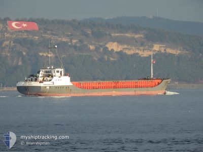
The current position of BMO RIVER is in Black Sea with coordinates 44.09764° / 28.73636° as reported on 2024-05-31 04:04 by AIS to our vessel tracker app. The vessel's current speed is 2.6 Knots and is currently inside the port of MURFATLAR.
The vessel BMO RIVER (IMO: 8511914, MMSI: 511100682) is a General Cargo that was built in 1986 ( 38 years old ). It's sailing under the flag of [PW] Palau.
In this page you can find informations about the vessels current position, last detected port calls, and current voyage information. If the vessels is not in coverage by AIS you will find the latest position.
The current position of BMO RIVER is detected by our AIS receivers and we are not responsible for the reliability of the data. The last position was recorded while the vessel was in Coverage by the Ais receivers of our vessel tracking app.
The current draught of BMO RIVER as reported by AIS is 2.4 meters
Weather
| Temperature | 17.8°C / 64.04°F |
|---|---|
| Wind Speed | 5 knots |
| Direction | 201° SSW |
| Pressure | 1013.6 hPa |
| Humidity | 72.3 % |
| Cloud Coverage | 18 % |
Featured Company
Events
| Time | Event | Details | Position / Dest | Info |
|---|---|---|---|---|
| 2024-05-31 13:37 | PORT ARRIVAL |
|
44.17833 / 28.39333
[RO] MURFATLAR
|
Speed: 2.4 kn Course: 223° |
| 2024-05-31 08:46 | START Moving | 3.03 nm, South West of CONSTANTA |
44.10036 / 28.60885
RO BASARABI
|
Speed: 5.1 kn Course: 281° |
| 2024-05-31 05:54 | STOP Moving | 2.53 nm, South West of CONSTANTA |
44.10008 / 28.62228
RO BASARABI
|
Speed: 0.3 kn Course: 271° |
| 2024-05-31 04:10 | Status Changed | Default At anchor |
44.09434 / 28.73738
RO BASARABI
|
Speed: 2.6 kn Course: 175° |
| 2024-05-31 04:04 | Status Changed | At anchor Default |
44.09764 / 28.73636
RO BASARABI
|
Speed: 4.4 kn Course: 185° |
| 2024-05-31 04:04 | OUT of Coverage |
44.09764 / 28.73636
Black Sea
RO BASARABI
|
Speed: 2.6 kn Course: 166.4° |
|
| 2024-05-31 03:58 | Status Changed | Default At anchor |
44.10643 / 28.73790
RO BASARABI
|
Speed: 5.1 kn Course: 180.6° |
| 2024-05-31 03:50 | Status Changed | At anchor Default |
44.11815 / 28.74014
RO BASARABI
|
Speed: 0.2 kn Course: 154° |
| 2024-05-31 03:50 | START Moving | 2.99 nm, East of CONSTANTA |
44.11815 / 28.74014
RO BASARABI
|
Speed: 5 kn Course: 181° |
| 2024-05-31 03:38 | Status Changed | Default At anchor |
44.12320 / 28.73987
RO BASARABI
|
Speed: 0.2 kn Course: 149° |