
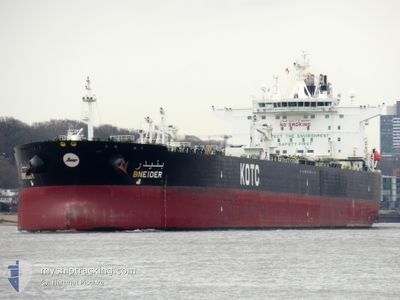
BNEIDER
Crude Oil Tanker
Current Trip
| Time Travelled | 6 days |
|---|---|
| Remaining Time | 2 days |
| Distance Travelled | 1632.21 nm |
| Remaining Distance | 2416.13 nm |
| AVG Speed | 11.8 Knots |
| MAX Speed | 15.5 Knots |
| AVG Wind | 15.5 knots |
| MAX Wind | 27.8 knots |
| MIN Temp | 16.4°C / 61.52°F |
| MAX Temp | 29.7°C / 85.46°F |
| Draught | 13.1 m |
| Position Received | 6 d ago |
Current Position
| Longitude | 129.15260° |
|---|---|
| Latitude | 34.57119° |
| Status | Under way using engine |
| Speed | 12.1 Knots |
| Course | 199.4° |
| Area | Japan Sea |
| Station | T-AIS |
| Position Received | 6 d ago |
Info
Information
The current position of BNEIDER is in Japan Sea with coordinates 34.57119° / 129.15260° as reported on 2024-05-25 21:26 by AIS to our vessel tracker app. The vessel's current speed is 12.1 Knots and is heading at the port of SINGAPORE. The estimated time of arrival as calculated by vessel tracking app is 2024-06-03 09:20 LT
The vessel BNEIDER (IMO: 9595010, MMSI: 447089000) is a Crude Oil Tanker that was built in 2012 ( 12 years old ). It's sailing under the flag of [KW] Kuwait.
In this page you can find informations about the vessels current position, last detected port calls, and current voyage information. If the vessels is not in coverage by AIS you will find the latest position.
The current position of BNEIDER is detected by our AIS receivers and we are not responsible for the reliability of the data. The last position was recorded while the vessel was in Coverage by the Ais receivers of our vessel tracking app.
The current draught of BNEIDER as reported by AIS is 13.1 meters
Weather
| Temperature | 30°C / 86°F |
|---|---|
| Wind Speed | 5 knots |
| Direction | 221° SW |
| Pressure | 1010.6 hPa |
| Humidity | 71.6 % |
| Cloud Coverage | 100 % |
Featured Company
Last Port Calls
| Port | Arrival | Departure | Time In Port |
|---|---|---|---|
| 2024-05-21 14:36 | 2024-05-25 13:16 | 3 d | |
| 2024-05-15 02:44 | 2024-05-16 07:48 | 1 d | |
| 2024-04-20 20:07 | 2024-04-21 18:46 | 22 h |
Most Visited Ports (Last year)
| Port | Arrivals | |
|---|---|---|
| 3 | ||
| 3 | ||
| 2 | ||
| 1 | ||
| 1 | ||
| 1 |
Last Trips
| Origin | Departure | Destination | Arrival | Distance | |
|---|---|---|---|---|---|
| 2024-05-16 16:48 | 2024-05-21 23:36 | 772.57 nm | |||
| 2024-04-21 21:46 | 2024-05-15 11:44 | 6860.29 nm | |||
| 2024-03-02 08:40 | 2024-04-20 23:07 | 12684.01 nm |
Events
| Time | Event | Details | Position / Dest | Info |
|---|---|---|---|---|
| 2024-05-25 21:32 | Status Changed | Default Under way using engine |
34.55061 / 129.14294
KR USN>SG SIN
|
Speed: 12.1 kn Course: 199.4° |
| 2024-05-25 21:26 | OUT of Coverage |
34.57119 / 129.15260
Japan Sea
KR USN>SG SIN
|
Speed: 12.1 kn Course: 199.4° |
|
| 2024-05-25 20:55 | Status Changed | Under way using engine Default |
34.66194 / 129.21355
KR USN>SG SIN
|
Speed: 11.9 kn Course: 212° |
| 2024-05-25 20:51 | Status Changed | Default Under way using engine |
34.67180 / 129.22110
KR USN>SG SIN
|
Speed: 11.9 kn Course: 213.3° |
| 2024-05-25 18:55 | Change Sea Area | Japanese part of the Japan Sea South Korean part of the Japan Sea |
34.98675 / 129.46606
Japan Sea
KR USN>SG SIN
|
Speed: 9.5 kn Course: 210.6° |
| 2024-05-25 16:51 | Draught Changed | 13.1 8.3 |
35.29492 / 129.45669
KR USN>SG SIN
|
Speed: 8.7 kn Course: 182.6° |
| 2024-05-25 16:51 | Destination Changed | KR USN>SG SIN >KR USN |
35.29492 / 129.45669
KR USN>SG SIN
|
Speed: 8.7 kn Course: 182.6° |
| 2024-05-25 16:51 | ETA Changed | 2024/06/04 17:00 2024/05/21 17:00 |
35.29492 / 129.45669
KR USN>SG SIN
|
Speed: 8.7 kn Course: 182.6° |
| 2024-05-25 16:28 | Status Changed | Under way using engine Default |
35.34861 / 129.45224
>KR USN
|
Speed: 8.7 kn Course: 170° |
| 2024-05-25 16:20 | Status Changed | Default Under way using engine |
35.36673 / 129.44865
>KR USN
|
Speed: 8.8 kn Course: 160.1° |