
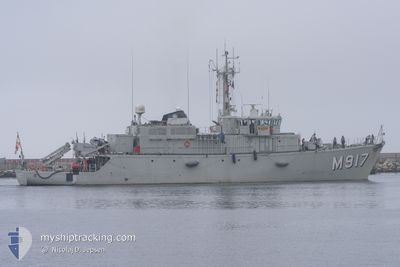
BNS CROCUS
Military ops
Current Trip
| Trip Time | 4 days |
|---|---|
| Trip Distance | 263.25 nm |
| AVG Speed | 7.6 Knots |
| MAX Speed | 13.8 Knots |
| Draught | 3.6 m |
| AVG Wind | 9.5 knots |
| MAX Wind | 17 knots |
| MIN Temp | 11.6°C / 52.88°F |
| MAX Temp | 21.3°C / 70.34°F |
| Position Received | Now |
Current Position
| Longitude | 3.20542° |
|---|---|
| Latitude | 51.33710° |
| Status | Under way using engine |
| Speed | |
| Course | --- |
| Area | North Sea |
| Station | T-AIS |
| Position Received | Now |
Info
Information
The current position of BNS CROCUS is in North Sea with coordinates 51.33710° / 3.20542° as reported on 2024-06-27 11:24 by AIS to our vessel tracker app. The vessel's current speed is 0 Knots and is currently inside the port of ZEEBRUGGE.
The vessel BNS CROCUS (MMSI: 205208000) is a Military ops It's sailing under the flag of [BE] Belgium.
In this page you can find informations about the vessels current position, last detected port calls, and current voyage information. If the vessels is not in coverage by AIS you will find the latest position.
The current position of BNS CROCUS is detected by our AIS receivers and we are not responsible for the reliability of the data. The last position was recorded while the vessel was in Coverage by the Ais receivers of our vessel tracking app.
The current draught of BNS CROCUS as reported by AIS is 3.6 meters
Weather
| Temperature | 25.4°C / 77.72°F |
|---|---|
| Wind Speed | 9 knots |
| Direction | 258° WSW |
| Pressure | 1008.5 hPa |
| Humidity | 60.3 % |
| Cloud Coverage | 60 % |
Featured Company
Last Port Calls
Last Trips
| Origin | Departure | Destination | Arrival | Distance | |
|---|---|---|---|---|---|
| 2024-06-21 19:19 | 2024-06-26 08:45 | 263.25 nm | |||
| 2024-06-17 12:19 | 2024-06-20 23:38 | 295.12 nm | |||
| 2024-04-15 08:18 | 2024-05-03 09:17 | 1099.77 nm | |||
| 2024-04-08 10:33 | 2024-04-12 10:26 | 246.23 nm | |||
| 2024-04-02 10:54 | 2024-04-05 10:51 | 439.75 nm |
Events
| Time | Event | Details | Position / Dest | Info |
|---|---|---|---|---|
| 2024-06-26 06:46 | STOP Moving |
51.33776 / 3.20552
[BE] ZEEBRUGGE
|
Speed: 0.3 kn Course: 305° |
|
| 2024-06-26 06:45 | PORT ARRIVAL |
|
51.33773 / 3.20549
[BE] ZEEBRUGGE
|
Speed: 0.6 kn Course: 276° |
| 2024-06-26 06:04 | START Moving | 3.9 nm, West of ZEEBRUGGE |
51.36223 / 3.10371
SAFETY DISTANCE0.5NM
|
Speed: 6.2 kn Course: 50.6° |
| 2024-06-26 06:02 | STOP Moving | 3.97 nm, West of ZEEBRUGGE |
51.36093 / 3.10115
SAFETY DISTANCE0.5NM
|
Speed: Course: 49° |
| 2024-06-26 01:43 | Change Sea Area | Belgian part of the North Sea French part of the North Sea |
51.32001 / 2.36885
North Sea
|
Speed: 8.3 kn Course: 59.3° |
| 2024-06-25 21:38 | Change Sea Area | French part of the North Sea French part of the English Channel |
51.00026 / 1.62071
North Sea
|
Speed: 7.6 kn Course: 44.3° |
| 2024-06-25 17:07 | START Moving | 11.04 nm, South West of BOULOGNE-SUR-MER |
50.61766 / 1.36262
SAFETY DISTANCE0.5NM
|
Speed: 3.6 kn Course: 125° |
| 2024-06-25 16:31 | STOP Moving | 10.97 nm, South West of BOULOGNE-SUR-MER |
50.61525 / 1.36790
SAFETY DISTANCE0.5NM
|
Speed: 0.3 kn Course: 67° |
| 2024-06-25 16:20 | START Moving | 10.98 nm, South West of BOULOGNE-SUR-MER |
50.61921 / 1.36264
SAFETY DISTANCE0.5NM
|
Speed: 3.3 kn Course: 139° |
| 2024-06-25 14:28 | STOP Moving | 11 nm, South West of BOULOGNE-SUR-MER |
50.61604 / 1.36592
SAFETY DISTANCE0.5NM
|
Speed: 0.1 kn Course: 211° |