
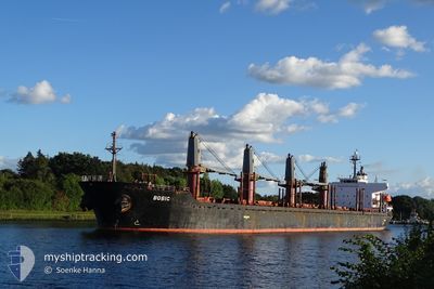
MV BOBIC
Bulk Carrier
Current Trip
| Trip Time | 6 days |
|---|---|
| Trip Distance | 495.79 nm |
| AVG Speed | 7.4 Knots |
| MAX Speed | 13 Knots |
| Draught | 5.7 m |
| AVG Wind | 6.2 knots |
| MAX Wind | 16.5 knots |
| MIN Temp | 10.9°C / 51.62°F |
| MAX Temp | 19.8°C / 67.64°F |
| Position Received | 7 d ago |
Current Position
| Longitude | 29.27395° |
|---|---|
| Latitude | 41.49722° |
| Status | Under way using engine |
| Speed | 11.1 Knots |
| Course | 339° |
| Area | Black Sea |
| Station | T-AIS |
| Position Received | 7 d ago |
Info
Information
The current position of MV BOBIC is in Black Sea with coordinates 41.49722° / 29.27395° as reported on 2024-05-24 21:41 by AIS to our vessel tracker app. The vessel's current speed is 11.1 Knots and is currently inside the port of VARNA.
The vessel MV BOBIC (IMO: 9317781, MMSI: 538006462) is a Bulk Carrier that was built in 2006 ( 18 years old ). It's sailing under the flag of [MH] Marshall Is.
In this page you can find informations about the vessels current position, last detected port calls, and current voyage information. If the vessels is not in coverage by AIS you will find the latest position.
The current position of MV BOBIC is detected by our AIS receivers and we are not responsible for the reliability of the data. The last position was recorded while the vessel was in Coverage by the Ais receivers of our vessel tracking app.
The current draught of MV BOBIC as reported by AIS is 5.7 meters
Weather
| Temperature | 19.3°C / 66.74°F |
|---|---|
| Wind Speed | 3 knots |
| Direction | 204° SSW |
| Pressure | 1015.9 hPa |
| Humidity | 75 % |
| Cloud Coverage | 6 % |
Featured Company
Events
| Time | Event | Details | Position / Dest | Info |
|---|---|---|---|---|
| 2024-05-28 22:46 | STOP Moving |
43.19083 / 27.76585
[BG] VARNA
|
Speed: 0.3 kn Course: 36° |
|
| 2024-05-28 22:41 | PORT ARRIVAL |
|
43.19067 / 27.76653
[BG] VARNA
|
Speed: 1.7 kn Course: 350° |
| 2024-05-24 21:49 | Status Changed | Default Under way using engine |
41.52017 / 29.27028
ISTANBUL ANCHORAGE
|
Speed: 11.1 kn Course: 339° |
| 2024-05-24 21:41 | OUT of Coverage |
41.49722 / 29.27395
Black Sea
|
Speed: 11.1 kn Course: 339° |
|
| 2024-05-24 21:38 | Status Changed | Under way using engine Default |
41.48832 / 29.27698
ISTANBUL ANCHORAGE
|
Speed: 12 kn Course: 21° |
| 2024-05-24 21:27 | Status Changed | Default Under way using engine |
41.45152 / 29.26408
ISTANBUL ANCHORAGE
|
Speed: 12 kn Course: 19° |
| 2024-05-24 20:17 | Change Sea Area | Turkish part of the Black Sea Turkish part of the Sea of Marmara |
41.23628 / 29.14847
Black Sea
|
Speed: 11.9 kn Course: 41° |
| 2024-05-24 15:39 | START Moving | 18.57 nm, South of AMBARLI |
40.65395 / 28.61018
ISTANBUL ANCHORAGE
|
Speed: 3.3 kn Course: 54° |
| 2024-05-23 13:27 | STOP Moving | 17.81 nm, South of YESILKOY |
40.66183 / 28.76662
ISTANBUL ANCHORAGE
|
Speed: 0.3 kn Course: 43° |