
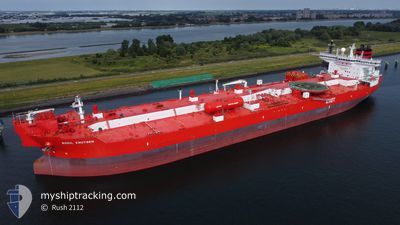
BODIL KNUTSEN
Shuttle Tanker
Current Trip
OFF FLESLAND
| Time Travelled | 52 days |
|---|---|
| Remaining Time | --- |
| Distance Travelled | 3139.29 nm |
| Remaining Distance | --- |
| AVG Speed | 8.3 Knots |
| MAX Speed | 16.2 Knots |
| AVG Wind | 14.4 knots |
| MAX Wind | 39.9 knots |
| MIN Temp | 3.3°C / 37.94°F |
| MAX Temp | 16.4°C / 61.52°F |
| Draught | 9.1 m |
| Position Received | 1 m ago |
Current Position
| Longitude | 4.38234° |
|---|---|
| Latitude | 60.31870° |
| Status | Under way using engine |
| Speed | 0.1 Knots |
| Course | 200° |
| Area | North Sea |
| Station | T-AIS |
| Position Received | 1 m ago |
Info
Information
The current position of BODIL KNUTSEN is in North Sea with coordinates 60.31870° / 4.38234° as reported on 2024-05-29 10:32 by AIS to our vessel tracker app. The vessel's current speed is 0.1 Knots
The vessel BODIL KNUTSEN (IMO: 9472529, MMSI: 257998000) is a Shuttle Tanker that was built in 2011 ( 13 years old ). It's sailing under the flag of [NO] Norway.
In this page you can find informations about the vessels current position, last detected port calls, and current voyage information. If the vessels is not in coverage by AIS you will find the latest position.
The current position of BODIL KNUTSEN is detected by our AIS receivers and we are not responsible for the reliability of the data. The last position was recorded while the vessel was in Coverage by the Ais receivers of our vessel tracking app.
The current draught of BODIL KNUTSEN as reported by AIS is 9.1 meters
Weather
| Temperature | 11.2°C / 52.16°F |
|---|---|
| Wind Speed | 8 knots |
| Direction | 104° ESE |
| Pressure | 1009 hPa |
| Humidity | 84.9 % |
| Cloud Coverage | 53 % |
Featured Company
Last Port Calls
| Port | Arrival | Departure | Time In Port |
|---|---|---|---|
| 2024-04-05 08:16 | 2024-04-07 05:57 | 1 d | |
| 2024-03-26 01:09 | 2024-03-27 02:33 | 1 d | |
| 2024-03-12 15:26 | 2024-03-13 15:30 | 1 d |
Most Visited Ports (Last year)
| Port | Arrivals | |
|---|---|---|
| 10 | ||
| 3 | ||
| 2 | ||
| 2 | ||
| 2 | ||
| 2 |
Last Trips
| Origin | Departure | Destination | Arrival | Distance | |
|---|---|---|---|---|---|
| 2024-03-27 03:33 | 2024-04-05 09:16 | 1351.16 nm | |||
| 2024-03-13 17:30 | 2024-03-26 02:09 | 1614.75 nm | |||
| 2024-02-22 12:00 | 2024-03-12 17:26 | 3033.57 nm |
Events
| Time | Event | Details | Position / Dest | Info |
|---|---|---|---|---|
| 2024-05-28 18:54 | STOP Moving | 17.94 nm, South West of KOLLSNES |
60.36302 / 4.42061
OFF FLESLAND
|
Speed: 0.3 kn Course: 247° |
| 2024-05-28 17:11 | START Moving | 20.45 nm, South West of AAGOTNES |
60.23185 / 4.44281
OFF FLESLAND
|
Speed: 3.1 kn Course: 330° |
| 2024-05-28 10:08 | STOP Moving | 19.84 nm, South West of AAGOTNES |
60.23859 / 4.45805
OFF FLESLAND
|
Speed: 0.2 kn Course: 203° |
| 2024-05-27 18:48 | Status Changed | Under way using engine Default |
60.89570 / 2.74415
OFF FLESLAND
|
Speed: 6.8 kn Course: 113° |
| 2024-05-27 18:34 | Status Changed | Default Under way using engine |
60.90634 / 2.69147
OFF FLESLAND
|
Speed: 6.9 kn Course: 114° |
| 2024-05-27 18:22 | Status Changed | Under way using engine Default |
60.91493 / 2.65098
OFF FLESLAND
|
Speed: 7 kn Course: 115° |
| 2024-05-27 17:57 | Status Changed | Default Under way using engine |
60.93401 / 2.55824
OFF FLESLAND
|
Speed: 7 kn Course: 113° |
| 2024-05-27 16:36 | Change Sea Area | Norwegian part of the North Sea Norwegian part of the Norwegian Sea |
60.99807 / 2.26165
North Sea
OFF FLESLAND
|
Speed: 5.7 kn Course: 128° |
| 2024-05-27 16:20 | Destination Changed | OFF FLESLAND STATFJORD |
61.00691 / 2.24082
OFF FLESLAND
|
Speed: 1.7 kn Course: 142° |
| 2024-05-27 16:20 | ETA Changed | 2024/05/28 04:00 2024/05/25 15:15 |
61.00691 / 2.24082
OFF FLESLAND
|
Speed: 1.7 kn Course: 142° |