
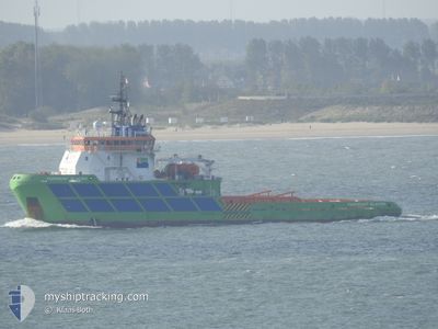
BOKA GLACIER
Tug
Current Trip
| Time Travelled | 56 days |
|---|---|
| Remaining Time | 11 days |
| Distance Travelled | 2484.12 nm |
| Remaining Distance | 3375.72 nm |
| AVG Speed | 7.3 Knots |
| MAX Speed | 14 Knots |
| AVG Wind | 12.3 knots |
| MAX Wind | 24 knots |
| MIN Temp | 18.3°C / 64.94°F |
| MAX Temp | 36.6°C / 97.88°F |
| Draught | 5.9 m |
| Position Received | 22 h, 38 m ago |
Current Position
| Longitude | -42.89419° |
|---|---|
| Latitude | -23.07888° |
| Status | Under way using engine |
| Speed | 12.4 Knots |
| Course | 102° |
| Area | South Atlantic Ocean |
| Station | T-AIS |
| Position Received | 22 h, 38 m ago |
Info
Information
The current position of BOKA GLACIER is in South Atlantic Ocean with coordinates -23.07888° / -42.89419° as reported on 2024-06-09 08:00 by AIS to our vessel tracker app. The vessel's current speed is 12.4 Knots and is heading at the port of LAS PALMAS. The estimated time of arrival as calculated by vessel tracking app is 2024-06-21 21:40 LT
The vessel BOKA GLACIER (IMO: 9344796, MMSI: 248568000) is a Tug that was built in 2006 ( 18 years old ). It's sailing under the flag of [MT] Malta.
In this page you can find informations about the vessels current position, last detected port calls, and current voyage information. If the vessels is not in coverage by AIS you will find the latest position.
The current position of BOKA GLACIER is detected by our AIS receivers and we are not responsible for the reliability of the data. The last position was recorded while the vessel was in Coverage by the Ais receivers of our vessel tracking app.
The current draught of BOKA GLACIER as reported by AIS is 5.9 meters
Weather
| Temperature | 24.1°C / 75.38°F |
|---|---|
| Wind Speed | 10 knots |
| Direction | 25° NNE |
| Pressure | 1019.6 hPa |
| Humidity | 66.1 % |
| Cloud Coverage | 68 % |
Featured Company
Last Port Calls
| Port | Arrival | Departure | Time In Port |
|---|---|---|---|
| 2024-04-14 11:56 | 2024-04-14 15:05 | 3 h | |
| 2024-04-13 11:28 | 2024-04-14 11:49 | 1 d |
Most Visited Ports (Last year)
| Port | Arrivals | |
|---|---|---|
| 6 | ||
| 1 | ||
| 1 |
Last Trips
| Origin | Departure | Destination | Arrival | Distance | |
|---|---|---|---|---|---|
| 2024-04-14 12:49 | 2024-04-14 12:56 | 1.14 nm | |||
| 2024-02-25 11:49 | 2024-04-13 12:28 | 2775.75 nm |
Events
| Time | Event | Details | Position / Dest | Info |
|---|---|---|---|---|
| 2024-06-09 08:05 | Status Changed | Default Under way using engine |
-23.08152 / -42.87461
LAS PALMAS
|
Speed: 12.4 kn Course: 102° |
| 2024-06-09 08:00 | OUT of Coverage |
-23.07888 / -42.89419
South Atlantic Ocean
|
Speed: 12.4 kn Course: 102° |
|
| 2024-06-09 07:58 | Status Changed | Under way using engine Default |
-23.07753 / -42.90022
LAS PALMAS
|
Speed: 12.1 kn Course: 112° |
| 2024-06-09 07:54 | Status Changed | Default Under way using engine |
-23.07212 / -42.91514
LAS PALMAS
|
Speed: 12.3 kn Course: 113° |
| 2024-06-09 07:41 | Status Changed | Under way using engine Default |
-23.05509 / -42.95659
LAS PALMAS
|
Speed: 12 kn Course: 109° |
| 2024-06-09 07:36 | Status Changed | Default Under way using engine |
-23.04833 / -42.97333
LAS PALMAS
|
Speed: 12.2 kn Course: 106° |
| 2024-06-09 07:31 | Status Changed | Under way using engine Default |
-23.04340 / -42.99367
LAS PALMAS
|
Speed: 11.2 kn Course: 106° |
| 2024-06-09 07:18 | Status Changed | Default Under way using engine |
-23.03167 / -43.03333
LAS PALMAS
|
Speed: 11.1 kn Course: 111° |
| 2024-06-09 06:38 | Draught Changed | 5.9 6.4 |
-22.96383 / -43.13246
LAS PALMAS
|
Speed: 10.5 kn Course: 162° |
| 2024-06-09 06:38 | ETA Changed | 2024/07/22 12:00 2024/06/08 09:00 |
-22.96383 / -43.13246
LAS PALMAS
|
Speed: 10.5 kn Course: 162° |