
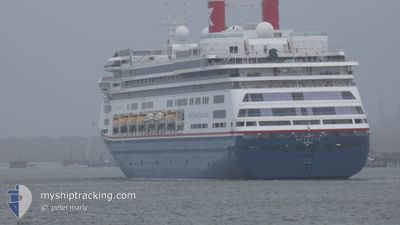
BOLETTE
Passengers Ship
Current Trip
| Time Travelled | 14 h, 53 mins |
|---|---|
| Remaining Time | 1 h, 0 mins |
| Distance Travelled | 222.74 nm |
| Remaining Distance | 17.64 nm |
| AVG Speed | 15.2 Knots |
| MAX Speed | 15.8 Knots |
| AVG Wind | 5.6 knots |
| MAX Wind | 9.8 knots |
| MIN Temp | 17°C / 62.6°F |
| MAX Temp | 21.8°C / 71.24°F |
| Draught | 8.1 m |
| Position Received | 6 h, 13 m ago |
Current Position
| Longitude | 11.94755° |
|---|---|
| Latitude | 40.74615° |
| Status | Under way using engine |
| Speed | 15.2 Knots |
| Course | 277.8° |
| Area | Tyrrhenian Sea |
| Station | T-AIS |
| Position Received | 6 h, 13 m ago |
Info
Information
The current position of BOLETTE is in Tyrrhenian Sea with coordinates 40.74615° / 11.94755° as reported on 2024-05-17 00:46 by AIS to our vessel tracker app. The vessel's current speed is 15.2 Knots and is heading at the port of OLBIA. The estimated time of arrival as calculated by vessel tracking app is 2024-05-17 08:00 LT
The vessel BOLETTE (IMO: 9188037, MMSI: 311000986) is a Passengers Ship that was built in 2000 ( 24 years old ). It's sailing under the flag of [BS] Bahamas.
In this page you can find informations about the vessels current position, last detected port calls, and current voyage information. If the vessels is not in coverage by AIS you will find the latest position.
The current position of BOLETTE is detected by our AIS receivers and we are not responsible for the reliability of the data. The last position was recorded while the vessel was in Coverage by the Ais receivers of our vessel tracking app.
The current draught of BOLETTE as reported by AIS is 8.1 meters
Weather
| Temperature | 17°C / 62.6°F |
|---|---|
| Wind Speed | 5 knots |
| Direction | 246° WSW |
| Pressure | 1011.6 hPa |
| Humidity | 71.3 % |
| Cloud Coverage | 27 % |
Featured Company
Last Port Calls
| Port | Arrival | Departure | Time In Port |
|---|---|---|---|
| 2024-05-15 21:17 | 2024-05-16 16:07 | 18 h | |
| 2024-05-12 06:53 | 2024-05-12 15:50 | 8 h | |
| 2024-05-08 10:08 | 2024-05-08 20:46 | 10 h | |
| 2024-05-06 05:15 | 2024-05-06 20:34 | 15 h | |
| 2024-05-05 07:42 | 2024-05-05 18:49 | 11 h | |
| 2024-05-03 04:45 | 2024-05-03 15:58 | 11 h | |
| 2024-04-30 06:09 | 2024-04-30 17:25 | 11 h | |
| 2024-04-29 07:25 | 2024-04-29 17:26 | 10 h | |
| 2024-04-26 07:14 | 2024-04-27 18:10 | 1 d | |
| 2024-04-19 04:31 | 2024-04-19 16:50 | 12 h |
Last Trips
| Origin | Departure | Destination | Arrival | Distance | |
|---|---|---|---|---|---|
| 2024-05-12 16:50 | 2024-05-15 23:17 | 1058.40 nm | |||
| 2024-05-08 21:46 | 2024-05-12 07:53 | 1306.75 nm | |||
| 2024-05-06 21:34 | 2024-05-08 11:08 | 418.40 nm | |||
| 2024-05-05 19:49 | 2024-05-06 06:15 | 148.35 nm | |||
| 2024-05-03 16:58 | 2024-05-05 08:42 | 586.50 nm | |||
| 2024-04-30 18:25 | 2024-05-03 05:45 | 854.17 nm | |||
| 2024-04-29 18:26 | 2024-04-30 07:09 | 197.35 nm | |||
| 2024-04-27 19:10 | 2024-04-29 08:25 | 530.37 nm | |||
| 2024-04-19 17:50 | 2024-04-26 08:14 | 1993.49 nm | |||
| 2024-04-17 18:41 | 2024-04-19 05:31 | 573.13 nm |
Events
| Time | Event | Details | Position / Dest | Info |
|---|---|---|---|---|
| 2024-05-17 00:51 | Status Changed | Default Under way using engine |
40.74833 / 11.92167
IT OLB
|
Speed: 15.2 kn Course: 277.8° |
| 2024-05-17 00:46 | OUT of Coverage |
40.74615 / 11.94755
Tyrrhenian Sea
IT OLB
|
Speed: 15.2 kn Course: 277.8° |
|
| 2024-05-16 23:32 | Status Changed | Under way using engine Default |
40.70163 / 12.36433
IT OLB
|
Speed: 15 kn Course: 277° |
| 2024-05-16 23:32 | IN Coverage |
40.70332 / 12.34853
Tyrrhenian Sea
IT OLB
|
Speed: 15.5 kn Course: 278.1° |
|
| 2024-05-16 22:33 | Status Changed | Default Under way using engine |
40.66611 / 12.69668
IT OLB
|
Speed: 15.5 kn Course: 277.8° |
| 2024-05-16 22:16 | OUT of Coverage |
40.65570 / 12.79383
Tyrrhenian Sea
IT OLB
|
Speed: 15.5 kn Course: 277.8° |
|
| 2024-05-16 16:07 | PORT DEPARTURE |
|
40.66362 / 14.73915
IT OLB
|
Speed: 5 kn Course: 250° |
| 2024-05-16 16:05 | Destination Changed | IT OLB IT SAL |
40.66457 / 14.74285
[IT] SALERNO
|
Speed: 5.5 kn Course: 255° |
| 2024-05-16 16:05 | ETA Changed | 2024/05/17 08:00 2024/05/15 21:00 |
40.66457 / 14.74285
[IT] SALERNO
|
Speed: 5.5 kn Course: 255° |
| 2024-05-16 16:02 | START Moving |
40.66668 / 14.74828
[IT] SALERNO
|
Speed: 4.3 kn Course: 214° |