
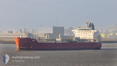
BOND
Oil Products Tanker
Current Trip
OPLMALTA
| Time Travelled | 18 days |
|---|---|
| Remaining Time | --- |
| Distance Travelled | 3960.28 nm |
| Remaining Distance | --- |
| AVG Speed | 12.9 Knots |
| MAX Speed | 17.4 Knots |
| AVG Wind | 14.1 knots |
| MAX Wind | 26.6 knots |
| MIN Temp | 4.3°C / 39.74°F |
| MAX Temp | 21.2°C / 70.16°F |
| Draught | 11.2 m |
| Position Received | 16 m ago |
Current Position
| Longitude | 14.86949° |
|---|---|
| Latitude | 35.88752° |
| Status | At anchor |
| Speed | |
| Course | 6° |
| Area | Mediterranean Sea - Eastern Basin |
| Station | T-AIS |
| Position Received | 16 m ago |
Info
Information
The current position of BOND is in Mediterranean Sea - Eastern Basin with coordinates 35.88752° / 14.86949° as reported on 2024-05-17 09:43 by AIS to our vessel tracker app. The vessel's current speed is 0 Knots
The vessel BOND (IMO: 9311725, MMSI: 636022397) is a Oil Products Tanker that was built in 2006 ( 18 years old ). It's sailing under the flag of [LR] Liberia.
In this page you can find informations about the vessels current position, last detected port calls, and current voyage information. If the vessels is not in coverage by AIS you will find the latest position.
The current position of BOND is detected by our AIS receivers and we are not responsible for the reliability of the data. The last position was recorded while the vessel was in Coverage by the Ais receivers of our vessel tracking app.
The current draught of BOND as reported by AIS is 11.2 meters
Weather
| Temperature | 19.8°C / 67.64°F |
|---|---|
| Wind Speed | 15 knots |
| Direction | 211° SSW |
| Pressure | 1014.3 hPa |
| Humidity | 78.4 % |
| Cloud Coverage | 100 % |
Featured Company
Events
| Time | Event | Details | Position / Dest | Info |
|---|---|---|---|---|
| 2024-05-17 09:46 | Status Changed | Default At anchor |
35.88756 / 14.86947
OPLMALTA
|
Speed: Course: 6° |
| 2024-05-17 09:43 | Status Changed | At anchor Default |
35.88752 / 14.86949
OPLMALTA
|
Speed: Course: 8° |
| 2024-05-17 09:22 | Status Changed | Default At anchor |
35.88751 / 14.86945
OPLMALTA
|
Speed: 0.1 kn Course: 9° |
| 2024-05-17 09:19 | Status Changed | At anchor Default |
35.88747 / 14.86941
OPLMALTA
|
Speed: Course: 11° |
| 2024-05-17 09:16 | Status Changed | Default At anchor |
35.88745 / 14.86938
OPLMALTA
|
Speed: 0.1 kn Course: 6° |
| 2024-05-17 07:19 | Status Changed | At anchor Default |
35.88752 / 14.87009
OPLMALTA
|
Speed: 0.3 kn Course: 339° |
| 2024-05-17 07:16 | Status Changed | Default At anchor |
35.88747 / 14.87029
OPLMALTA
|
Speed: 0.2 kn Course: 346° |
| 2024-05-17 06:13 | Status Changed | At anchor Default |
35.88748 / 14.86994
OPLMALTA
|
Speed: 0.1 kn Course: 16° |
| 2024-05-17 06:10 | Status Changed | Default At anchor |
35.88739 / 14.86985
OPLMALTA
|
Speed: 0.1 kn Course: 0° |
| 2024-05-17 05:25 | Status Changed | At anchor Default |
35.88737 / 14.87034
OPLMALTA
|
Speed: 0.1 kn Course: 350° |