
BORE WAVE
Cargo
Current Trip
| Time Travelled | 2 days |
|---|---|
| Remaining Time | 21 h, 41 mins |
| Distance Travelled | 891.76 nm |
| Remaining Distance | 287.34 nm |
| AVG Speed | 13.3 Knots |
| MAX Speed | 15.5 Knots |
| AVG Wind | 12.4 knots |
| MAX Wind | 27.8 knots |
| MIN Temp | 12.7°C / 54.86°F |
| MAX Temp | 16.6°C / 61.88°F |
| Draught | 6.7 m |
| Position Received | Now |
Current Position
| Longitude | 7.60288° |
|---|---|
| Latitude | 56.57703° |
| Status | Under way using engine |
| Speed | 13.3 Knots |
| Course | 210° |
| Area | North Sea |
| Station | T-AIS |
| Position Received | Now |
Info
Information
The current position of BORE WAVE is in North Sea with coordinates 56.57703° / 7.60288° as reported on 2024-06-23 01:49 by AIS to our vessel tracker app. The vessel's current speed is 13.3 Knots and is heading at the port of AMSTERDAM. The estimated time of arrival as calculated by vessel tracking app is 2024-06-23 23:31 LT
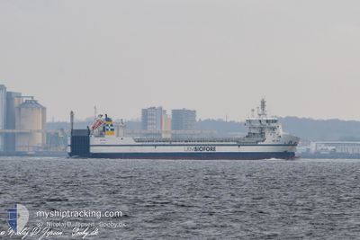
The vessel BORE WAVE (IMO: 9892896, MMSI: 246278000) is a Cargo It's sailing under the flag of [NL] Netherlands.
In this page you can find informations about the vessels current position, last detected port calls, and current voyage information. If the vessels is not in coverage by AIS you will find the latest position.
The current position of BORE WAVE is detected by our AIS receivers and we are not responsible for the reliability of the data. The last position was recorded while the vessel was in Coverage by the Ais receivers of our vessel tracking app.
The current draught of BORE WAVE as reported by AIS is 6.7 meters
Weather
| Temperature | 14°C / 57.2°F |
|---|---|
| Wind Speed | 10 knots |
| Direction | 275° W |
| Pressure | 1012.7 hPa |
| Humidity | 80.6 % |
| Cloud Coverage | --- |
Featured Company
Last Port Calls
| Port | Arrival | Departure | Time In Port |
|---|---|---|---|
| 2024-06-19 00:43 | 2024-06-20 07:21 | 1 d | |
| 2024-06-16 05:44 | 2024-06-17 13:09 | 1 d | |
| 2024-06-08 05:23 | 2024-06-08 09:19 | 3 h | |
| 2024-06-06 14:55 | 2024-06-07 11:19 | 20 h | |
| 2024-06-03 03:09 | 2024-06-03 16:01 | 12 h | |
| 2024-05-28 17:21 | 2024-05-30 02:26 | 1 d | |
| 2024-05-26 15:54 | 2024-05-27 11:08 | 19 h | |
| 2024-05-21 12:34 | 2024-05-22 10:58 | 22 h | |
| 2024-05-19 17:45 | 2024-05-20 20:49 | 1 d | |
| 2024-05-12 19:29 | 2024-05-14 19:17 | 1 d |
Last Trips
| Origin | Departure | Destination | Arrival | Distance | |
|---|---|---|---|---|---|
| 2024-06-17 16:09 | 2024-06-19 03:43 | 375.24 nm | |||
| 2024-06-08 11:19 | 2024-06-16 08:44 | 1919.41 nm | |||
| 2024-06-07 13:19 | 2024-06-08 07:23 | 223.48 nm | |||
| 2024-06-03 18:01 | 2024-06-06 16:55 | 814.60 nm | |||
| 2024-05-30 05:26 | 2024-06-03 05:09 | 1197.24 nm | |||
| 2024-05-27 14:08 | 2024-05-28 20:21 | 375.98 nm | |||
| 2024-05-22 12:58 | 2024-05-26 18:54 | 1148.63 nm | |||
| 2024-05-20 21:49 | 2024-05-21 14:34 | 188.28 nm | |||
| 2024-05-14 22:17 | 2024-05-19 18:45 | 1324.41 nm | |||
| 2024-05-09 01:41 | 2024-05-12 22:29 | 1188.00 nm |
Events
| Time | Event | Details | Position / Dest | Info |
|---|---|---|---|---|
| 2024-06-22 22:11 | Change Sea Area | Danish part of the North Sea Danish part of the Skaggerak |
57.21359 / 8.41409
North Sea
NLAMS
|
Speed: 12.5 kn Course: 236° |
| 2024-06-22 14:53 | Change Sea Area | Danish part of the Skaggerak Danish part of the Kattegat |
57.79735 / 10.92483
Skaggerak
NLAMS
|
Speed: 13.1 kn Course: 310.8° |
| 2024-06-22 13:56 | Change Sea Area | Danish part of the Kattegat Swedish part of the Kattegat |
57.64789 / 11.20573
Kattegat
NLAMS
|
Speed: 13.7 kn Course: 319° |
| 2024-06-22 05:02 | Change Sea Area | Swedish part of the Kattegat Danish part of the Kattegat |
55.82065 / 12.72685
Kattegat
NLAMS
|
Speed: 14.1 kn Course: 20.4° |
| 2024-06-22 03:32 | Change Sea Area | Danish part of the Kattegat Swedish part of the Kattegat |
55.48189 / 12.69934
Kattegat
NLAMS
|
Speed: 14 kn Course: 359.4° |
| 2024-06-22 02:53 | Change Sea Area | Swedish part of the Kattegat Swedish part of the Baltic Sea |
55.33509 / 12.66655
Kattegat
NLAMS
|
Speed: 12.7 kn Course: 7.4° |
| 2024-06-21 21:14 | Detected in Sea | Swedish part of the Baltic Sea |
55.47805 / 14.71159
Baltic Sea
NLAMS
|
Speed: 13.8 kn Course: 238.8° |
| 2024-06-21 19:47 | Change Sea Area | Danish part of the Kattegat Swedish part of the Baltic Sea |
55.64497 / 15.20988
Kattegat
NLAMS
|
Speed: 13.5 kn Course: 240° |
| 2024-06-21 12:29 | Status Changed | Under way using engine Default |
56.55056 / 17.70217
NLAMS
|
Speed: 13.8 kn Course: 233° |
| 2024-06-21 12:05 | Status Changed | Default Under way using engine |
56.60341 / 17.83231
NLAMS
|
Speed: 13.9 kn Course: 233.3° |