
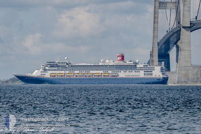
BOREALIS
Passengers Ship
Aktuelle Reise
| Bisherige Reisezeit | 2 Tage |
|---|---|
| Verbleibende Reisezeit | 1 Tag |
| Zurückgelegte Distanz | 744.31 nm |
| Verbleibende Distanz | 547.33 nm |
| Durchschnittliche Geschwindigkeit | 13.6 Knoten |
| Maximale Geschwindigkeit | 19.1 Knoten |
| Durchschnittliche Windgeschwindigkeit | 7.6 Knoten |
| Maximale Windgeschwindigkeit | 18.6 Knoten |
| Minimale Temperatur | 14.2°C / 57.56°F |
| Maximale Temperatur | 17.7°C / 63.86°F |
| Tiefgang | 8.4 m |
| Position erhalten | 10 h, 21 m alt |
Aktuelle Position
| Länge | --- |
|---|---|
| Breite | --- |
| Zustand | Under way using engine |
| Geschwindigkeit | 14.5 Knoten |
| Kurs | 210° |
| Gebiet | North Atlantic Ocean |
| Station | T-AIS |
| Position erhalten | 10 h, 21 m alt |
Schiffsdetails
Information
Die BOREALIS befindet sich derzeit in North Atlantic Ocean mit den Koordinaten 43.36697° / -10.05662°, Diese Position wurde am 2024-10-31 14:12 von unserer Schiffsverfolgungs-App über AIS erfasst. Das Schiff fährt momentan mit einer Geschwindigkeit von 14.5 Knoten und fahrt in den Hafen von CADIZ. Die geschatzte Ankunftszeit, berechnet von der -App zur Schiffsverfolgung, ist 2024-11-02 04:44 LT
Das Schiff BOREALIS (IMO: 9122552, MMSI: 311000987) ist Passengers Ship das wurde im Jahr 1997 ( 27 Jahre alt ) gebaut. und fährt unter der Flagge von [BS] Bahamas.
Auf dieser Seite erhalten Sie Informationen zur aktuellen Position des Schiffes, zu den letzten bekannten Hafenanläufen und zu den aktuellen Reiseinformationen. Sollte das Schiff nicht durch AIS abgedeckt sein, wird die zuletzt erfasste Position angezeigt.
Die BOREALIS wird durch unsere AIS-Empfänger ermittelt. Wir übernehmen keine Gewähr für die Richtigkeit der Daten. Die letzte Position wurde von unseren AIS-Empfängern aufgezeichnet, während das Schiff in Reichweite war.
Der aktuelle Entwurf von BOREALIS, wie von AIS gemeldet, betragt 8.4 meter
Wetter
| Temperatur | 17.6°C / 63.68°F |
|---|---|
| Windgeschwindigkeit | 15 Knoten |
| Windrichtung | 124° SE |
| Luftdruck | 1016.3 hPa |
| Luftfeuchtigkeit | 81.9 % |
| Wolken | 53 % |
Featured Company
Letzte Hafenanläufe
| Hafen | Ankunft | Abfahrt | Time In Port |
|---|---|---|---|
| 2024-10-29 05:34 | 2024-10-29 20:33 | 14 h | |
| 2024-10-23 09:53 | 2024-10-23 18:33 | 8 h | |
| 2024-10-21 09:50 | 2024-10-21 19:47 | 9 h | |
| 2024-10-19 10:50 | 2024-10-19 17:58 | 7 h | |
| 2024-10-17 12:51 | 2024-10-18 22:00 | 1 d | |
| 2024-10-16 07:53 | 2024-10-17 02:05 | 18 h | |
| 2024-10-15 11:15 | 2024-10-16 02:23 | 15 h | |
| 2024-10-07 06:11 | 2024-10-07 17:07 | 10 h | |
| 2024-10-03 04:23 | 2024-10-03 16:19 | 11 h | |
| 2024-09-26 06:11 | 2024-09-26 21:01 | 14 h |
Letzte Reisen
| Herkunft | Abfahrt | Ziel | Ankunft | Distanz | |
|---|---|---|---|---|---|
| 2024-10-23 16:03 | 2024-10-29 05:34 | 2102.30 nm | |||
| 2024-10-21 17:17 | 2024-10-23 07:23 | 524.47 nm | |||
| 2024-10-19 13:58 | 2024-10-21 07:20 | 554.42 nm | |||
| 2024-10-18 18:00 | 2024-10-19 06:50 | 162.58 nm | |||
| 2024-10-16 22:05 | 2024-10-17 08:51 | 126.50 nm | |||
| 2024-10-15 22:23 | 2024-10-16 03:53 | 60.48 nm | |||
| 2024-10-07 18:07 | 2024-10-15 07:15 | 2772.13 nm | |||
| 2024-10-03 17:19 | 2024-10-07 07:11 | 1365.68 nm | |||
| 2024-09-26 22:01 | 2024-10-03 05:23 | 1908.65 nm | |||
| 2024-09-24 20:07 | 2024-09-26 07:11 | 579.97 nm |
Events
| Zeit | Ereignis | Details | Position / Ziel | Information |
|---|---|---|---|---|
| 2024-10-31 14:30 | geänderter Status | Default Under way using engine |
43.30298 / -10.10313
ES CAD
|
Geschwindigkeit: 14.5 kn Kurs: 210° |
| 2024-10-31 14:12 | außerhalb Abdeckung |
43.36697 / -10.05662
North Atlantic Ocean
ES CAD
|
Geschwindigkeit: 14.5 kn Kurs: 210° |
|
| 2024-10-31 13:50 | geänderter Status | Under way using engine Default |
43.44301 / -9.99610
ES CAD
|
Geschwindigkeit: 14.5 kn Kurs: 211° |
| 2024-10-31 13:25 | geänderter Status | Default Under way using engine |
43.53215 / -9.92547
ES CAD
|
Geschwindigkeit: 14.2 kn Kurs: 205.5° |
| 2024-10-31 12:36 | geänderter Status | Under way using engine Default |
43.70480 / -9.80490
ES CAD
|
Geschwindigkeit: 14.4 kn Kurs: 207° |
| 2024-10-31 12:31 | geänderter Status | Default Under way using engine |
43.72224 / -9.79243
ES CAD
|
Geschwindigkeit: 14.6 kn Kurs: 207.6° |
| 2024-10-31 11:54 | Ändere Seegebiet | Spanish part of the North Atlantic Ocean French part of the North Atlantic Ocean |
43.85530 / -9.70083
North Atlantic Ocean
ES CAD
|
Geschwindigkeit: 14.7 kn Kurs: 203.6° |
| 2024-10-31 11:54 | geänderter Status | Under way using engine Default |
43.85530 / -9.70083
ES CAD
|
Geschwindigkeit: 14.6 kn Kurs: 204° |
| 2024-10-31 11:41 | in Abdeckung |
43.85530 / -9.70083
North Atlantic Ocean
ES CAD
|
Geschwindigkeit: 14.7 kn Kurs: 203.6° |
|
| 2024-10-31 00:35 | außerhalb Abdeckung |
46.28960 / -7.83193
North Atlantic Ocean
ES CAD
|
Geschwindigkeit: 14.2 kn Kurs: 211.1° |