
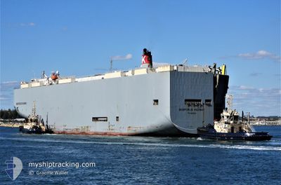
BOSPORUS HIGHWAY
Vehicles Carrier
Current Trip
| Time Travelled | 10 days |
|---|---|
| Remaining Time | --- |
| Distance Travelled | 4651.69 nm |
| Remaining Distance | --- |
| AVG Speed | 17.7 Knots |
| MAX Speed | 20.8 Knots |
| AVG Wind | 13.5 knots |
| MAX Wind | 25 knots |
| MIN Temp | 7.8°C / 46.04°F |
| MAX Temp | 22.2°C / 71.96°F |
| Draught | 9.3 m |
| Position Received | 8 d ago |
Current Position
| Longitude | 141.42453° |
|---|---|
| Latitude | 35.44292° |
| Status | Under way using engine |
| Speed | 19.9 Knots |
| Course | 63° |
| Area | North Pacific Ocean |
| Station | T-AIS |
| Position Received | 8 d ago |
Info
Information
The current position of BOSPORUS HIGHWAY is in North Pacific Ocean with coordinates 35.44292° / 141.42453° as reported on 2024-05-24 16:25 by AIS to our vessel tracker app. The vessel's current speed is 19.9 Knots and is heading at the port of LAZARO CARDENAS. The estimated time of arrival as calculated by vessel tracking app is 2024-06-07 21:00 LT
The vessel BOSPORUS HIGHWAY (IMO: 9519107, MMSI: 372981000) is a Vehicles Carrier that was built in 2009 ( 15 years old ). It's sailing under the flag of [PA] Panama.
In this page you can find informations about the vessels current position, last detected port calls, and current voyage information. If the vessels is not in coverage by AIS you will find the latest position.
The current position of BOSPORUS HIGHWAY is detected by our AIS receivers and we are not responsible for the reliability of the data. The last position was recorded while the vessel was in Coverage by the Ais receivers of our vessel tracking app.
The current draught of BOSPORUS HIGHWAY as reported by AIS is 9.3 meters
Weather
| Temperature | 17.6°C / 63.68°F |
|---|---|
| Wind Speed | 18 knots |
| Direction | 252° WSW |
| Pressure | 1023.4 hPa |
| Humidity | 92.7 % |
| Cloud Coverage | 100 % |
Featured Company
Most Visited Ports (Last year)
| Port | Arrivals | |
|---|---|---|
| 12 | ||
| 7 | ||
| 7 | ||
| 5 | ||
| 4 | ||
| 4 |
Last Trips
Events
| Time | Event | Details | Position / Dest | Info |
|---|---|---|---|---|
| 2024-05-24 16:25 | Status Changed | Default Under way using engine |
35.44318 / 141.42513
MX LZC
|
Speed: 19.9 kn Course: 63° |
| 2024-05-24 16:25 | OUT of Coverage |
35.44292 / 141.42453
North Pacific Ocean
MX LZC
|
Speed: 19.9 kn Course: 63° |
|
| 2024-05-24 11:26 | Change Sea Area | Japanese part of the North Pacific Ocean Japanese part of the Philippine Sea |
34.68248 / 139.63985
North Pacific Ocean
MX LZC
|
Speed: 18.4 kn Course: 58° |
| 2024-05-24 10:41 | Status Changed | Under way using engine Default |
34.59505 / 139.37685
MX LZC
|
Speed: 18.8 kn Course: 60° |
| 2024-05-24 10:36 | Status Changed | Default Under way using engine |
34.57922 / 139.34697
MX LZC
|
Speed: 19.3 kn Course: 75° |
| 2024-05-24 10:19 | Status Changed | Under way using engine Default |
34.55590 / 139.24162
MX LZC
|
Speed: 19.2 kn Course: 64° |
| 2024-05-24 10:16 | Status Changed | Default Under way using engine |
34.55253 / 139.22669
MX LZC
|
Speed: 19.3 kn Course: 68° |
| 2024-05-24 10:13 | Status Changed | Under way using engine Default |
34.54498 / 139.20740
MX LZC
|
Speed: 19.6 kn Course: 59° |
| 2024-05-24 09:57 | IN Coverage |
34.54498 / 139.20740
Philippine Sea
MX LZC
|
Speed: 19.3 kn Course: 68° |
|
| 2024-05-24 06:23 | OUT of Coverage |
33.99447 / 137.92207
Philippine Sea
MX LZC
|
Speed: 18.8 kn Course: 62° |