
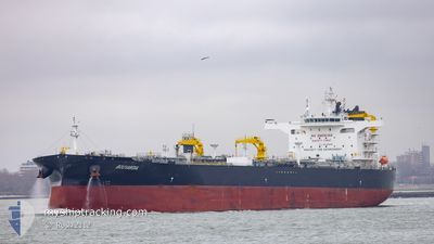
BOUVARDIA
Tanker
Current Trip
| Time Travelled | 7 days |
|---|---|
| Remaining Time | 5 days |
| Distance Travelled | 2164.32 nm |
| Remaining Distance | 1618.77 nm |
| AVG Speed | 12.3 Knots |
| MAX Speed | 14.4 Knots |
| AVG Wind | 9.1 knots |
| MAX Wind | 22 knots |
| MIN Temp | 26.3°C / 79.34°F |
| MAX Temp | 30.7°C / 87.26°F |
| Draught | 14.3 m |
| Position Received | 9 h, 5 m ago |
Current Position
| Longitude | 77.23760° |
|---|---|
| Latitude | 7.48393° |
| Status | Under way using engine |
| Speed | 12.2 Knots |
| Course | 115.4° |
| Area | Laccadive Sea |
| Station | T-AIS |
| Position Received | 9 h, 5 m ago |
Info
Information
The current position of BOUVARDIA is in Laccadive Sea with coordinates 7.48393° / 77.23760° as reported on 2024-05-18 12:41 by AIS to our vessel tracker app. The vessel's current speed is 12.2 Knots and is heading at the port of SINGAPORE. The estimated time of arrival as calculated by vessel tracking app is 2024-05-24 10:42 LT
The vessel BOUVARDIA (IMO: 9935595, MMSI: 636021772) is a Tanker It's sailing under the flag of [LR] Liberia.
In this page you can find informations about the vessels current position, last detected port calls, and current voyage information. If the vessels is not in coverage by AIS you will find the latest position.
The current position of BOUVARDIA is detected by our AIS receivers and we are not responsible for the reliability of the data. The last position was recorded while the vessel was in Coverage by the Ais receivers of our vessel tracking app.
The current draught of BOUVARDIA as reported by AIS is 14.3 meters
Weather
| Temperature | 29°C / 84.2°F |
|---|---|
| Wind Speed | 20 knots |
| Direction | 262° W |
| Pressure | 1004.7 hPa |
| Humidity | 78 % |
| Cloud Coverage | 100 % |
Featured Company
Last Port Calls
| Port | Arrival | Departure | Time In Port |
|---|---|---|---|
| 2024-05-10 02:11 | 2024-05-11 17:58 | 1 d | |
| 2024-04-13 22:46 | 2024-04-15 08:42 | 1 d | |
| 2024-03-28 10:44 | 2024-03-30 16:04 | 2 d | |
| 2024-03-21 10:24 | 2024-03-23 12:32 | 2 d | |
| 2024-03-09 05:34 | 2024-03-09 14:26 | 8 h |
Most Visited Ports (Last year)
| Port | Arrivals | |
|---|---|---|
| 6 | ||
| 4 | ||
| 2 | ||
| 1 | ||
| 1 | ||
| 1 |
Last Trips
| Origin | Departure | Destination | Arrival | Distance | |
|---|---|---|---|---|---|
| 2024-04-15 15:42 | 2024-05-10 05:11 | 4593.80 nm | |||
| 2024-03-30 19:04 | 2024-04-14 05:46 | 4438.06 nm | |||
| 2024-03-23 16:32 | 2024-03-28 13:44 | 608.72 nm | |||
| 2024-02-19 13:03 | 2024-03-21 14:24 | 6802.12 nm | |||
| 2024-02-19 13:03 | 2024-03-09 07:34 | 3849.94 nm |
Events
| Time | Event | Details | Position / Dest | Info |
|---|---|---|---|---|
| 2024-05-18 12:48 | Status Changed | Default Under way using engine |
7.47333 / 77.25667
SG PWBGA
|
Speed: 12.2 kn Course: 115.4° |
| 2024-05-18 12:41 | OUT of Coverage |
7.48393 / 77.23760
Laccadive Sea
SG PWBGA
|
Speed: 12.2 kn Course: 115.4° |
|
| 2024-05-18 10:10 | Destination Changed | SG PWBGA MALTA FOR ORDERS |
7.76670 / 76.78557
SG PWBGA
|
Speed: 12.6 kn Course: 119.9° |
| 2024-05-18 10:10 | ETA Changed | 2024/05/24 11:00 2024/05/22 17:00 |
7.76670 / 76.78557
SG PWBGA
|
Speed: 12.6 kn Course: 119.9° |
| 2024-05-18 09:49 | Status Changed | Under way using engine Default |
7.80586 / 76.72033
MALTA FOR ORDERS
|
Speed: 12 kn Course: 122° |
| 2024-05-18 09:24 | Status Changed | Default Under way using engine |
7.85333 / 76.64333
MALTA FOR ORDERS
|
Speed: 12.8 kn Course: 121.3° |
| 2024-05-18 09:10 | Status Changed | Under way using engine Default |
7.88042 / 76.60033
MALTA FOR ORDERS
|
Speed: 12 kn Course: 121° |
| 2024-05-18 08:42 | Status Changed | Default Under way using engine |
7.93333 / 76.51334
MALTA FOR ORDERS
|
Speed: 12.9 kn Course: 121.6° |
| 2024-05-18 08:40 | Status Changed | Under way using engine Default |
7.93722 / 76.50910
MALTA FOR ORDERS
|
Speed: 12 kn Course: 122° |
| 2024-05-18 08:40 | Change Sea Area | Indian part of the Laccadive Sea Iranian part of the Gulf of Oman |
7.93722 / 76.50910
Laccadive Sea
MALTA FOR ORDERS
|
Speed: 12.9 kn Course: 121.6° |