
BOUZAS
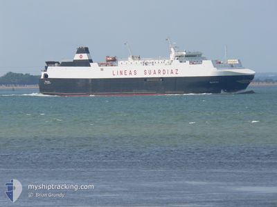
Vehicles Carrier
Current Trip
| Time Travelled | 1 day |
|---|---|
| Remaining Time | 52 mins |
| Distance Travelled | 468.54 nm |
| Remaining Distance | 17.02 nm |
| AVG Speed | 17.7 Knots |
| MAX Speed | 18.9 Knots |
| AVG Wind | 18.7 knots |
| MAX Wind | 29 knots |
| MIN Temp | 15.6°C / 60.08°F |
| MAX Temp | 18°C / 64.4°F |
| Draught | 5.8 m |
| Position Received | 1 m ago |
Current Position
| Longitude | -2.43012° |
|---|---|
| Latitude | 47.07329° |
| Status | Under way using engine |
| Speed | 17.4 Knots |
| Course | 58.4° |
| Area | Bay of Biscay |
| Station | T-AIS |
| Position Received | 1 m ago |
Info
Information
The current position of BOUZAS is in Bay of Biscay with coordinates 47.07329° / -2.43012° as reported on 2024-06-29 02:29 by AIS to our vessel tracker app. The vessel's current speed is 17.4 Knots and is heading at the port of ST NAZAIRE. The estimated time of arrival as calculated by vessel tracking app is 2024-06-29 03:22 LT
The vessel BOUZAS (IMO: 9249996, MMSI: 224029000) is a Vehicles Carrier that was built in 2002 ( 22 years old ). It's sailing under the flag of [ES] Spain.
In this page you can find informations about the vessels current position, last detected port calls, and current voyage information. If the vessels is not in coverage by AIS you will find the latest position.
The current position of BOUZAS is detected by our AIS receivers and we are not responsible for the reliability of the data. The last position was recorded while the vessel was in Coverage by the Ais receivers of our vessel tracking app.
The current draught of BOUZAS as reported by AIS is 5.8 meters
Weather
| Temperature | 15.8°C / 60.44°F |
|---|---|
| Wind Speed | 15 knots |
| Direction | 40° NE |
| Pressure | 1015.3 hPa |
| Humidity | 75.3 % |
| Cloud Coverage | 100 % |
Featured Company
Last Port Calls
| Port | Arrival | Departure | Time In Port |
|---|---|---|---|
| 2024-06-27 08:44 | 2024-06-27 23:59 | 15 h | |
| 2024-06-25 20:24 | 2024-06-26 03:32 | 7 h | |
| 2024-06-24 00:21 | 2024-06-24 16:07 | 15 h | |
| 2024-06-21 22:13 | 2024-06-22 17:46 | 19 h | |
| 2024-06-20 09:12 | 2024-06-20 17:46 | 8 h | |
| 2024-06-18 18:55 | 2024-06-19 03:54 | 8 h | |
| 2024-06-17 03:49 | 2024-06-17 16:08 | 12 h | |
| 2024-06-14 23:34 | 2024-06-15 19:23 | 19 h | |
| 2024-06-13 09:26 | 2024-06-13 18:41 | 9 h | |
| 2024-06-11 17:27 | 2024-06-12 04:31 | 11 h |
Last Trips
| Origin | Departure | Destination | Arrival | Distance | |
|---|---|---|---|---|---|
| 2024-06-26 05:32 | 2024-06-27 10:44 | 511.82 nm | |||
| 2024-06-24 18:07 | 2024-06-25 22:24 | 486.61 nm | |||
| 2024-06-22 19:46 | 2024-06-24 02:21 | 525.23 nm | |||
| 2024-06-20 19:46 | 2024-06-22 00:13 | 485.74 nm | |||
| 2024-06-19 05:54 | 2024-06-20 11:12 | 516.59 nm | |||
| 2024-06-17 18:08 | 2024-06-18 20:55 | 486.96 nm | |||
| 2024-06-15 21:23 | 2024-06-17 05:49 | 517.05 nm | |||
| 2024-06-13 20:41 | 2024-06-15 01:34 | 487.25 nm | |||
| 2024-06-12 06:31 | 2024-06-13 11:26 | 511.02 nm | |||
| 2024-06-10 14:17 | 2024-06-11 19:27 | 487.32 nm |
Events
| Time | Event | Details | Position / Dest | Info |
|---|---|---|---|---|
| 2024-06-29 02:13 | ETA Changed | 2024/06/29 04:45 2024/06/29 05:00 |
47.03563 / -2.53410
FR SNR
|
Speed: 16.8 kn Course: 61.5° |
| 2024-06-29 00:02 | Detected in Sea | French part of the Bay of Biscay |
46.67439 / -3.28430
Bay of Biscay
FR SNR
|
Speed: 18 kn Course: 53.1° |
| 2024-06-29 00:02 | Status Changed | Under way using engine Default |
46.67283 / -3.28737
FR SNR
|
Speed: 17.8 kn Course: 54° |
| 2024-06-29 00:02 | IN Coverage |
46.67439 / -3.28430
Bay of Biscay
FR SNR
|
Speed: 18 kn Course: 53.1° |
|
| 2024-06-28 08:32 | Status Changed | Default Under way using engine |
43.98194 / -8.63045
FR SNR
|
Speed: 17.6 kn Course: 46.8° |
| 2024-06-28 08:17 | OUT of Coverage |
43.93468 / -8.70418
North Atlantic Ocean
FR SNR
|
Speed: 17.6 kn Course: 46.8° |
|
| 2024-06-28 06:55 | ETA Changed | 2024/06/29 05:00 2024/06/29 04:30 |
43.66766 / -9.12244
FR SNR
|
Speed: 17.2 kn Course: 49.4° |
| 2024-06-28 06:01 | Status Changed | Under way using engine Default |
43.50106 / -9.38712
FR SNR
|
Speed: 17.3 kn Course: 55° |
| 2024-06-28 05:33 | Status Changed | Default Under way using engine |
43.42198 / -9.54080
FR SNR
|
Speed: 17.5 kn Course: 53.1° |
| 2024-06-28 05:21 | Status Changed | Under way using engine Default |
43.38596 / -9.60468
FR SNR
|
Speed: 17 kn Course: 49° |