
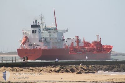
BOW FAGUS
Oil/Chemical Tanker
Current Trip
| Time Travelled | 6 days |
|---|---|
| Remaining Time | --- |
| Distance Travelled | 1989.87 nm |
| Remaining Distance | --- |
| AVG Speed | 13.8 Knots |
| MAX Speed | 16 Knots |
| AVG Wind | 10.4 knots |
| MAX Wind | 32.4 knots |
| MIN Temp | 23.2°C / 73.76°F |
| MAX Temp | 28.8°C / 83.84°F |
| Draught | 11 m |
| Position Received | 3 d ago |
Current Position
| Longitude | -79.30948° |
|---|---|
| Latitude | 26.27587° |
| Status | Under way using engine |
| Speed | 14 Knots |
| Course | 89.8° |
| Area | North Atlantic Ocean |
| Station | T-AIS |
| Position Received | 3 d ago |
Info
Information
The current position of BOW FAGUS is in North Atlantic Ocean with coordinates 26.27587° / -79.30948° as reported on 2024-06-24 16:32 by AIS to our vessel tracker app. The vessel's current speed is 14 Knots and is heading at the port of ROTTERDAM. The estimated time of arrival as calculated by vessel tracking app is 2024-07-07 15:00 LT
The vessel BOW FAGUS (IMO: 9047764, MMSI: 538009685) is a Oil/Chemical Tanker that was built in 1995 ( 29 years old ). It's sailing under the flag of [MH] Marshall Is.
In this page you can find informations about the vessels current position, last detected port calls, and current voyage information. If the vessels is not in coverage by AIS you will find the latest position.
The current position of BOW FAGUS is detected by our AIS receivers and we are not responsible for the reliability of the data. The last position was recorded while the vessel was in Coverage by the Ais receivers of our vessel tracking app.
The current draught of BOW FAGUS as reported by AIS is 11 meters
Weather
| Temperature | 24°C / 75.2°F |
|---|---|
| Wind Speed | 28 knots |
| Direction | 193° SSW |
| Pressure | 1014.4 hPa |
| Humidity | 90.2 % |
| Cloud Coverage | 100 % |
Featured Company
Last Port Calls
| Port | Arrival | Departure | Time In Port |
|---|---|---|---|
| 2024-06-22 05:06 | 2024-06-22 07:03 | 1 h | |
| 2024-06-14 01:26 | 2024-06-20 01:23 | 5 d | |
| 2024-06-10 19:39 | 2024-06-12 12:50 | 1 d | |
| 2024-06-05 08:29 | 2024-06-06 20:50 | 1 d | |
| 2024-05-11 08:41 | 2024-05-18 10:06 | 7 d | |
| 2024-04-30 03:33 | 2024-04-30 12:32 | 8 h | |
| 2024-04-25 03:23 | 2024-04-28 01:59 | 2 d | |
| 2024-04-22 22:05 | 2024-04-23 11:48 | 13 h | |
| 2024-04-09 20:46 | 2024-04-11 23:01 | 2 d |
Most Visited Ports (Last year)
| Port | Arrivals | |
|---|---|---|
| 5 | ||
| 4 | ||
| 3 | ||
| 3 | ||
| 3 | ||
| 3 |
Last Trips
| Origin | Departure | Destination | Arrival | Distance | |
|---|---|---|---|---|---|
| 2024-06-19 20:23 | 2024-06-22 00:06 | 134.20 nm | |||
| 2024-06-12 07:50 | 2024-06-13 20:26 | 445.70 nm | |||
| 2024-06-06 15:50 | 2024-06-10 14:39 | 81.55 nm | |||
| 2024-05-18 12:06 | 2024-06-05 03:29 | 5271.97 nm | |||
| 2024-04-28 04:59 | 2024-05-11 10:41 | 3946.17 nm | |||
| 2024-04-28 04:59 | 2024-04-30 05:33 | 516.04 nm | |||
| 2024-04-12 01:01 | 2024-04-25 06:23 | 3962.40 nm | |||
| 2024-04-12 01:01 | 2024-04-23 00:05 | 3364.76 nm | |||
| 2024-03-30 02:05 | 2024-04-09 22:46 | 3324.63 nm |
Events
| Time | Event | Details | Position / Dest | Info |
|---|---|---|---|---|
| 2024-06-24 16:40 | Status Changed | Default Under way using engine |
26.27486 / -79.27729
ROTTERDAM
|
Speed: 14 kn Course: 89.8° |
| 2024-06-24 16:32 | OUT of Coverage |
26.27587 / -79.30948
North Atlantic Ocean
ROTTERDAM
|
Speed: 14 kn Course: 89.8° |
|
| 2024-06-24 13:29 | Change Sea Area | Bahamas part of the North Atlantic Ocean United States part of the North Atlantic Ocean |
25.57326 / -79.70146
North Atlantic Ocean
ROTTERDAM
|
Speed: 15.8 kn Course: 22.9° |
| 2024-06-24 12:04 | Status Changed | Under way using engine Default |
25.23815 / -79.86969
ROTTERDAM
|
Speed: 15.3 kn Course: 36° |
| 2024-06-24 12:04 | IN Coverage |
25.23913 / -79.86894
North Atlantic Ocean
ROTTERDAM
|
Speed: 15.3 kn Course: 34.8° |
|
| 2024-06-24 11:15 | Status Changed | Default Under way using engine |
25.07147 / -80.00060
ROTTERDAM
|
Speed: 14.8 kn Course: 36.5° |
| 2024-06-24 10:57 | OUT of Coverage |
25.00948 / -80.05071
North Atlantic Ocean
ROTTERDAM
|
Speed: 14.8 kn Course: 36.5° |
|
| 2024-06-24 08:29 | Destination Changed | ROTTERDAM SW PASS |
24.62516 / -80.53885
ROTTERDAM
|
Speed: 14.3 kn Course: 56.8° |
| 2024-06-24 08:29 | ETA Changed | 2024/07/07 15:00 2024/06/22 11:00 |
24.62516 / -80.53885
ROTTERDAM
|
Speed: 14.3 kn Course: 56.8° |
| 2024-06-24 08:18 | Status Changed | Under way using engine Default |
24.60114 / -80.57917
SW PASS
|
Speed: 14.4 kn Course: 57° |