
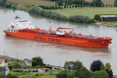
BOW HARMONY
Oil/Chemical Tanker
Current Trip
| Time Travelled | 1 day |
|---|---|
| Remaining Time | 13 h, 52 mins |
| Distance Travelled | 504.81 nm |
| Remaining Distance | 292.37 nm |
| AVG Speed | 12.6 Knots |
| MAX Speed | 16.3 Knots |
| AVG Wind | 11.7 knots |
| MAX Wind | 18 knots |
| MIN Temp | 12°C / 53.6°F |
| MAX Temp | 20.7°C / 69.26°F |
| Draught | 7.1 m |
| Position Received | 12 h, 58 m ago |
Current Position
| Longitude | -5.33603° |
|---|---|
| Latitude | 49.08652° |
| Status | Under way using engine |
| Speed | 13.6 Knots |
| Course | 239° |
| Area | Celtic Sea |
| Station | T-AIS |
| Position Received | 12 h, 58 m ago |
Info
Information
The current position of BOW HARMONY is in Celtic Sea with coordinates 49.08652° / -5.33603° as reported on 2024-05-15 21:14 by AIS to our vessel tracker app. The vessel's current speed is 13.6 Knots and is heading at the port of BILBAO. The estimated time of arrival as calculated by vessel tracking app is 2024-05-17 00:05 LT
The vessel BOW HARMONY (IMO: 9379909, MMSI: 257441000) is a Oil/Chemical Tanker that was built in 2008 ( 16 years old ). It's sailing under the flag of [NO] Norway.
In this page you can find informations about the vessels current position, last detected port calls, and current voyage information. If the vessels is not in coverage by AIS you will find the latest position.
The current position of BOW HARMONY is detected by our AIS receivers and we are not responsible for the reliability of the data. The last position was recorded while the vessel was in Coverage by the Ais receivers of our vessel tracking app.
The current draught of BOW HARMONY as reported by AIS is 7.1 meters
Weather
| Temperature | 13.2°C / 55.76°F |
|---|---|
| Wind Speed | 14 knots |
| Direction | 149° SSE |
| Pressure | 999.6 hPa |
| Humidity | 86.6 % |
| Cloud Coverage | 94 % |
Featured Company
Last Port Calls
| Port | Arrival | Departure | Time In Port |
|---|---|---|---|
| 2024-05-09 18:40 | 2024-05-14 14:18 | 4 d | |
| 2024-05-03 19:40 | 2024-05-08 00:09 | 4 d | |
| 2024-04-28 14:58 | 2024-05-01 12:40 | 2 d | |
| 2024-04-21 14:14 | 2024-04-22 17:46 | 1 d | |
| 2024-04-06 01:39 | 2024-04-08 09:54 | 2 d | |
| 2024-03-26 00:32 | 2024-03-26 01:19 | 47 m | |
| 2024-03-14 20:36 | 2024-03-15 23:27 | 1 d | |
| 2024-03-03 04:50 |
Last Trips
| Origin | Departure | Destination | Arrival | Distance | |
|---|---|---|---|---|---|
| 2024-05-08 02:09 | 2024-05-09 20:40 | 305.85 nm | |||
| 2024-05-01 14:40 | 2024-05-03 21:40 | 79.89 nm | |||
| 2024-04-22 19:46 | 2024-04-28 16:58 | 1920.51 nm | |||
| 2024-04-08 06:54 | 2024-04-21 16:14 | 4050.32 nm | |||
| 2024-03-25 22:19 | 2024-04-05 22:39 | 2158.42 nm | |||
| 2024-03-15 20:27 | 2024-03-25 21:32 | 173.06 nm | |||
| 2024-02-18 11:27 | 2024-03-03 01:50 | 3604.26 nm |
Events
| Time | Event | Details | Position / Dest | Info |
|---|---|---|---|---|
| 2024-05-15 21:17 | Status Changed | Default Under way using engine |
49.08168 / -5.34840
ES BIO
|
Speed: 13.6 kn Course: 239° |
| 2024-05-15 21:14 | Detected in Sea | French part of the Celtic Sea |
49.08652 / -5.33603
Celtic Sea
ES BIO
|
Speed: 13.6 kn Course: 239° |
| 2024-05-15 21:14 | OUT of Coverage |
49.08652 / -5.33603
Celtic Sea
ES BIO
|
Speed: 13.6 kn Course: 239° |
|
| 2024-05-15 21:14 | Status Changed | Under way using engine Default |
49.08678 / -5.33537
ES BIO
|
Speed: 13.4 kn Course: 239° |
| 2024-05-15 21:14 | IN Coverage |
49.08652 / -5.33603
Celtic Sea
ES BIO
|
Speed: 13.6 kn Course: 239° |
|
| 2024-05-15 20:16 | Status Changed | Default Under way using engine |
49.19553 / -5.05578
ES BIO
|
Speed: 13.3 kn Course: 237° |
| 2024-05-15 20:08 | Detected in Sea | French part of the English Channel |
49.21035 / -5.01885
English Channel
ES BIO
|
Speed: 13.3 kn Course: 237° |
| 2024-05-15 20:08 | Status Changed | Under way using engine Default |
49.21035 / -5.01885
ES BIO
|
Speed: 12.4 kn Course: 236° |
| 2024-05-15 20:08 | OUT of Coverage |
49.21035 / -5.01885
English Channel
ES BIO
|
Speed: 13.3 kn Course: 237° |
|
| 2024-05-15 20:04 | IN Coverage |
49.21035 / -5.01885
English Channel
ES BIO
|
Speed: 13.3 kn Course: 237° |