
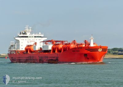
BOW SAGA
Oil/Chemical Tanker
Current Trip
| Time Travelled | 21 days |
|---|---|
| Remaining Time | 16 days |
| Distance Travelled | 4921.17 nm |
| Remaining Distance | 5068.72 nm |
| AVG Speed | 12.4 Knots |
| MAX Speed | 15.9 Knots |
| AVG Wind | 12.2 knots |
| MAX Wind | 24.9 knots |
| MIN Temp | 18°C / 64.4°F |
| MAX Temp | 33°C / 91.4°F |
| Draught | 11.9 m |
| Position Received | 6 h, 12 m ago |
Current Position
| Longitude | -123.32706° |
|---|---|
| Latitude | 26.29481° |
| Status | Under way using engine |
| Speed | 13.2 Knots |
| Course | 295.2° |
| Area | North Pacific Ocean |
| Station | T-AIS |
| Position Received | 6 h, 12 m ago |
Info
Information
The current position of BOW SAGA is in North Pacific Ocean with coordinates 26.29481° / -123.32706° as reported on 2024-06-20 06:50 by AIS to our vessel tracker app. The vessel's current speed is 13.2 Knots and is heading at the port of YOKOHAMA. The estimated time of arrival as calculated by vessel tracking app is 2024-07-06 14:40 LT
The vessel BOW SAGA (IMO: 9215309, MMSI: 258960000) is a Oil/Chemical Tanker that was built in 2007 ( 17 years old ). It's sailing under the flag of [NO] Norway.
In this page you can find informations about the vessels current position, last detected port calls, and current voyage information. If the vessels is not in coverage by AIS you will find the latest position.
The current position of BOW SAGA is detected by our AIS receivers and we are not responsible for the reliability of the data. The last position was recorded while the vessel was in Coverage by the Ais receivers of our vessel tracking app.
The current draught of BOW SAGA as reported by AIS is 11.9 meters
Weather
| Temperature | 18.7°C / 65.66°F |
|---|---|
| Wind Speed | 8 knots |
| Direction | 1° N |
| Pressure | 1015.5 hPa |
| Humidity | 73.5 % |
| Cloud Coverage | --- |
Featured Company
Last Port Calls
| Port | Arrival | Departure | Time In Port |
|---|---|---|---|
| 2024-05-27 22:16 | 2024-05-30 09:05 | 2 d | |
| 2024-05-26 08:12 | 2024-05-27 03:47 | 19 h | |
| 2024-05-17 04:01 | 2024-05-24 00:02 | 6 d | |
| 2024-05-07 12:58 | 2024-05-09 14:51 | 2 d | |
| 2024-04-23 08:15 | 2024-04-25 07:28 | 1 d | |
| 2024-04-16 06:51 | 2024-04-16 16:35 | 9 h | |
| 2024-04-11 05:01 | 2024-04-13 12:25 | 2 d | |
| 2024-04-05 03:41 | 2024-04-05 12:32 | 8 h |
Most Visited Ports (Last year)
| Port | Arrivals | |
|---|---|---|
| 14 | ||
| 7 | ||
| 5 | ||
| 3 | ||
| 2 | ||
| 2 |
Last Trips
| Origin | Departure | Destination | Arrival | Distance | |
|---|---|---|---|---|---|
| 2024-05-26 22:47 | 2024-05-27 17:16 | 146.75 nm | |||
| 2024-05-23 19:02 | 2024-05-26 03:12 | 76.74 nm | |||
| 2024-05-09 10:51 | 2024-05-16 23:01 | 1525.63 nm | |||
| 2024-04-25 09:28 | 2024-05-07 08:58 | 3715.31 nm | |||
| 2024-04-13 15:25 | 2024-04-23 10:15 | 2651.38 nm | |||
| 2024-04-13 15:25 | 2024-04-16 08:51 | 590.87 nm | |||
| 2024-03-24 20:58 | 2024-04-11 08:01 | 4574.91 nm | |||
| 2024-03-24 20:58 | 2024-04-05 05:41 | 3695.71 nm |
Events
| Time | Event | Details | Position / Dest | Info |
|---|---|---|---|---|
| 2024-06-20 06:55 | Status Changed | Default Under way using engine |
26.30267 / -123.34609
JPYOK 00 00
|
Speed: 13.2 kn Course: 295.2° |
| 2024-06-20 06:50 | OUT of Coverage |
26.29481 / -123.32706
North Pacific Ocean
JPYOK 00 00
|
Speed: 13.2 kn Course: 295.2° |
|
| 2024-06-20 05:15 | Status Changed | Under way using engine Default |
26.14901 / -122.97787
JPYOK 00 00
|
Speed: 13.2 kn Course: 295° |
| 2024-06-20 04:57 | Status Changed | Default Under way using engine |
26.12114 / -122.91088
JPYOK 00 00
|
Speed: 13.3 kn Course: 294.2° |
| 2024-06-20 04:34 | Status Changed | Under way using engine Default |
26.08502 / -122.82426
JPYOK 00 00
|
Speed: 13.2 kn Course: 295° |
| 2024-06-20 04:08 | Status Changed | Default Under way using engine |
26.04464 / -122.72743
JPYOK 00 00
|
Speed: 13.2 kn Course: 294.8° |
| 2024-06-20 00:33 | Status Changed | Under way using engine Default |
25.72000 / -121.94776
JPYOK 00 00
|
Speed: 13.1 kn Course: 294° |
| 2024-06-20 00:27 | Status Changed | Default Under way using engine |
25.71156 / -121.92648
JPYOK 00 00
|
Speed: 13 kn Course: 293.9° |
| 2024-06-20 00:08 | Status Changed | Under way using engine Default |
25.68349 / -121.85641
JPYOK 00 00
|
Speed: 12.8 kn Course: 294° |
| 2024-06-20 00:03 | Status Changed | Default Under way using engine |
25.67664 / -121.83952
JPYOK 00 00
|
Speed: 12.8 kn Course: 293.7° |