
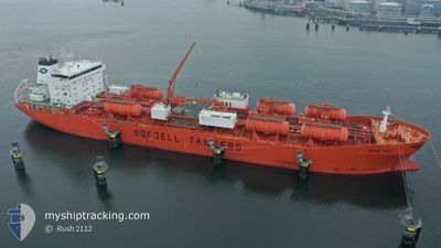
BOW SKY
Oil/Chemical Tanker
Current Trip
| Time Travelled | 7 days |
|---|---|
| Remaining Time | 20 h, 2 mins |
| Distance Travelled | 1006.47 nm |
| Remaining Distance | 285.15 nm |
| AVG Speed | 12.1 Knots |
| MAX Speed | 15.5 Knots |
| AVG Wind | 9.3 knots |
| MAX Wind | 26.9 knots |
| MIN Temp | 13°C / 55.4°F |
| MAX Temp | 32.1°C / 89.78°F |
| Draught | 9 m |
| Position Received | 6 d ago |
Current Position
| Longitude | 128.94730° |
|---|---|
| Latitude | 34.52745° |
| Status | Under way using engine |
| Speed | 14.3 Knots |
| Course | 243.8° |
| Area | Japan Sea |
| Station | T-AIS |
| Position Received | 6 d ago |
Info
Information
The current position of BOW SKY is in Japan Sea with coordinates 34.52745° / 128.94730° as reported on 2024-05-13 07:38 by AIS to our vessel tracker app. The vessel's current speed is 14.3 Knots and is heading at the port of TAICANG. The estimated time of arrival as calculated by vessel tracking app is 2024-05-21 03:10 LT
The vessel BOW SKY (IMO: 9215268, MMSI: 259787000) is a Oil/Chemical Tanker that was built in 2005 ( 19 years old ). It's sailing under the flag of [NO] Norway.
In this page you can find informations about the vessels current position, last detected port calls, and current voyage information. If the vessels is not in coverage by AIS you will find the latest position.
The current position of BOW SKY is detected by our AIS receivers and we are not responsible for the reliability of the data. The last position was recorded while the vessel was in Coverage by the Ais receivers of our vessel tracking app.
The current draught of BOW SKY as reported by AIS is 9 meters
Weather
| Temperature | 20.6°C / 69.08°F |
|---|---|
| Wind Speed | 1 knots |
| Direction | 154° SSE |
| Pressure | 1015.7 hPa |
| Humidity | 73.6 % |
| Cloud Coverage | 100 % |
Featured Company
Last Port Calls
| Port | Arrival | Departure | Time In Port |
|---|---|---|---|
| 2024-05-12 01:13 | 2024-05-13 02:44 | 1 d | |
| 2024-05-11 07:14 | 2024-05-12 00:00 | 16 h | |
| 2024-05-10 07:19 | 2024-05-11 06:11 | 22 h | |
| 2024-05-09 09:45 | 2024-05-10 07:06 | 21 h | |
| 2024-04-01 20:20 | 2024-04-02 22:15 | 1 d | |
| 2024-03-29 00:04 | 2024-04-01 14:54 | 3 d | |
| 2024-03-22 07:20 | 2024-03-23 18:39 | 1 d | |
| 2024-03-20 02:02 | 2024-03-22 01:07 | 1 d | |
| 2024-03-17 08:27 | 2024-03-18 16:08 | 1 d | |
| 2024-03-11 08:10 | 2024-03-12 18:23 | 1 d |
Most Visited Ports (Last year)
| Port | Arrivals | |
|---|---|---|
| 11 | ||
| 5 | ||
| 4 | ||
| 3 | ||
| 2 | ||
| 2 |
Last Trips
| Origin | Departure | Destination | Arrival | Distance | |
|---|---|---|---|---|---|
| 2024-05-12 09:00 | 2024-05-12 10:13 | 9.72 nm | |||
| 2024-05-11 15:11 | 2024-05-11 16:14 | 8.15 nm | |||
| 2024-05-10 16:06 | 2024-05-10 16:19 | 2.04 nm | |||
| 2024-04-02 17:15 | 2024-05-09 18:45 | 9861.98 nm | |||
| 2024-04-01 09:54 | 2024-04-01 15:20 | 57.21 nm | |||
| 2024-03-23 13:39 | 2024-03-28 19:04 | 351.77 nm | |||
| 2024-03-21 20:07 | 2024-03-22 02:20 | 32.74 nm | |||
| 2024-03-18 11:08 | 2024-03-19 21:02 | 70.76 nm | |||
| 2024-03-12 14:23 | 2024-03-17 03:27 | 1443.16 nm | |||
| 2024-02-25 21:34 | 2024-03-11 04:10 | 4128.96 nm |
Events
| Time | Event | Details | Position / Dest | Info |
|---|---|---|---|---|
| 2024-05-19 02:54 | START Moving | 1.53 nm, East of ZHANGJIAGANG |
31.97570 / 120.44205
CJK
|
Speed: 3.5 kn Course: 61° |
| 2024-05-18 05:27 | STOP Moving | 1.5 nm, East of ZHANGJIAGANG |
31.97312 / 120.44123
CJK
|
Speed: Course: 236° |
| 2024-05-18 04:04 | START Moving | 8.17 nm, East of ZHANGJIAGANG |
32.01779 / 120.56439
CJK
|
Speed: 6.6 kn Course: 282° |
| 2024-05-17 09:00 | STOP Moving | 8.37 nm, East of ZHANGJIAGANG |
32.01730 / 120.56870
CJK
|
Speed: 0.3 kn Course: 299° |
| 2024-05-17 06:51 | START Moving | 2.66 nm, West of JIANGYIN |
31.94017 / 120.12637
CJK
|
Speed: 12 kn Course: 106° |
| 2024-05-16 07:24 | STOP Moving | 3.32 nm, West of JIANGYIN |
31.93732 / 120.11222
CJK
|
Speed: 0.2 kn Course: 290° |
| 2024-05-15 23:36 | START Moving | 8.97 nm, South East of TAICANG |
31.57698 / 121.33861
CJK
|
Speed: 3.5 kn Course: 277° |
| 2024-05-15 14:09 | STOP Moving | 9.12 nm, South East of TAICANG |
31.57575 / 121.34097
CJK
|
Speed: Course: 297° |
| 2024-05-15 04:11 | START Moving |
31.21158 / 122.68454
CJK
|
Speed: 3.1 kn Course: 84° |
|
| 2024-05-14 12:54 | STOP Moving |
31.20667 / 122.68333
CJK
|
Speed: Course: -1° |