
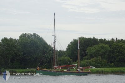
BOY LESLIE
Sailing
Current Trip
| Trip Time | 5 h, 12 mins |
|---|---|
| Trip Distance | 30.55 nm |
| AVG Speed | 7.6 Knots |
| MAX Speed | 8.8 Knots |
| Draught | 3.1 m |
| AVG Wind | 4.1 knots |
| MAX Wind | 10 knots |
| MIN Temp | 14.8°C / 58.64°F |
| MAX Temp | 23.4°C / 74.12°F |
| Position Received | 51 m ago |
Current Position
| Longitude | 7.99774° |
|---|---|
| Latitude | 58.13336° |
| Status | Under way using engine |
| Speed | 7.1 Knots |
| Course | 335.6° |
| Area | Skaggerak |
| Station | T-AIS |
| Position Received | 51 m ago |
Info
Information
The current position of BOY LESLIE is in Skaggerak with coordinates 58.13336° / 7.99774° as reported on 2024-06-01 15:45 by AIS to our vessel tracker app. The vessel's current speed is 7.1 Knots and is currently inside the port of KRISTIANSAND.
The vessel BOY LESLIE (MMSI: 257164800) is a Sailing It's sailing under the flag of [NO] Norway.
In this page you can find informations about the vessels current position, last detected port calls, and current voyage information. If the vessels is not in coverage by AIS you will find the latest position.
The current position of BOY LESLIE is detected by our AIS receivers and we are not responsible for the reliability of the data. The last position was recorded while the vessel was in Coverage by the Ais receivers of our vessel tracking app.
The current draught of BOY LESLIE as reported by AIS is 3.1 meters
Weather
| Temperature | 23.3°C / 73.94°F |
|---|---|
| Wind Speed | 4 knots |
| Direction | 198° SSW |
| Pressure | 1016.4 hPa |
| Humidity | 50 % |
| Cloud Coverage | 33 % |
Featured Company
Last Port Calls
| Port | Arrival | Departure | Time In Port |
|---|---|---|---|
| 2024-06-01 15:44 | |||
| 2024-06-01 10:32 | |||
| 2024-05-25 10:00 | 2024-05-25 10:12 | 12 m | |
| 2024-05-21 19:24 | 2024-05-24 17:22 | 2 d | |
| 2024-05-11 13:07 | 2024-05-21 13:20 | 10 d | |
| 2024-05-11 10:05 | |||
| 2024-05-09 10:01 |
Most Visited Ports (Last year)
| Port | Arrivals | |
|---|---|---|
| 20 | ||
| 11 | ||
| 2 | ||
| 2 | ||
| 1 | ||
| 1 |
Events
| Time | Event | Details | Position / Dest | Info |
|---|---|---|---|---|
| 2024-06-01 15:44 | PORT ARRIVAL |
|
58.13336 / 7.99774
[NO] KRISTIANSAND
|
Speed: 7.7 kn Course: 194° |
| 2024-06-01 12:03 | Destination Changed | BREVIK ARENDAL |
58.30837 / 8.58044
BREVIK
|
Speed: 7.6 kn Course: 203° |
| 2024-06-01 12:03 | ETA Changed | 2025/05/11 15:00 2024/05/11 15:00 |
58.30837 / 8.58044
BREVIK
|
Speed: 7.6 kn Course: 203° |
| 2024-06-01 11:22 | IN Coverage |
58.34978 / 8.67989
Skaggerak
|
Speed: 8.6 kn Course: 225.2° |
|
| 2024-06-01 10:32 | PORT DEPARTURE |
|
58.35139 / 8.68322
ARENDAL
|
Speed: Course: 324° |
| 2024-06-01 08:27 | OUT of Coverage |
58.45887 / 8.76946
Skaggerak
[NO] ARENDAL
|
Speed: Course: 219.4° |
|
| 2024-06-01 08:24 | IN Coverage |
58.45887 / 8.76946
Skaggerak
[NO] ARENDAL
|
Speed: Course: 190.9° |
|
| 2024-05-31 13:46 | OUT of Coverage |
58.60917 / 8.94372
Skaggerak
|
Speed: 2.8 kn Course: 160° |
|
| 2024-05-31 13:18 | IN Coverage |
58.61854 / 8.93905
Skaggerak
|
Speed: 3.8 kn Course: 159.4° |
|
| 2024-05-29 09:09 | OUT of Coverage |
59.03683 / 9.71474
Skaggerak
|
Speed: Course: 329.1° |