
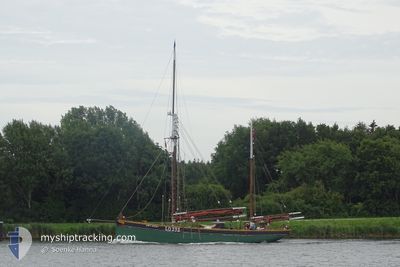
BOY LESLIE
Sailing
Current Trip
ARENDAL
| Time Travelled | 9 h, 16 mins |
|---|---|
| Remaining Time | --- |
| Distance Travelled | 7.46 nm |
| Remaining Distance | --- |
| AVG Speed | 5.8 Knots |
| MAX Speed | 7 Knots |
| AVG Wind | 3.5 knots |
| MAX Wind | 5.6 knots |
| MIN Temp | 13.3°C / 55.94°F |
| MAX Temp | 15.4°C / 59.72°F |
| Draught | 3.1 m |
| Position Received | 7 h, 22 m ago |
Current Position
| Longitude | 9.43274° |
|---|---|
| Latitude | 58.79870° |
| Status | Under way using engine |
| Speed | 3.9 Knots |
| Course | 12° |
| Area | Skaggerak |
| Station | T-AIS |
| Position Received | 7 h, 22 m ago |
Info
Information
The current position of BOY LESLIE is in Skaggerak with coordinates 58.79870° / 9.43274° as reported on 2024-05-25 12:05 by AIS to our vessel tracker app. The vessel's current speed is 3.9 Knots
The vessel BOY LESLIE (MMSI: 257164800) is a Sailing It's sailing under the flag of [NO] Norway.
In this page you can find informations about the vessels current position, last detected port calls, and current voyage information. If the vessels is not in coverage by AIS you will find the latest position.
The current position of BOY LESLIE is detected by our AIS receivers and we are not responsible for the reliability of the data. The last position was recorded while the vessel was in Coverage by the Ais receivers of our vessel tracking app.
The current draught of BOY LESLIE as reported by AIS is 3.1 meters
Weather
| Temperature | 13.3°C / 55.94°F |
|---|---|
| Wind Speed | 2 knots |
| Direction | 122° ESE |
| Pressure | 1021.5 hPa |
| Humidity | 97.3 % |
| Cloud Coverage | 95 % |
Featured Company
Most Visited Ports (Last year)
| Port | Arrivals | |
|---|---|---|
| 19 | ||
| 12 | ||
| 2 | ||
| 2 | ||
| 1 | ||
| 1 |
Events
| Time | Event | Details | Position / Dest | Info |
|---|---|---|---|---|
| 2024-05-25 12:05 | OUT of Coverage |
58.79870 / 9.43274
Skaggerak
|
Speed: 3.9 kn Course: 14° |
|
| 2024-05-25 11:59 | START Moving | 4.69 nm, South of KRAGERO |
58.79119 / 9.42797
ARENDAL
|
Speed: 3.3 kn Course: 25° |
| 2024-05-25 11:21 | STOP Moving | 4.69 nm, South of KRAGERO |
58.79136 / 9.43189
ARENDAL
|
Speed: 0.3 kn Course: 51° |
| 2024-05-25 10:34 | ETA Changed | 2024/05/11 15:00 2024/05/10 15:00 |
58.74332 / 9.31899
ARENDAL
|
Speed: 5.7 kn Course: 63.8° |
| 2024-05-25 10:12 | PORT DEPARTURE |
|
58.73106 / 9.26215
ARENDAL
|
Speed: 4.1 kn Course: 28° |
| 2024-05-25 10:00 | PORT ARRIVAL |
|
58.71758 / 9.24135
[NO] RISOR
|
Speed: 6.3 kn Course: 351.2° |
| 2024-05-25 09:37 | IN Coverage |
58.69405 / 9.24874
Skaggerak
|
Speed: 6.5 kn Course: 1.8° |
|
| 2024-05-24 19:10 | OUT of Coverage |
58.61983 / 9.08312
Skaggerak
|
Speed: 3.6 kn Course: 52.9° |
|
| 2024-05-24 18:57 | ETA Changed | 2024/05/10 15:00 2024/05/11 15:00 |
58.61046 / 9.05075
ARENDAL
|
Speed: 7.4 kn Course: 47.6° |
| 2024-05-24 18:39 | IN Coverage |
58.57766 / 9.02484
Skaggerak
|
Speed: 8.4 kn Course: 3.9° |