
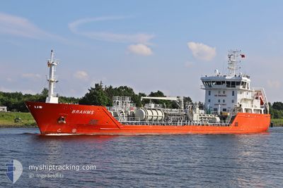
BRAHMS
Oil/Chemical Tanker
Current Trip
Current Position
| Longitude | 13.10689° |
|---|---|
| Latitude | 54.29771° |
| Status | Moored |
| Speed | |
| Course | 17° |
| Area | Baltic Sea |
| Station | T-AIS |
| Position Received | 3 m ago |
Info
Information
The current position of BRAHMS is in Baltic Sea with coordinates 54.29771° / 13.10689° as reported on 2024-06-01 20:00 by AIS to our vessel tracker app. The vessel's current speed is 0 Knots and is currently inside the port of STRALSUND.
The vessel BRAHMS (IMO: 9517446, MMSI: 209577000) is a Oil/Chemical Tanker that was built in 2009 ( 15 years old ). It's sailing under the flag of [CY] Cyprus.
In this page you can find informations about the vessels current position, last detected port calls, and current voyage information. If the vessels is not in coverage by AIS you will find the latest position.
The current position of BRAHMS is detected by our AIS receivers and we are not responsible for the reliability of the data. The last position was recorded while the vessel was in Coverage by the Ais receivers of our vessel tracking app.
The current draught of BRAHMS as reported by AIS is 4 meters
Weather
| Temperature | 15.2°C / 59.36°F |
|---|---|
| Wind Speed | 7 knots |
| Direction | 355° N |
| Pressure | 1013 hPa |
| Humidity | 91.4 % |
| Cloud Coverage | 95 % |
Featured Company
Last Port Calls
| Port | Arrival | Departure | Time In Port |
|---|---|---|---|
| 2024-05-29 10:29 | |||
| 2024-05-26 21:11 | 2024-05-27 21:04 | 23 h | |
| 2024-05-20 08:13 | 2024-05-22 04:42 | 1 d | |
| 2024-05-19 11:20 | 2024-05-19 12:56 | 1 h | |
| 2024-05-18 15:23 | 2024-05-18 16:53 | 1 h | |
| 2024-05-15 19:31 | 2024-05-16 19:51 | 1 d | |
| 2024-05-14 02:21 | 2024-05-14 03:05 | 43 m | |
| 2024-05-13 06:23 | 2024-05-13 08:11 | 1 h | |
| 2024-05-10 13:30 | 2024-05-11 23:31 | 1 d | |
| 2024-05-08 13:24 | 2024-05-08 14:57 | 1 h |
Last Trips
| Origin | Departure | Destination | Arrival | Distance | |
|---|---|---|---|---|---|
| 2024-05-27 23:04 | 2024-05-29 12:29 | 273.36 nm | |||
| 2024-05-22 06:42 | 2024-05-26 23:11 | 900.27 nm | |||
| 2024-05-19 14:56 | 2024-05-20 10:13 | 11.38 nm | |||
| 2024-05-18 18:53 | 2024-05-19 13:20 | 0.83 nm | |||
| 2024-05-16 21:51 | 2024-05-18 17:23 | 261.74 nm | |||
| 2024-05-14 05:05 | 2024-05-15 21:31 | 250.31 nm | |||
| 2024-05-13 10:11 | 2024-05-14 04:21 | 3.88 nm | |||
| 2024-05-12 01:31 | 2024-05-13 08:23 | 270.24 nm | |||
| 2024-05-08 16:57 | 2024-05-10 15:30 | 265.06 nm | |||
| 2024-05-08 03:17 | 2024-05-08 15:24 | 1.03 nm |
Events
| Time | Event | Details | Position / Dest | Info |
|---|---|---|---|---|
| 2024-06-01 00:04 | ETA Changed | 2025/05/27 19:00 2024/05/27 19:00 |
54.29771 / 13.10694
[DE] STRALSUND
|
Speed: Course: 17° |
| 2024-05-30 19:39 | IN Coverage |
54.29663 / 13.10632
Baltic Sea
[DE] STRALSUND
|
Speed: Course: 237.9° |
|
| 2024-05-30 18:06 | OUT of Coverage |
54.29665 / 13.10633
Baltic Sea
[DE] STRALSUND
|
Speed: Course: 237.9° |
|
| 2024-05-30 17:30 | Status Changed | Moored Default |
54.29663 / 13.10636
[DE] STRALSUND
|
Speed: Course: -1° |
| 2024-05-30 17:30 | IN Coverage |
54.29663 / 13.10636
Baltic Sea
[DE] STRALSUND
|
Speed: Course: 237.9° |
|
| 2024-05-30 14:52 | Status Changed | Default Moored |
54.29500 / 13.10500
[DE] STRALSUND
|
Speed: Course: 17° |
| 2024-05-30 14:06 | OUT of Coverage |
54.29661 / 13.10648
Baltic Sea
[DE] STRALSUND
|
Speed: Course: 237.9° |
|
| 2024-05-29 11:48 | IN Coverage |
54.29648 / 13.10718
Baltic Sea
[DE] STRALSUND
|
Speed: Course: 237.9° |
|
| 2024-05-29 10:46 | OUT of Coverage |
54.29650 / 13.10714
Baltic Sea
[DE] STRALSUND
|
Speed: Course: 237.9° |
|
| 2024-05-29 10:45 | Status Changed | Moored Under way using engine |
54.29651 / 13.10716
[DE] STRALSUND
|
Speed: Course: 18° |