
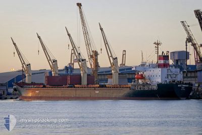
BRAVE COMMANDER
Bulk Carrier
Current Trip
| Time Travelled | 1 day |
|---|---|
| Remaining Time | --- |
| Distance Travelled | 395.13 nm |
| Remaining Distance | --- |
| AVG Speed | 11.7 Knots |
| MAX Speed | 13.4 Knots |
| AVG Wind | 10.5 knots |
| MAX Wind | 13 knots |
| MIN Temp | 20.8°C / 69.44°F |
| MAX Temp | 22.4°C / 72.32°F |
| Draught | 8.3 m |
| Position Received | 1 h, 52 m ago |
Current Position
| Longitude | 35.70742° |
|---|---|
| Latitude | 34.37322° |
| Status | Under way using engine |
| Speed | 7.2 Knots |
| Course | 176.7° |
| Area | Mediterranean Sea - Eastern Basin |
| Station | T-AIS |
| Position Received | 1 h, 52 m ago |
Info
Information
The current position of BRAVE COMMANDER is in Mediterranean Sea - Eastern Basin with coordinates 34.37322° / 35.70742° as reported on 2024-05-30 13:14 by AIS to our vessel tracker app. The vessel's current speed is 7.2 Knots and is heading at the port of CHEKKA. The estimated time of arrival as calculated by vessel tracking app is 2024-05-30 17:00 LT
The vessel BRAVE COMMANDER (IMO: 9136931, MMSI: 450555000) is a Bulk Carrier that was built in 1996 ( 28 years old ). It's sailing under the flag of [LB] Lebanon.
In this page you can find informations about the vessels current position, last detected port calls, and current voyage information. If the vessels is not in coverage by AIS you will find the latest position.
The current position of BRAVE COMMANDER is detected by our AIS receivers and we are not responsible for the reliability of the data. The last position was recorded while the vessel was in Coverage by the Ais receivers of our vessel tracking app.
The current draught of BRAVE COMMANDER as reported by AIS is 8.3 meters
Weather
| Temperature | 20.7°C / 69.26°F |
|---|---|
| Wind Speed | 10 knots |
| Direction | 239° WSW |
| Pressure | 1014.1 hPa |
| Humidity | 68.4 % |
| Cloud Coverage | 15 % |
Featured Company
Last Port Calls
| Port | Arrival | Departure | Time In Port |
|---|---|---|---|
| 2024-05-26 11:05 | 2024-05-29 04:34 | 2 d | |
| 2024-05-06 04:49 | 2024-05-08 10:24 | 2 d | |
| 2024-04-26 17:41 | 2024-04-30 04:20 | 3 d | |
| 2024-04-23 06:30 | 2024-04-23 13:31 | 7 h | |
| 2024-04-09 15:01 | 2024-04-15 10:06 | 5 d | |
| 2024-04-09 04:41 | 2024-04-09 06:41 | 2 h | |
| 2024-03-26 00:01 | 2024-03-31 21:24 | 5 d | |
| 2024-03-23 13:40 | 2024-03-24 20:59 | 1 d | |
| 2024-03-07 17:41 | 2024-03-14 05:24 | 6 d | |
| 2024-03-02 10:43 | 2024-03-07 13:54 | 5 d |
Most Visited Ports (Last year)
| Port | Arrivals | |
|---|---|---|
| 6 | ||
| 6 | ||
| 5 | ||
| 2 | ||
| 2 | ||
| 1 |
Last Trips
| Origin | Departure | Destination | Arrival | Distance | |
|---|---|---|---|---|---|
| 2024-05-08 12:24 | 2024-05-26 13:05 | 889.24 nm | |||
| 2024-04-30 06:20 | 2024-05-06 06:49 | 47.01 nm | |||
| 2024-04-23 15:31 | 2024-04-26 19:41 | 28.25 nm | |||
| 2024-04-15 13:06 | 2024-04-23 08:30 | 1087.62 nm | |||
| 2024-04-09 09:41 | 2024-04-09 18:01 | 58.49 nm | |||
| 2024-03-31 23:24 | 2024-04-09 07:41 | 1074.79 nm | |||
| 2024-03-24 22:59 | 2024-03-26 02:01 | 14.99 nm | |||
| 2024-03-14 07:24 | 2024-03-23 15:40 | 1076.85 nm | |||
| 2024-03-07 15:54 | 2024-03-07 19:41 | 0.72 nm | |||
| 2024-02-11 21:19 | 2024-03-02 12:43 | 1502.07 nm |
Events
| Time | Event | Details | Position / Dest | Info |
|---|---|---|---|---|
| 2024-05-30 14:05 | STOP Moving | 1.22 nm, North East of CHEKKA |
34.33333 / 35.72167
CHEKKA
|
Speed: Course: -1° |
| 2024-05-30 13:14 | Status Changed | Default Under way using engine |
34.37254 / 35.70747
CHEKKA
|
Speed: 7.2 kn Course: 176.7° |
| 2024-05-30 13:14 | OUT of Coverage |
34.37322 / 35.70742
Mediterranean Sea - Eastern Basin
CHEKKA
|
Speed: 7.2 kn Course: 176.7° |
|
| 2024-05-30 13:05 | Status Changed | Under way using engine Default |
34.39445 / 35.70597
CHEKKA
|
Speed: 9.2 kn Course: 174° |
| 2024-05-30 12:58 | Status Changed | Default Under way using engine |
34.41180 / 35.70355
CHEKKA
|
Speed: 10.3 kn Course: 170.1° |
| 2024-05-30 11:24 | Status Changed | Under way using engine Default |
34.47313 / 35.42215
CHEKKA
|
Speed: 13.4 kn Course: 83° |
| 2024-05-30 11:17 | Status Changed | Default Under way using engine |
34.47001 / 35.39057
CHEKKA
|
Speed: 13.4 kn Course: 83° |
| 2024-05-30 09:29 | Detected in Sea | Lebanese part of the Mediterranean Sea - Eastern Basin |
34.37514 / 34.93071
Mediterranean Sea - Eastern Basin
CHEKKA
|
Speed: 13 kn Course: 78.4° |
| 2024-05-30 09:29 | IN Coverage |
34.37514 / 34.93071
Mediterranean Sea - Eastern Basin
CHEKKA
|
Speed: 13 kn Course: 78.4° |
|
| 2024-05-30 01:09 | OUT of Coverage |
33.67561 / 33.05684
Mediterranean Sea - Eastern Basin
CHEKKA
|
Speed: 11.8 kn Course: 59.8° |