
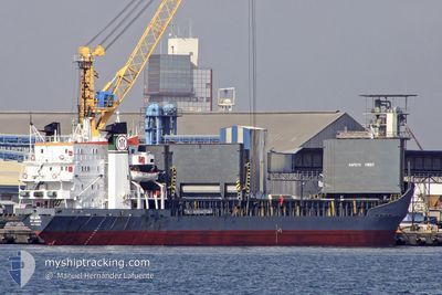
BRAVE KNIGHT
Bulk Carrier
Current Trip
TRIST
| Time Travelled | 5 days |
|---|---|
| Remaining Time | --- |
| Distance Travelled | 316.63 nm |
| Remaining Distance | --- |
| AVG Speed | 9.8 Knots |
| MAX Speed | 11.5 Knots |
| AVG Wind | 8.9 knots |
| MAX Wind | 18.1 knots |
| MIN Temp | 17°C / 62.6°F |
| MAX Temp | 29.7°C / 85.46°F |
| Draught | 4 m |
| Position Received | 4 d ago |
Current Position
| Longitude | 29.16239° |
|---|---|
| Latitude | 41.49799° |
| Status | Under way using engine |
| Speed | 9.8 Knots |
| Course | 349° |
| Area | Black Sea |
| Station | T-AIS |
| Position Received | 4 d ago |
Info
Information
The current position of BRAVE KNIGHT is in Black Sea with coordinates 41.49799° / 29.16239° as reported on 2024-06-12 02:38 by AIS to our vessel tracker app. The vessel's current speed is 9.8 Knots
The vessel BRAVE KNIGHT (IMO: 7129336, MMSI: 450552000) is a Bulk Carrier that was built in 1972 ( 52 years old ). It's sailing under the flag of [LB] Lebanon.
In this page you can find informations about the vessels current position, last detected port calls, and current voyage information. If the vessels is not in coverage by AIS you will find the latest position.
The current position of BRAVE KNIGHT is detected by our AIS receivers and we are not responsible for the reliability of the data. The last position was recorded while the vessel was in Coverage by the Ais receivers of our vessel tracking app.
The current draught of BRAVE KNIGHT as reported by AIS is 4 meters
Weather
| Temperature | 18.4°C / 65.12°F |
|---|---|
| Wind Speed | 3 knots |
| Direction | 290° WNW |
| Pressure | 1011.8 hPa |
| Humidity | 68.5 % |
| Cloud Coverage | 6 % |
Featured Company
Last Port Calls
| Port | Arrival | Departure | Time In Port |
|---|---|---|---|
| 2024-06-11 23:24 | 2024-06-12 00:49 | 1 h | |
| 2024-06-05 15:48 | 2024-06-07 10:58 | 1 d | |
| 2024-05-22 13:52 | 2024-05-26 05:38 | 3 d | |
| 2024-05-21 13:44 | 2024-05-22 04:12 | 14 h | |
| 2024-05-14 12:20 | 2024-05-16 13:20 | 2 d | |
| 2024-04-09 06:14 | 2024-04-10 08:16 | 1 d | |
| 2024-04-03 16:57 | 2024-04-08 11:41 | 4 d |
Last Trips
| Origin | Departure | Destination | Arrival | Distance | |
|---|---|---|---|---|---|
| 2024-06-07 12:58 | 2024-06-12 02:24 | 991.27 nm | |||
| 2024-05-26 08:38 | 2024-06-05 17:48 | 1314.85 nm | |||
| 2024-05-22 07:12 | 2024-05-22 16:52 | 59.48 nm | |||
| 2024-05-16 16:20 | 2024-05-21 16:44 | 1021.60 nm | |||
| 2024-04-10 11:16 | 2024-05-14 15:20 | 2296.84 nm | |||
| 2024-04-08 14:41 | 2024-04-09 09:14 | 31.57 nm | |||
| 2024-03-10 07:16 | 2024-04-03 19:57 | 1146.93 nm |
Events
| Time | Event | Details | Position / Dest | Info |
|---|---|---|---|---|
| 2024-06-14 12:47 | STOP Moving | 8.78 nm, North of TULCEA |
45.31918 / 28.86417
TRIST
|
Speed: Course: -1° |
| 2024-06-13 04:49 | START Moving | 7.84 nm, East of SULINA |
45.20699 / 29.81877
TRIST
|
Speed: 6.9 kn Course: 356° |
| 2024-06-13 01:23 | STOP Moving | 7.71 nm, East of SULINA |
45.16366 / 29.82924
TRIST
|
Speed: 0.3 kn Course: 27° |
| 2024-06-12 02:44 | Status Changed | Default Under way using engine |
41.51594 / 29.15793
TRIST
|
Speed: 9.8 kn Course: 349° |
| 2024-06-12 02:38 | OUT of Coverage |
41.49799 / 29.16239
Black Sea
|
Speed: 9.8 kn Course: 349° |
|
| 2024-06-12 00:59 | Change Sea Area | Turkish part of the Black Sea Turkish part of the Sea of Marmara |
41.22906 / 29.14586
Black Sea
|
Speed: 11.3 kn Course: 38.8° |
| 2024-06-12 00:49 | PORT DEPARTURE |
|
41.20604 / 29.12091
TRIST
|
Speed: 11.3 kn Course: 47° |
| 2024-06-11 23:24 | PORT ARRIVAL |
|
41.00876 / 28.99877
[TR] ISTANBUL
|
Speed: 9.6 kn Course: 7.4° |
| 2024-06-11 21:16 | START Moving | 9.34 nm, South of YESILKOY |
40.80057 / 28.84891
TRIST
|
Speed: 3.2 kn Course: 355° |
| 2024-06-11 10:12 | STOP Moving | 9.56 nm, South East of YESILKOY |
40.80910 / 28.90915
TRIST
|
Speed: 0.2 kn Course: 35° |