
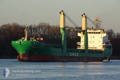
BREB COURTESY
General Cargo
Current Trip
| Time Travelled | 1 day |
|---|---|
| Remaining Time | 19 h, 30 mins |
| Distance Travelled | 318.72 nm |
| Remaining Distance | 237.53 nm |
| AVG Speed | 10.1 Knots |
| MAX Speed | 11.7 Knots |
| AVG Wind | 5.2 knots |
| MAX Wind | 8.4 knots |
| MIN Temp | 16.1°C / 60.98°F |
| MAX Temp | 23.2°C / 73.76°F |
| Draught | 4.7 m |
| Position Received | 3 h, 41 m ago |
Current Position
| Longitude | 11.30886° |
|---|---|
| Latitude | 37.24855° |
| Status | Under way using engine |
| Speed | 10.1 Knots |
| Course | 157.8° |
| Area | Mediterranean Sea - Western Basin |
| Station | T-AIS |
| Position Received | 3 h, 41 m ago |
Info
Information
The current position of BREB COURTESY is in Mediterranean Sea - Western Basin with coordinates 37.24855° / 11.30886° as reported on 2024-06-06 08:35 by AIS to our vessel tracker app. The vessel's current speed is 10.1 Knots and is heading at the port of ZARZIS. The estimated time of arrival as calculated by vessel tracking app is 2024-06-07 07:46 LT
The vessel BREB COURTESY (IMO: 9421130, MMSI: 255806044) is a General Cargo that was built in 2009 ( 15 years old ). It's sailing under the flag of [PT] Portugal.
In this page you can find informations about the vessels current position, last detected port calls, and current voyage information. If the vessels is not in coverage by AIS you will find the latest position.
The current position of BREB COURTESY is detected by our AIS receivers and we are not responsible for the reliability of the data. The last position was recorded while the vessel was in Coverage by the Ais receivers of our vessel tracking app.
The current draught of BREB COURTESY as reported by AIS is 4.7 meters
Weather
| Temperature | 21.2°C / 70.16°F |
|---|---|
| Wind Speed | 8 knots |
| Direction | 338° NNW |
| Pressure | 1019.7 hPa |
| Humidity | 76.2 % |
| Cloud Coverage | --- |
Featured Company
Last Port Calls
| Port | Arrival | Departure | Time In Port |
|---|---|---|---|
| 2024-06-01 22:36 | 2024-06-05 01:18 | 3 d | |
| 2024-05-30 05:37 | 2024-05-30 11:19 | 5 h | |
| 2024-05-18 01:19 | 2024-05-23 20:21 | 5 d | |
| 2024-05-13 18:00 | 2024-05-17 15:44 | 3 d | |
| 2024-05-06 22:22 | 2024-05-09 13:46 | 2 d | |
| 2024-05-03 05:34 | 2024-05-06 15:58 | 3 d | |
| 2024-04-30 01:58 | 2024-05-02 19:33 | 2 d | |
| 2024-04-16 06:52 | 2024-04-19 14:35 | 3 d | |
| 2024-04-09 11:21 | 2024-04-13 13:41 | 4 d | |
| 2024-04-06 18:57 | 2024-04-08 19:02 | 2 d |
Last Trips
| Origin | Departure | Destination | Arrival | Distance | |
|---|---|---|---|---|---|
| 2024-05-30 12:19 | 2024-06-01 23:36 | 124.18 nm | |||
| 2024-05-23 22:21 | 2024-05-30 06:37 | 1361.07 nm | |||
| 2024-05-17 17:44 | 2024-05-18 03:19 | 102.85 nm | |||
| 2024-05-09 14:46 | 2024-05-13 20:00 | 1039.50 nm | |||
| 2024-05-06 16:58 | 2024-05-06 23:22 | 65.09 nm | |||
| 2024-05-02 20:33 | 2024-05-03 06:34 | 97.28 nm | |||
| 2024-04-19 16:35 | 2024-04-30 02:58 | 1406.16 nm | |||
| 2024-04-13 15:41 | 2024-04-16 08:52 | 34.76 nm | |||
| 2024-04-08 21:02 | 2024-04-09 13:21 | 32.12 nm |
Events
| Time | Event | Details | Position / Dest | Info |
|---|---|---|---|---|
| 2024-06-06 08:35 | OUT of Coverage |
37.24855 / 11.30886
Mediterranean Sea - Western Basin
TN ZRZ
|
Speed: 10.1 kn Course: 157.8° |
|
| 2024-06-06 07:47 | IN Coverage |
37.33541 / 11.19417
Mediterranean Sea - Western Basin
TN ZRZ
|
Speed: 10.3 kn Course: 123° |
|
| 2024-06-06 04:25 | OUT of Coverage |
37.49529 / 10.48739
Mediterranean Sea - Western Basin
TN ZRZ
|
Speed: 10.7 kn Course: 104° |
|
| 2024-06-06 04:11 | IN Coverage |
37.50518 / 10.43553
Mediterranean Sea - Western Basin
TN ZRZ
|
Speed: 10.8 kn Course: 102.9° |
|
| 2024-06-06 00:34 | OUT of Coverage |
37.48311 / 9.67325
Mediterranean Sea - Western Basin
TN ZRZ
|
Speed: 10 kn Course: 78.6° |
|
| 2024-06-05 21:23 | Draught Changed | 4.7 6.2 |
37.36328 / 9.01693
TN ZRZ
|
Speed: 10.4 kn Course: 72.1° |
| 2024-06-05 21:23 | Destination Changed | TN ZRZ DZ BJA |
37.36328 / 9.01693
TN ZRZ
|
Speed: 10.4 kn Course: 72.1° |
| 2024-06-05 21:23 | ETA Changed | 2024/06/07 10:00 2024/05/30 22:00 |
37.36328 / 9.01693
TN ZRZ
|
Speed: 10.4 kn Course: 72.1° |
| 2024-06-05 21:07 | Detected in Sea | Tunisian part of the Mediterranean Sea - Western Basin |
37.34967 / 8.95873
Mediterranean Sea - Western Basin
|
Speed: 10.4 kn Course: 74.3° |
| 2024-06-05 21:07 | IN Coverage |
37.34967 / 8.95873
Mediterranean Sea - Western Basin
|
Speed: 10.4 kn Course: 74.3° |