
BRIGHT GEMINI
Cargo
Current Trip
| Time Travelled | 44 days |
|---|---|
| Remaining Time | --- |
| Distance Travelled | 8484.98 nm |
| Remaining Distance | --- |
| AVG Speed | 11.9 Knots |
| MAX Speed | 16.7 Knots |
| AVG Wind | 11 knots |
| MAX Wind | 27.9 knots |
| MIN Temp | 15.8°C / 60.44°F |
| MAX Temp | 27.3°C / 81.14°F |
| Draught | 8.4 m |
| Position Received | 3 d ago |
Current Position
| Longitude | -46.33821° |
|---|---|
| Latitude | -24.06217° |
| Status | At anchor |
| Speed | 0.3 Knots |
| Course | 113° |
| Area | South Atlantic Ocean |
| Station | T-AIS |
| Position Received | 3 d ago |
Info
Information
The current position of BRIGHT GEMINI is in South Atlantic Ocean with coordinates -24.06217° / -46.33821° as reported on 2024-06-07 18:10 by AIS to our vessel tracker app. The vessel's current speed is 0.3 Knots
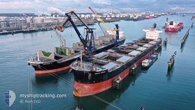
The vessel BRIGHT GEMINI (IMO: 9599092, MMSI: 355959000) is a Cargo It's sailing under the flag of [PA] Panama.
In this page you can find informations about the vessels current position, last detected port calls, and current voyage information. If the vessels is not in coverage by AIS you will find the latest position.
The current position of BRIGHT GEMINI is detected by our AIS receivers and we are not responsible for the reliability of the data. The last position was recorded while the vessel was in Coverage by the Ais receivers of our vessel tracking app.
The current draught of BRIGHT GEMINI as reported by AIS is 8.4 meters
Weather
| Temperature | 22.1°C / 71.78°F |
|---|---|
| Wind Speed | 5 knots |
| Direction | 357° N |
| Pressure | 1016.8 hPa |
| Humidity | 67.7 % |
| Cloud Coverage | 38 % |
Featured Company
Events
| Time | Event | Details | Position / Dest | Info |
|---|---|---|---|---|
| 2024-06-07 19:30 | STOP Moving | 9.58 nm, South East of SANTOS |
-24.08333 / -46.20334
BR SSZ
|
Speed: Course: -1° |
| 2024-06-07 18:41 | START Moving | 5.89 nm, South of SANTOS |
-24.06577 / -46.32771
BR SSZ
|
Speed: 8.5 kn Course: 105° |
| 2024-06-07 18:15 | Status Changed | Default At anchor |
-24.06167 / -46.33667
BR SSZ
|
Speed: 0.3 kn Course: 113° |
| 2024-06-07 18:10 | OUT of Coverage |
-24.06217 / -46.33821
South Atlantic Ocean
|
Speed: 0.3 kn Course: 292.5° |
|
| 2024-06-07 17:46 | Status Changed | At anchor Default |
-24.06215 / -46.33823
BR SSZ
|
Speed: Course: -1° |
| 2024-06-07 17:28 | IN Coverage |
-24.06215 / -46.33823
South Atlantic Ocean
|
Speed: 0.2 kn Course: 265.5° |
|
| 2024-06-07 14:33 | Status Changed | Default At anchor |
-24.06167 / -46.33667
BR SSZ
|
Speed: 0.3 kn Course: 125° |
| 2024-06-07 14:31 | Status Changed | At anchor Default |
-24.06193 / -46.33808
BR SSZ
|
Speed: Course: -1° |
| 2024-06-07 14:31 | OUT of Coverage |
-24.06193 / -46.33808
South Atlantic Ocean
|
Speed: 0.3 kn Course: 110.7° |
|
| 2024-06-07 14:27 | Status Changed | Default At anchor |
-24.06167 / -46.33667
BR SSZ
|
Speed: 0.3 kn Course: 121° |