
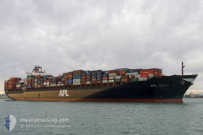
BRIGHTON
Container Ship
Current Trip
| Time Travelled | 8 days |
|---|---|
| Remaining Time | --- |
| Distance Travelled | 3355.54 nm |
| Remaining Distance | --- |
| AVG Speed | 16.8 Knots |
| MAX Speed | 19.7 Knots |
| AVG Wind | 11.3 knots |
| MAX Wind | 35.7 knots |
| MIN Temp | 2.9°C / 37.22°F |
| MAX Temp | 11.1°C / 51.98°F |
| Draught | 12.9 m |
| Position Received | 7 d ago |
Current Position
| Longitude | -127.21947° |
|---|---|
| Latitude | 49.11668° |
| Status | Under way using engine |
| Speed | 15.8 Knots |
| Course | 295.4° |
| Area | North Pacific Ocean |
| Station | T-AIS |
| Position Received | 7 d ago |
Info
Information
The current position of BRIGHTON is in North Pacific Ocean with coordinates 49.11668° / -127.21947° as reported on 2024-05-25 13:28 by AIS to our vessel tracker app. The vessel's current speed is 15.8 Knots and is heading at the port of TOKYO. The estimated time of arrival as calculated by vessel tracking app is 2024-06-04 20:00 LT
The vessel BRIGHTON (IMO: 9332846, MMSI: 235061354) is a Container Ship that was built in 2007 ( 17 years old ). It's sailing under the flag of [GB] United Kingdom.
In this page you can find informations about the vessels current position, last detected port calls, and current voyage information. If the vessels is not in coverage by AIS you will find the latest position.
The current position of BRIGHTON is detected by our AIS receivers and we are not responsible for the reliability of the data. The last position was recorded while the vessel was in Coverage by the Ais receivers of our vessel tracking app.
The current draught of BRIGHTON as reported by AIS is 12.9 meters
Weather
| Temperature | 4.3°C / 39.74°F |
|---|---|
| Wind Speed | 11 knots |
| Direction | 150° SSE |
| Pressure | 1021.6 hPa |
| Humidity | 90.7 % |
| Cloud Coverage | 6 % |
Featured Company
Last Port Calls
| Port | Arrival | Departure | Time In Port |
|---|---|---|---|
| 2024-05-22 18:24 | 2024-05-25 00:17 | 2 d | |
| 2024-05-18 12:05 | 2024-05-22 08:13 | 3 d | |
| 2024-05-05 22:22 | 2024-05-06 11:17 | 12 h | |
| 2024-05-03 22:20 | 2024-05-04 20:29 | 22 h | |
| 2024-04-29 10:19 | 2024-04-30 10:56 | 1 d | |
| 2024-04-23 15:17 | 2024-04-24 06:57 | 15 h | |
| 2024-04-18 22:15 | 2024-04-19 08:33 | 10 h | |
| 2024-04-17 10:34 | 2024-04-18 03:21 | 16 h | |
| 2024-04-15 22:43 | 2024-04-16 17:09 | 18 h | |
| 2024-04-03 00:17 |
Last Trips
| Origin | Departure | Destination | Arrival | Distance | |
|---|---|---|---|---|---|
| 2024-05-22 01:13 | 2024-05-22 11:24 | 155.40 nm | |||
| 2024-05-06 20:17 | 2024-05-18 05:05 | 4301.27 nm | |||
| 2024-05-05 05:29 | 2024-05-06 07:22 | 234.02 nm | |||
| 2024-04-30 18:56 | 2024-05-04 07:20 | 925.23 nm | |||
| 2024-04-24 14:57 | 2024-04-29 18:19 | 591.01 nm | |||
| 2024-04-19 17:33 | 2024-04-23 23:17 | 1343.85 nm | |||
| 2024-04-18 12:21 | 2024-04-19 07:15 | 235.08 nm | |||
| 2024-04-17 02:09 | 2024-04-17 19:34 | 218.67 nm | |||
| 2024-04-02 17:17 | 2024-04-16 07:43 | 4358.29 nm |
Events
| Time | Event | Details | Position / Dest | Info |
|---|---|---|---|---|
| 2024-05-25 13:32 | Status Changed | Default Under way using engine |
49.12545 / -127.24718
JP TYO
|
Speed: 15.8 kn Course: 295.4° |
| 2024-05-25 13:28 | OUT of Coverage |
49.11668 / -127.21947
North Pacific Ocean
JP TYO
|
Speed: 15.8 kn Course: 295.4° |
|
| 2024-05-25 07:39 | Status Changed | Under way using engine Default |
48.52097 / -125.07609
JP TYO
|
Speed: 17.3 kn Course: 270° |
| 2024-05-25 07:34 | Status Changed | Default Under way using engine |
48.52056 / -125.04209
JP TYO
|
Speed: 17.4 kn Course: 271.5° |
| 2024-05-25 07:30 | Detected in Sea | Canadian part of the North Pacific Ocean |
48.52005 / -125.01001
North Pacific Ocean
JP TYO
|
Speed: 17.4 kn Course: 271.5° |
| 2024-05-25 07:29 | Status Changed | Under way using engine Default |
48.51987 / -125.00197
JP TYO
|
Speed: 17.5 kn Course: 272° |
| 2024-05-25 07:10 | IN Coverage |
48.52005 / -125.01001
North Pacific Ocean
JP TYO
|
Speed: 17.4 kn Course: 271.5° |
|
| 2024-05-25 06:34 | Status Changed | Default Under way using engine |
48.48056 / -124.61836
JP TYO
|
Speed: 17.5 kn Course: 292.2° |
| 2024-05-25 06:28 | Status Changed | Under way using engine Default |
48.46822 / -124.57411
JP TYO
|
Speed: 17.5 kn Course: 293° |
| 2024-05-25 06:28 | OUT of Coverage |
48.46822 / -124.57411
The Coastal Waters of Southeast Alaska and British Columbia
JP TYO
|
Speed: 17.5 kn Course: 292.2° |